MyTopo
Center North Dakota US Topo Map
Couldn't load pickup availability
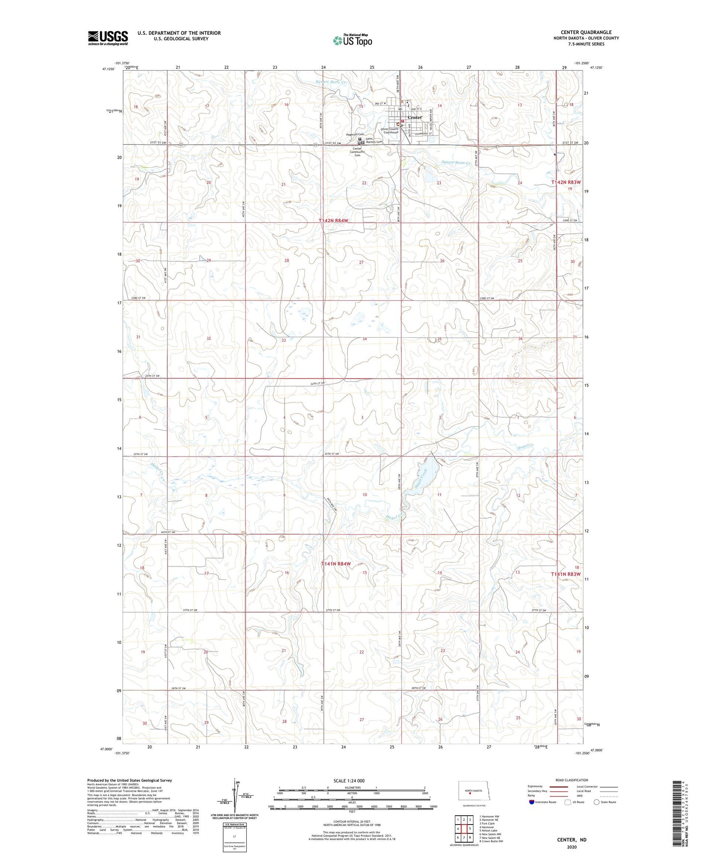
2020 topographic map quadrangle Center in the state of North Dakota. Scale: 1:24000. Based on the newly updated USGS 7.5' US Topo map series, this map is in the following counties: Oliver. The map contains contour data, water features, and other items you are used to seeing on USGS maps, but also has updated roads and other features. This is the next generation of topographic maps. Printed on high-quality waterproof paper with UV fade-resistant inks.
Quads adjacent to this one:
West: Hannover
Northwest: Hannover NW
North: Hannover NE
Northeast: Fort Clark
East: Nelson Lake
Southeast: Crown Butte NW
South: New Salem NE
Southwest: New Salem NW
Contains the following named places: Center, Center City Hall, Center Community Cemetery, Center Post Office, Center-Stanton Public School, City of Center, Hagerott Cemetery, Oliver County, Oliver County Ambulance Service, Oliver County Courthouse, Oliver County Rural Fire Station, Oliver County Sheriff's Office, Saint Martins Cemetery, Square Butte Number 4 Dam