MyTopo
Clark Butte NE North Dakota US Topo Map
Couldn't load pickup availability
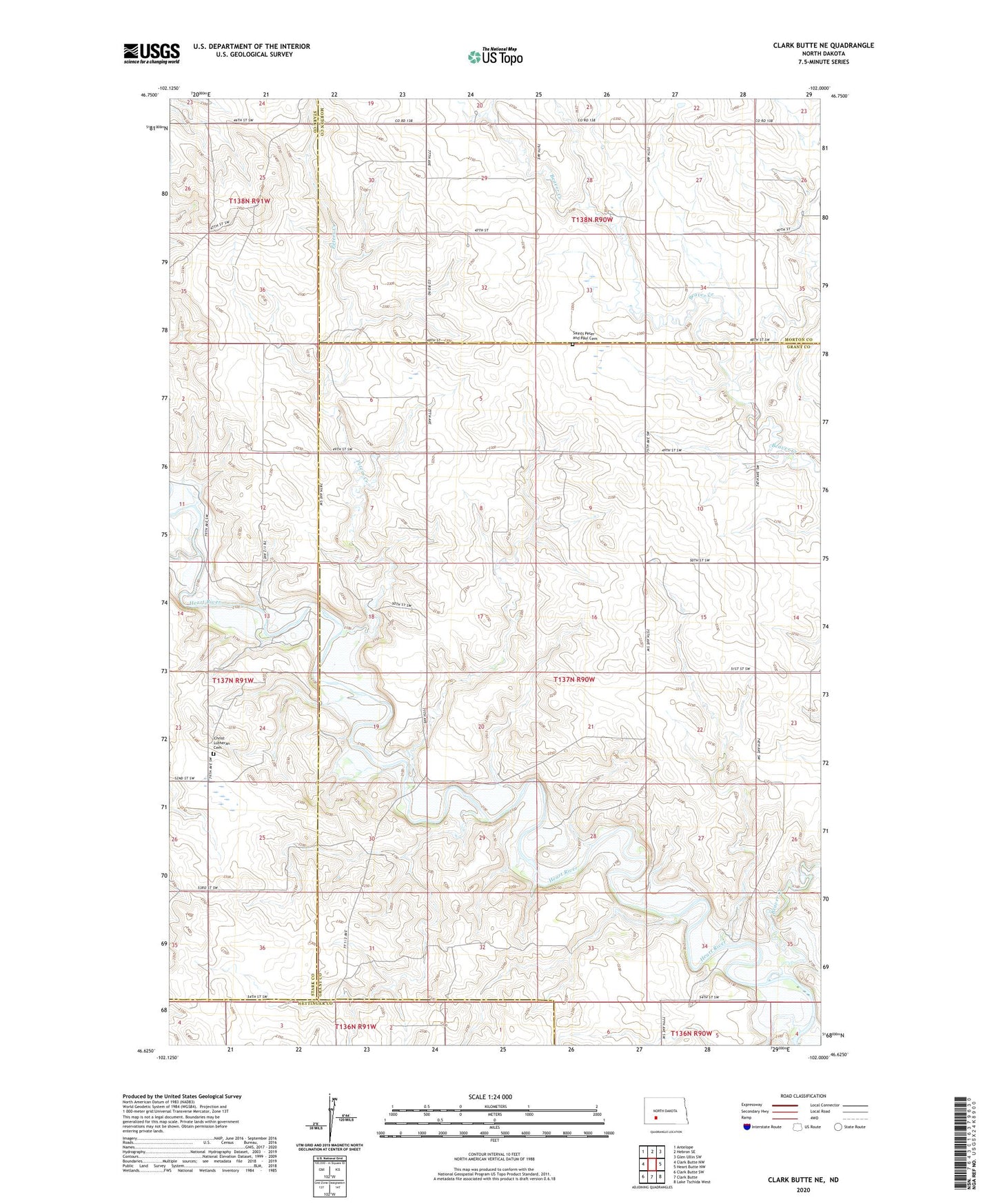
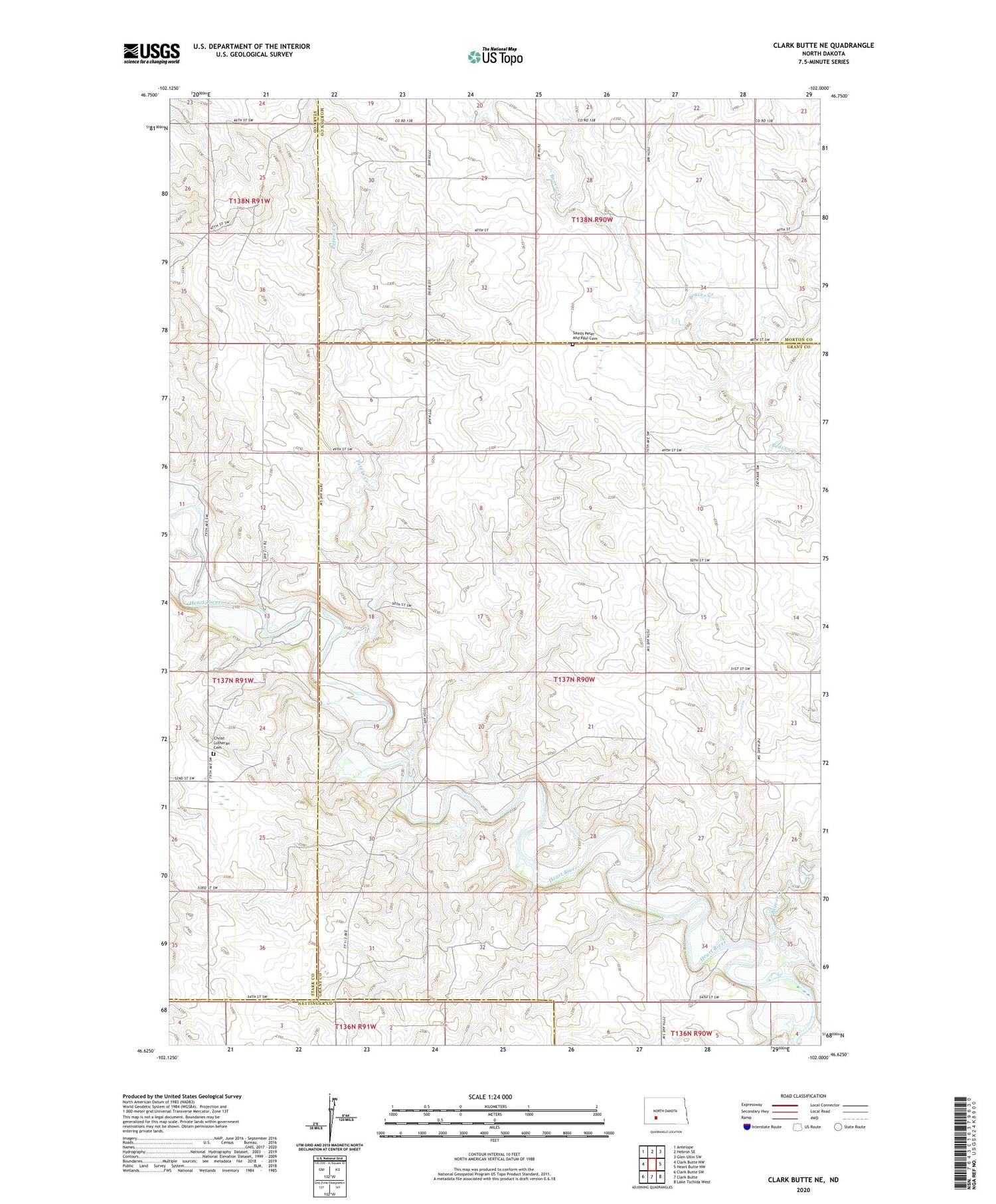
2020 topographic map quadrangle Clark Butte NE in the state of North Dakota. Scale: 1:24000. Based on the newly updated USGS 7.5' US Topo map series, this map is in the following counties: Grant, Stark, Morton, Hettinger. The map contains contour data, water features, and other items you are used to seeing on USGS maps, but also has updated roads and other features. This is the next generation of topographic maps. Printed on high-quality waterproof paper with UV fade-resistant inks.
Quads adjacent to this one:
West: Clark Butte NW
Northwest: Antelope
North: Hebron SE
Northeast: Glen Ullin SW
East: Heart Butte NW
Southeast: Lake Tschida West
South: Clark Butte
Southwest: Clark Butte SW
Contains the following named places: Beaver Creek, Christ Lutheran Cemetery, Heart Butte School Number 1, Heart Butte School Number 2, Peters Creek, Saints Peter and Paul Cemetery