MyTopo
Crosby North Dakota US Topo Map
Couldn't load pickup availability
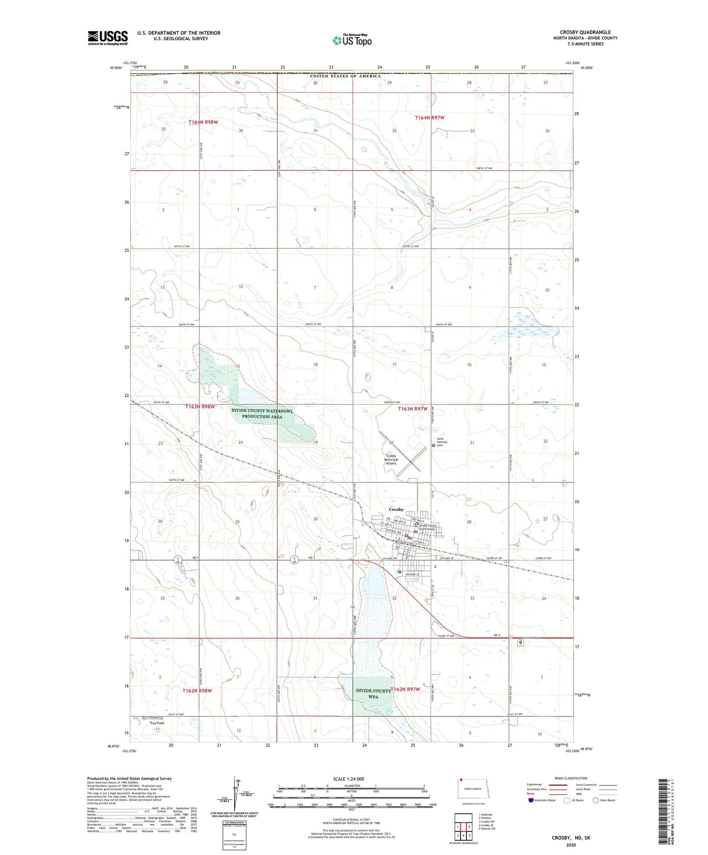
2020 topographic map quadrangle Crosby in the state of North Dakota. Scale: 1:24000. Based on the newly updated USGS 7.5' US Topo map series, this map is in the following counties: Divide. The map contains contour data, water features, and other items you are used to seeing on USGS maps, but also has updated roads and other features. This is the next generation of topographic maps. Printed on high-quality waterproof paper with UV fade-resistant inks.
Quads adjacent to this one:
West: Ambrose
East: Paulson
Southeast: Noonan SW
South: Crosby SE
Southwest: Crosby SW
Contains the following named places: City of Crosby, Concordia Cemetery, Crosby, Crosby City Hall, Crosby Country Club, Crosby Fire Department, Crosby Municipal Airport, Crosby Police Department, Crosby Post Office, Divide County Ambulance Service, Divide County Courthouse, Divide County Elementary School, Divide County High School, Divide County Museum and Pioneer Village, Divide County Public Library, Divide County Sheriff's Office, Good Samaritan Society-Crosby, Long Creek Dam, Saint Luke's Hospital, Saint Patricks Cemetery, School Number 2, School Number 4, Township of Fillmore, Troy Field