MyTopo
Florence Lake North Dakota US Topo Map
Couldn't load pickup availability
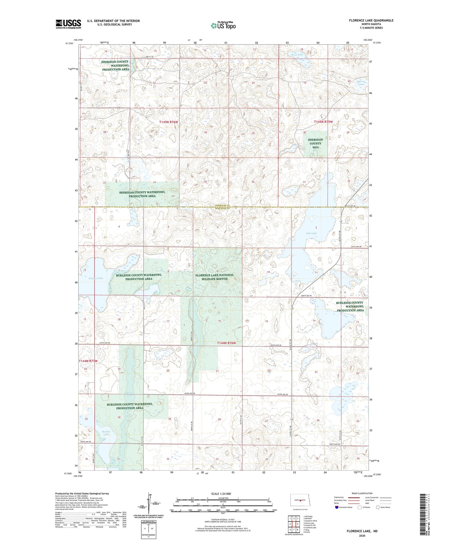
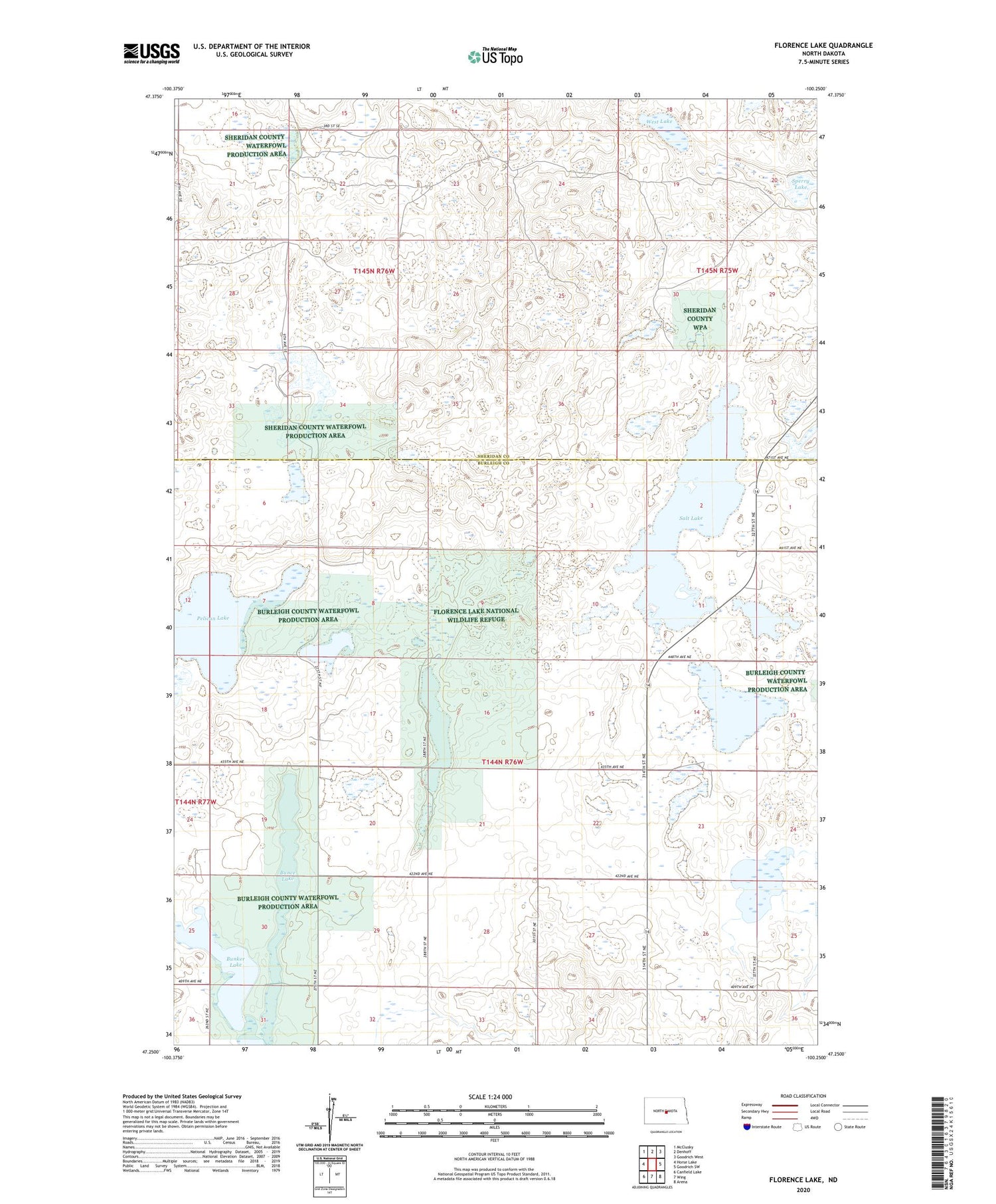
2020 topographic map quadrangle Florence Lake in the state of North Dakota. Scale: 1:24000. Based on the newly updated USGS 7.5' US Topo map series, this map is in the following counties: Burleigh, Sheridan. The map contains contour data, water features, and other items you are used to seeing on USGS maps, but also has updated roads and other features. This is the next generation of topographic maps. Printed on high-quality waterproof paper with UV fade-resistant inks.
Quads adjacent to this one:
West: Horse Lake
Northwest: McClusky
North: Denhoff
Northeast: Goodrich West
East: Goodrich SW
Southeast: Arena
South: Wing
Southwest: Canfield Lake
Contains the following named places: Bunce Lake, Bunker Lake, Florence Lake, Florence Lake National Wildlife Refuge, O'Brien Lake, Pelican Lake, Salt Lake, School Number 2, School Number 3, Sperry Lake, Township of Florence Lake, West Lake, Whittaker School