
MyTopo
Gladstone North Dakota US Topo Map
Couldn't load pickup availability
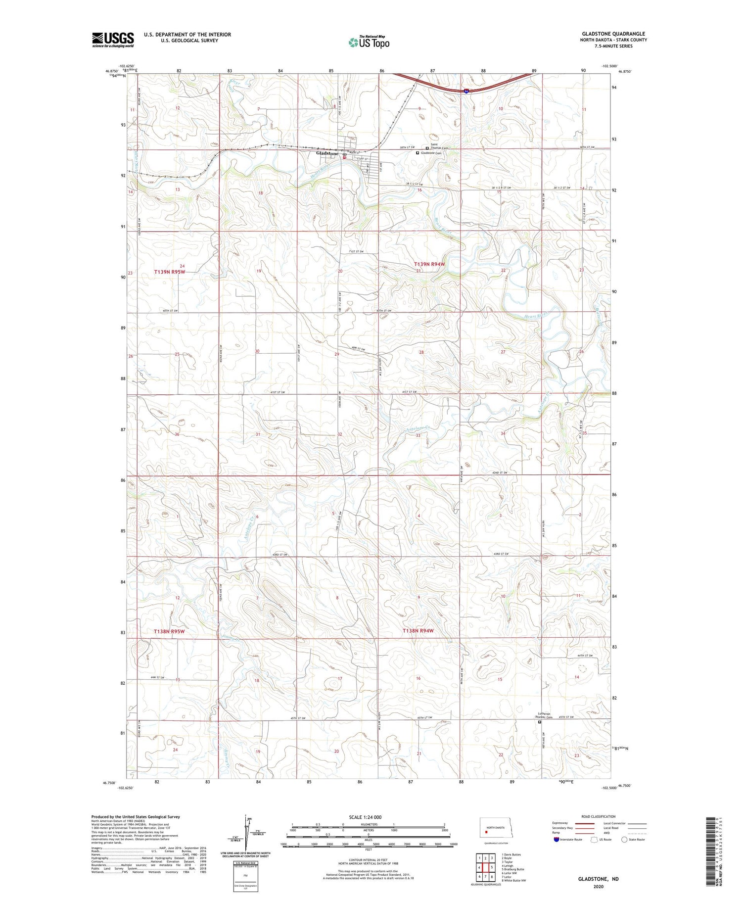
2020 topographic map quadrangle Gladstone in the state of North Dakota. Scale: 1:24000. Based on the newly updated USGS 7.5' US Topo map series, this map is in the following counties: Stark. The map contains contour data, water features, and other items you are used to seeing on USGS maps, but also has updated roads and other features. This is the next generation of topographic maps. Printed on high-quality waterproof paper with UV fade-resistant inks.
Quads adjacent to this one:
West: Lehigh
Northwest: Davis Buttes
North: Boyle
Northeast: Taylor
East: Bratburg Butte
Southeast: White Butte NW
South: Lefor
Southwest: Lefor NW
Contains the following named places: Antelope Creek, Beaver Creek, City of Gladstone, Gladstone, Gladstone Cemetery, Gladstone City Hall, Gladstone Consolidated Fire District, Gladstone Post Office, Green River, Jimmy Creek, Lutheran Pioneer Cemetery, Saint Thomas Cemetery


