
MyTopo
Goodrich West North Dakota US Topo Map
Couldn't load pickup availability
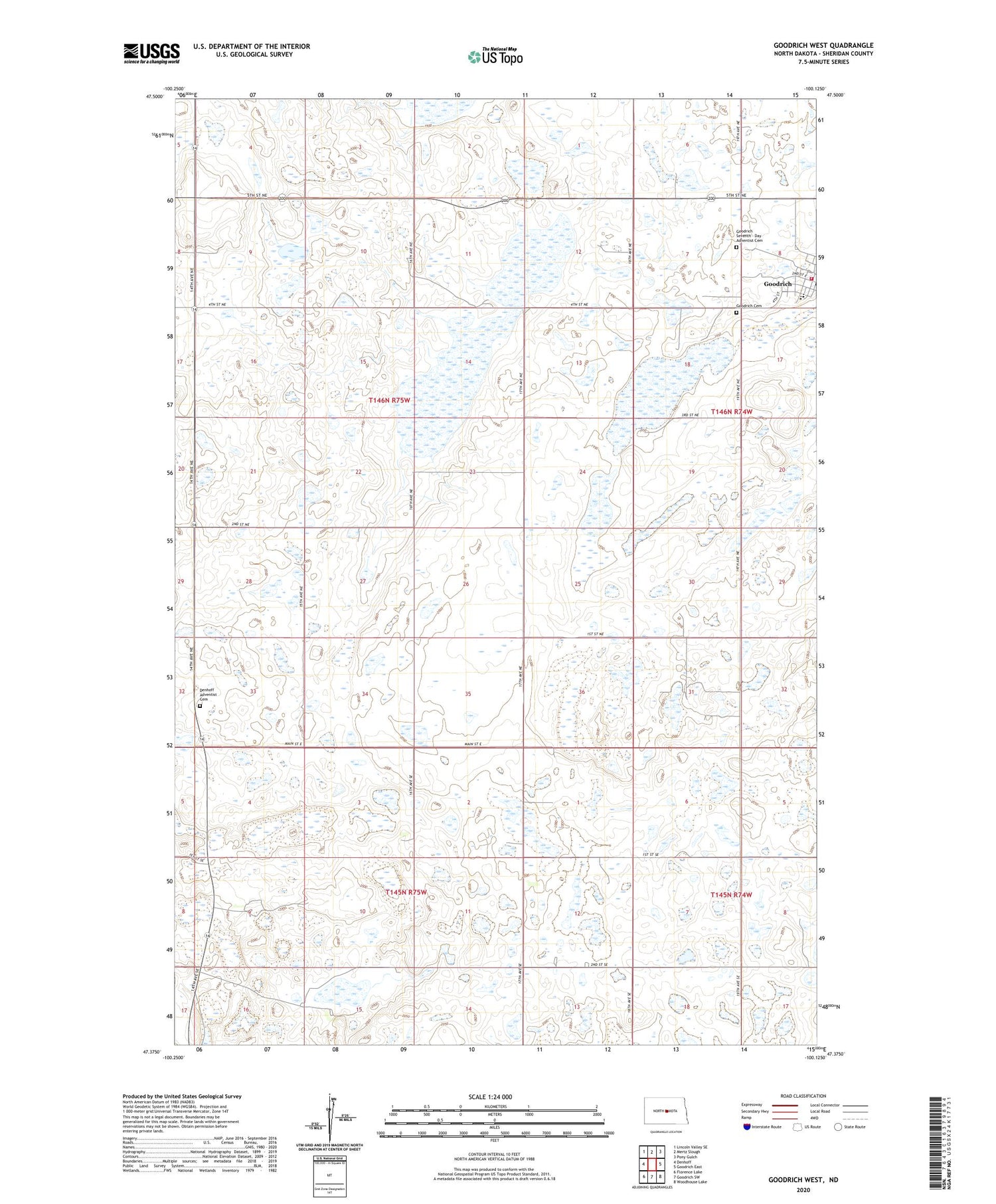
2020 topographic map quadrangle Goodrich West in the state of North Dakota. Scale: 1:24000. Based on the newly updated USGS 7.5' US Topo map series, this map is in the following counties: Sheridan. The map contains contour data, water features, and other items you are used to seeing on USGS maps, but also has updated roads and other features. This is the next generation of topographic maps. Printed on high-quality waterproof paper with UV fade-resistant inks.
Quads adjacent to this one:
West: Denhoff
Northwest: Lincoln Valley SE
North: Mertz Slough
Northeast: Pony Gulch
East: Goodrich East
Southeast: Woodhouse Lake
South: Goodrich SW
Southwest: Florence Lake
Contains the following named places: Denhoff Adventist Cemetery, Goodrich, Goodrich Ambulance Service, Goodrich Cemetery, Goodrich City Hall, Goodrich Fire Department, Goodrich Public Library, Goodrich Public School, Goodrich Seventh - Day Adventist Cemetery, Township of Denhoff, ZIP Code: 58444


