MyTopo
Halliday North Dakota US Topo Map
Couldn't load pickup availability
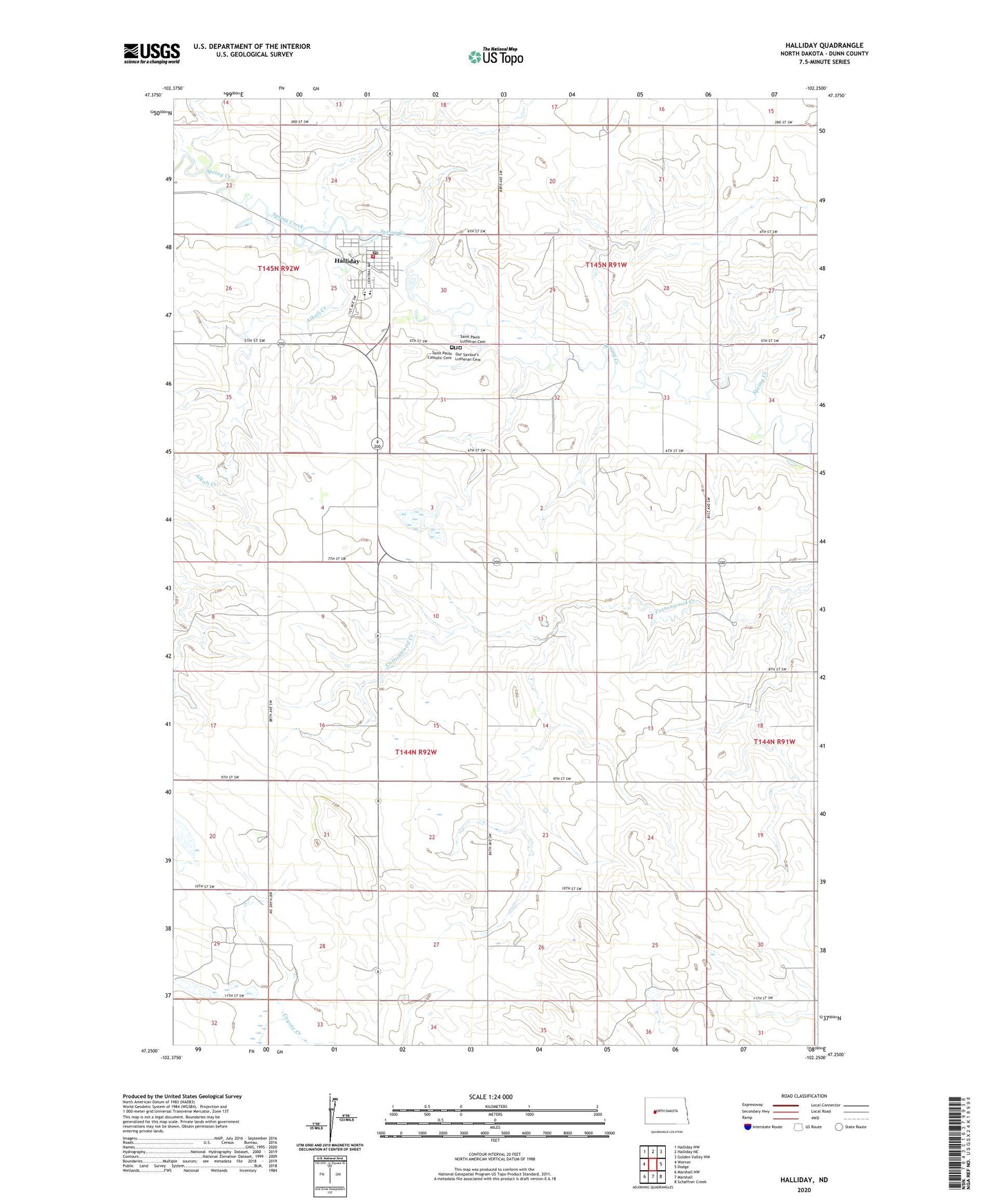
2020 topographic map quadrangle Halliday in the state of North Dakota. Scale: 1:24000. Based on the newly updated USGS 7.5' US Topo map series, this map is in the following counties: Dunn. The map contains contour data, water features, and other items you are used to seeing on USGS maps, but also has updated roads and other features. This is the next generation of topographic maps. Printed on high-quality waterproof paper with UV fade-resistant inks.
Quads adjacent to this one:
West: Werner
Northwest: Halliday NW
North: Halliday NE
Northeast: Golden Valley NW
East: Dodge
Southeast: Schaffner Creek
South: Marshall
Southwest: Marshall NW
Contains the following named places: Alkali Creek, City of Halliday, Halliday, Halliday City Hall, Halliday Post Office, Halliday Public School, Halliday Rural Fire Protection District, Our Saviour's Lutheran Cemetery, Saint Pauls Catholic Cemetery, Saint Pauls Lutheran Cemetery