MyTopo
Harmon North Dakota US Topo Map
Couldn't load pickup availability
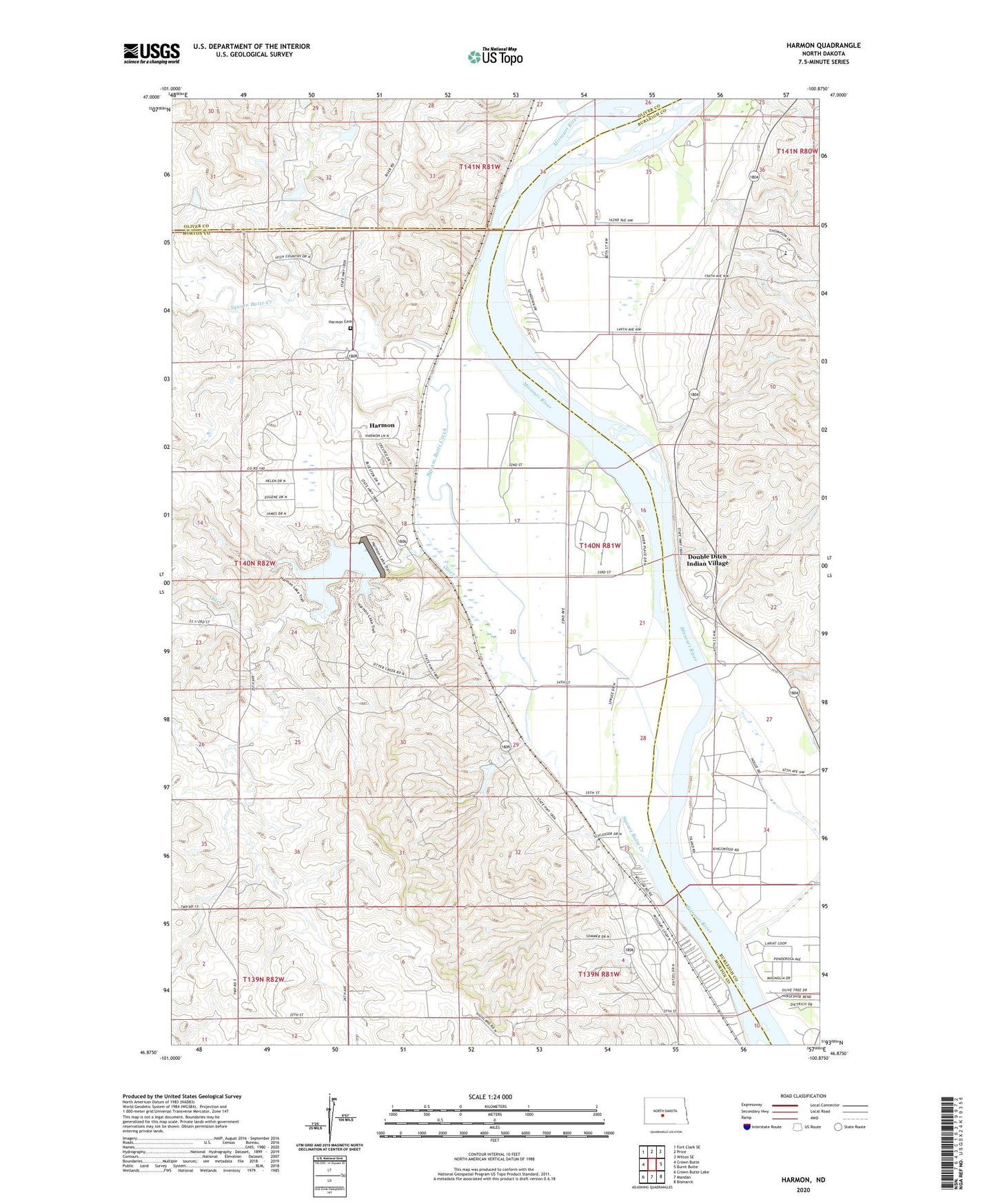
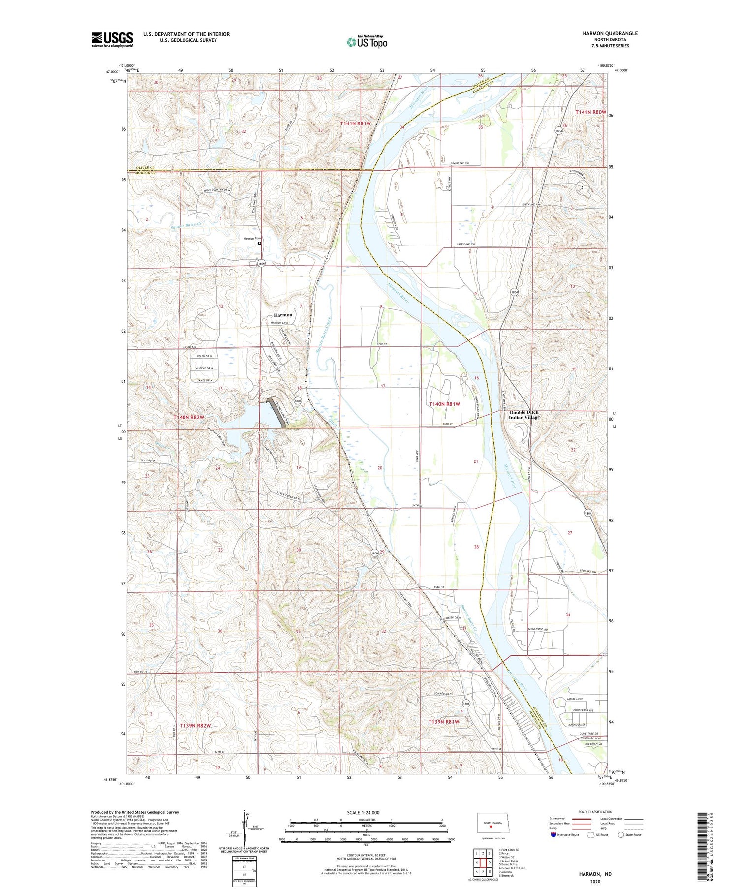
2020 topographic map quadrangle Harmon in the state of North Dakota. Scale: 1:24000. Based on the newly updated USGS 7.5' US Topo map series, this map is in the following counties: Morton, Burleigh, Oliver. The map contains contour data, water features, and other items you are used to seeing on USGS maps, but also has updated roads and other features. This is the next generation of topographic maps. Printed on high-quality waterproof paper with UV fade-resistant inks.
Quads adjacent to this one:
West: Crown Butte
Northwest: Fort Clark SE
North: Price
Northeast: Wilton SE
East: Burnt Butte
Southeast: Bismarck
South: Mandan
Southwest: Crown Butte Lake
Contains the following named places: Dakota Adventist Academy, Danielson Dam, Double Ditch Indian Village, Dry Point Bottom, Eagles Park, Harmon, Harmon Cemetery, Harmon Census Designated Place, Harmon Lake, Mountaineer Bend, Norwegian Bend, Otter Creek, Square Butte Creek, Square Butte School Number 1, Square Butte School Number 2, Wachter Ranch Private Landing Strip