MyTopo
Harvey North Dakota US Topo Map
Couldn't load pickup availability
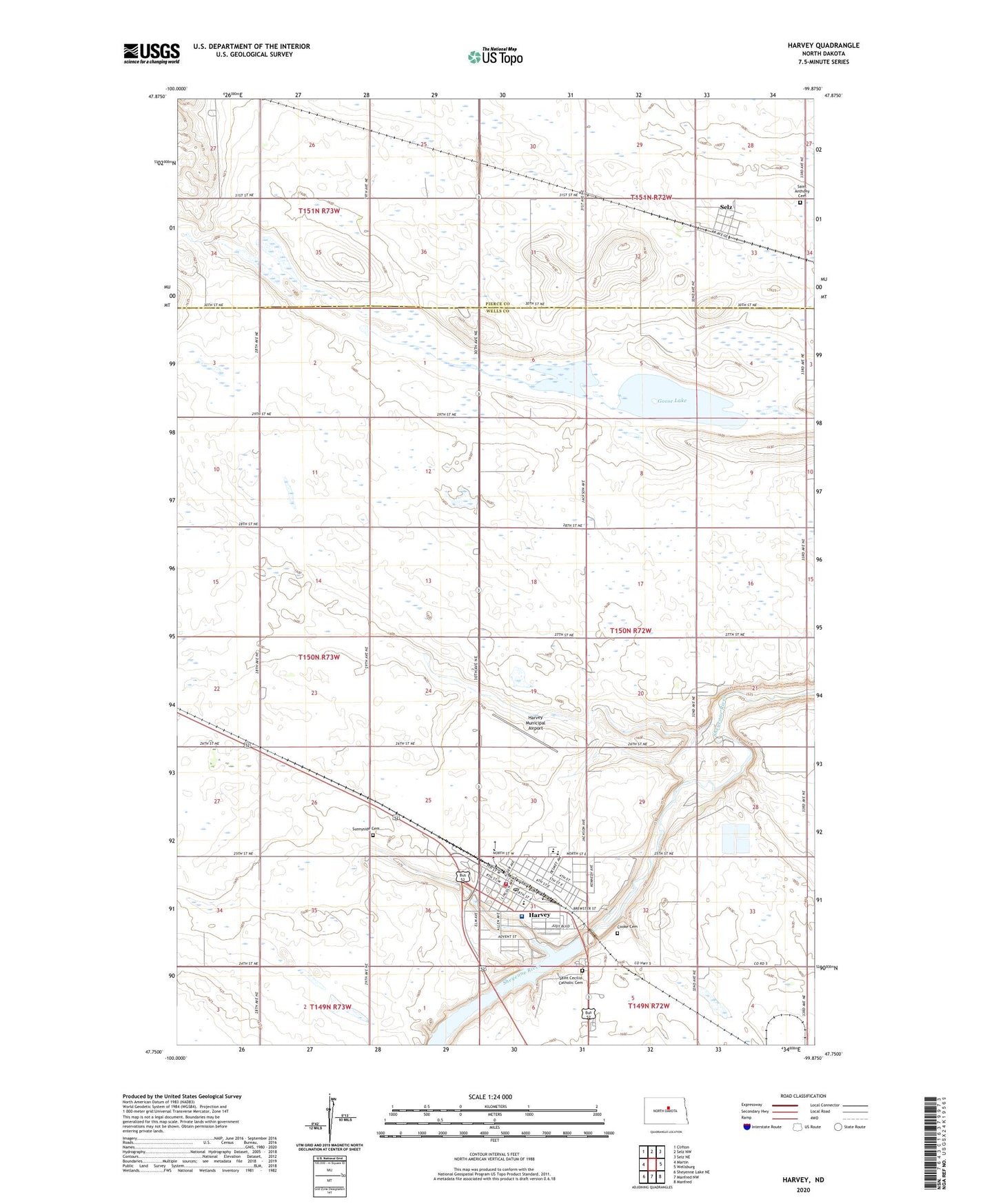
2020 topographic map quadrangle Harvey in the state of North Dakota. Scale: 1:24000. Based on the newly updated USGS 7.5' US Topo map series, this map is in the following counties: Wells, Pierce. The map contains contour data, water features, and other items you are used to seeing on USGS maps, but also has updated roads and other features. This is the next generation of topographic maps. Printed on high-quality waterproof paper with UV fade-resistant inks.
Quads adjacent to this one:
West: Martin
Northwest: Clifton
North: Selz NW
Northeast: Selz NE
East: Wellsburg
Southeast: Manfred
South: Manfred NW
Southwest: Sheyenne Lake NE
Contains the following named places: B M Hanson Elementary School, City of Harvey, Cooke Cemetery, Goose Lake, Harvey, Harvey City Hall, Harvey Dam, Harvey Fire Department and Ambulance Station, Harvey High School, Harvey Municipal Airport, Harvey Police Department, Harvey Post Office, Harvey Public Library, Hillsdale School Number 31, KHND-AM (Harvey), Saint Aloisius Medical Center, Saint Aloisius Medical Center Nursing Home, Saint Anthony Cemetery, Saint Cecilia Catholic Cemetery, Selz, Selz Census Designated Place, Sheyenne River Academy, Sunnyside Cemetery, Wells School Number 1