MyTopo
Hope North Dakota US Topo Map
Couldn't load pickup availability
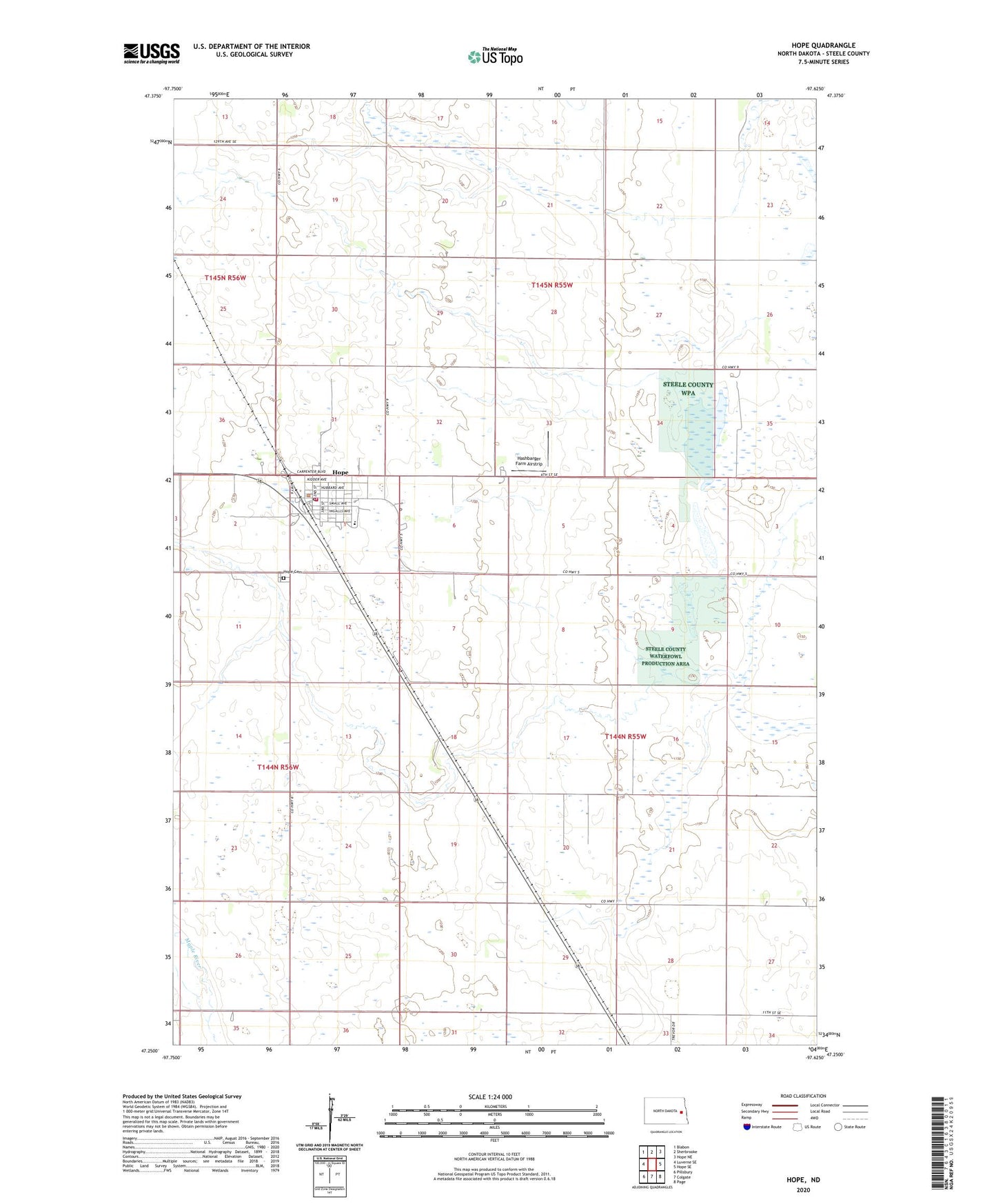
2020 topographic map quadrangle Hope in the state of North Dakota. Scale: 1:24000. Based on the newly updated USGS 7.5' US Topo map series, this map is in the following counties: Steele. The map contains contour data, water features, and other items you are used to seeing on USGS maps, but also has updated roads and other features. This is the next generation of topographic maps. Printed on high-quality waterproof paper with UV fade-resistant inks.
Quads adjacent to this one:
West: Luverne SE
Northwest: Blabon
North: Sherbrooke
Northeast: Hope NE
East: Hope SE
Southeast: Page
South: Colgate
Southwest: Pillsbury
Contains the following named places: Bellevyria, City of Hope, Hashbarger Farm Airstrip, Hope, Hope Ambulance Service, Hope Cemetery, Hope City Hall, Hope High School, Hope Library, Hope Post Office, Hope Volunteer Fire Department, Hugo Town Hall, Steele County Museum, Township of Colgate, Township of Hugo, ZIP Code: 58046