MyTopo
Inkster NE North Dakota US Topo Map
Couldn't load pickup availability
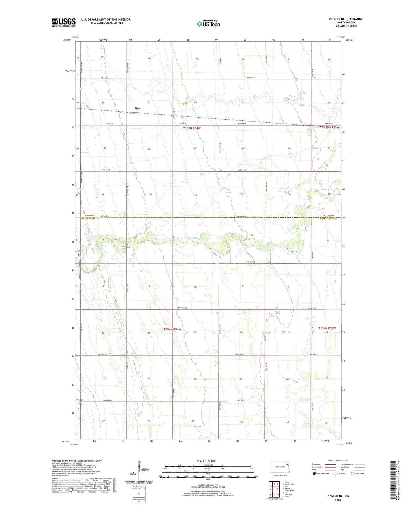
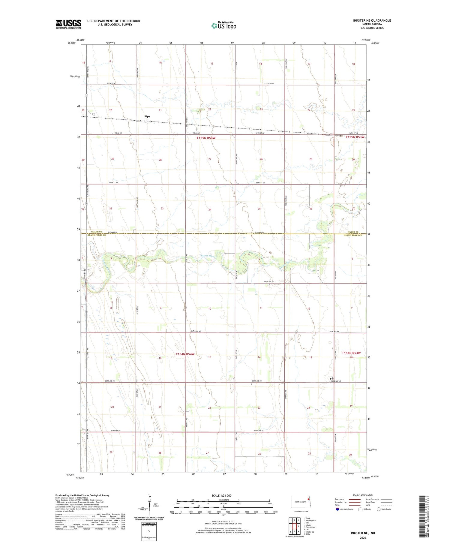
2020 topographic map quadrangle Inkster NE in the state of North Dakota. Scale: 1:24000. Based on the newly updated USGS 7.5' US Topo map series, this map is in the following counties: Grand Forks, Walsh. The map contains contour data, water features, and other items you are used to seeing on USGS maps, but also has updated roads and other features. This is the next generation of topographic maps. Printed on high-quality waterproof paper with UV fade-resistant inks.
Quads adjacent to this one:
West: Inkster
Northwest: Pisek
North: Veseleyville
Northeast: Voss
East: Forest River
Southeast: Gilby
South: Inkster SE
Southwest: Orr
Contains the following named places: Midway Elementary School, Ops, Reno, Strabane, Township of Ops, Township of Strabane, ZIP Codes: 58233, 58244