MyTopo
Jud North Dakota US Topo Map
Couldn't load pickup availability
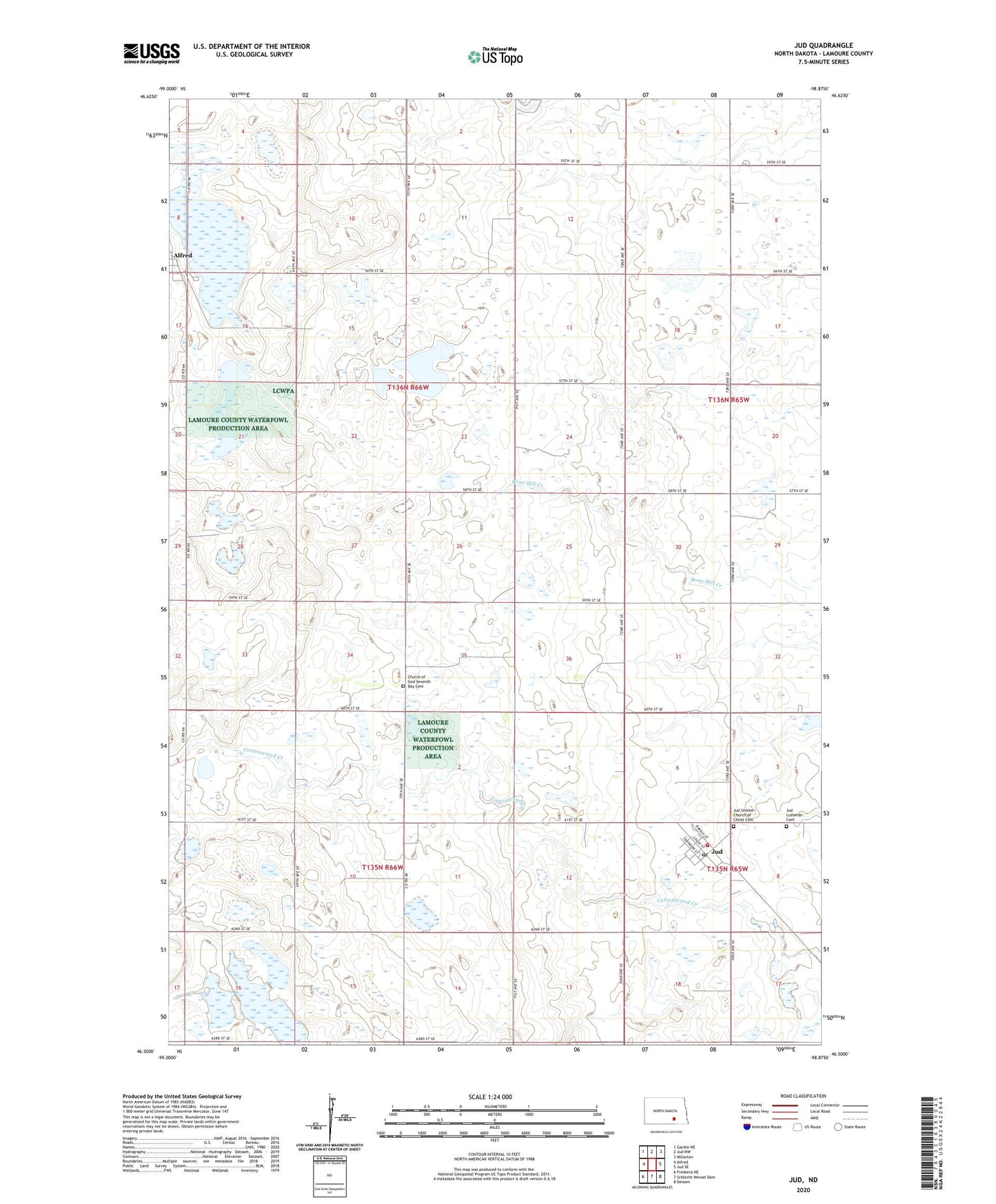
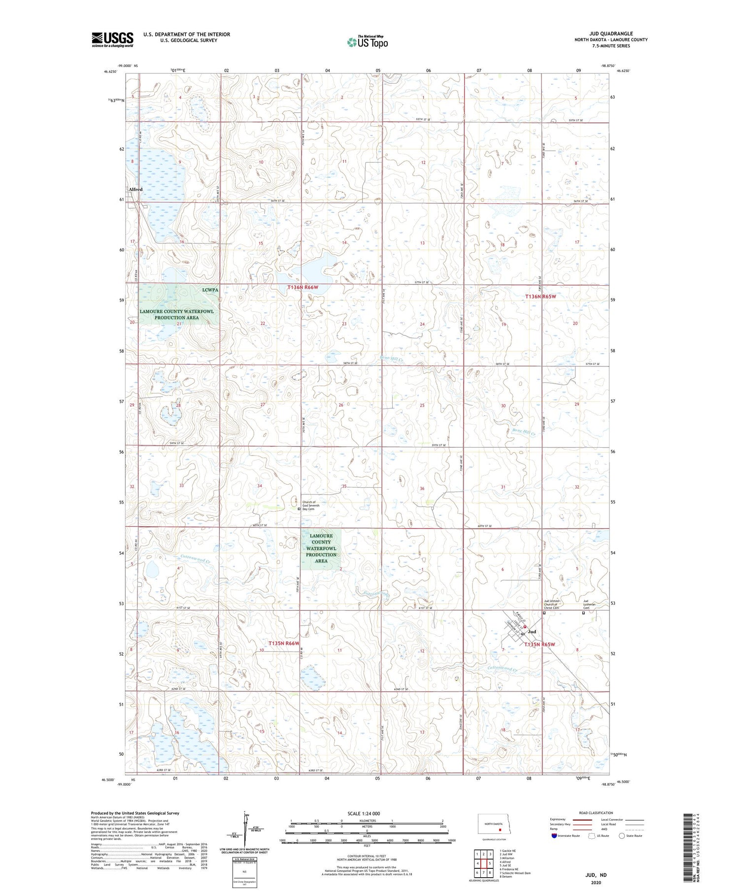
2020 topographic map quadrangle Jud in the state of North Dakota. Scale: 1:24000. Based on the newly updated USGS 7.5' US Topo map series, this map is in the following counties: LaMoure. The map contains contour data, water features, and other items you are used to seeing on USGS maps, but also has updated roads and other features. This is the next generation of topographic maps. Printed on high-quality waterproof paper with UV fade-resistant inks.
Quads adjacent to this one:
West: Alfred
Northwest: Gackle NE
North: Jud NW
Northeast: Millarton
East: Jud SE
Southeast: Deisem
South: Schlecht-Weixel Dam
Southwest: Fredonia NE
Contains the following named places: Alfred, Church of God Seventh Day Cemetery, City of Jud, Jud, Jud Lutheran Cemetery, Jud Post Office, Jud Rural Fire Station, Jud United Church of Christ Cemetery, Lehr-Beglad-Henne Fish Dam, School Number 1, Township of Glen, Township of Raney, ZIP Code: 58454