MyTopo
Langdon East North Dakota US Topo Map
Couldn't load pickup availability
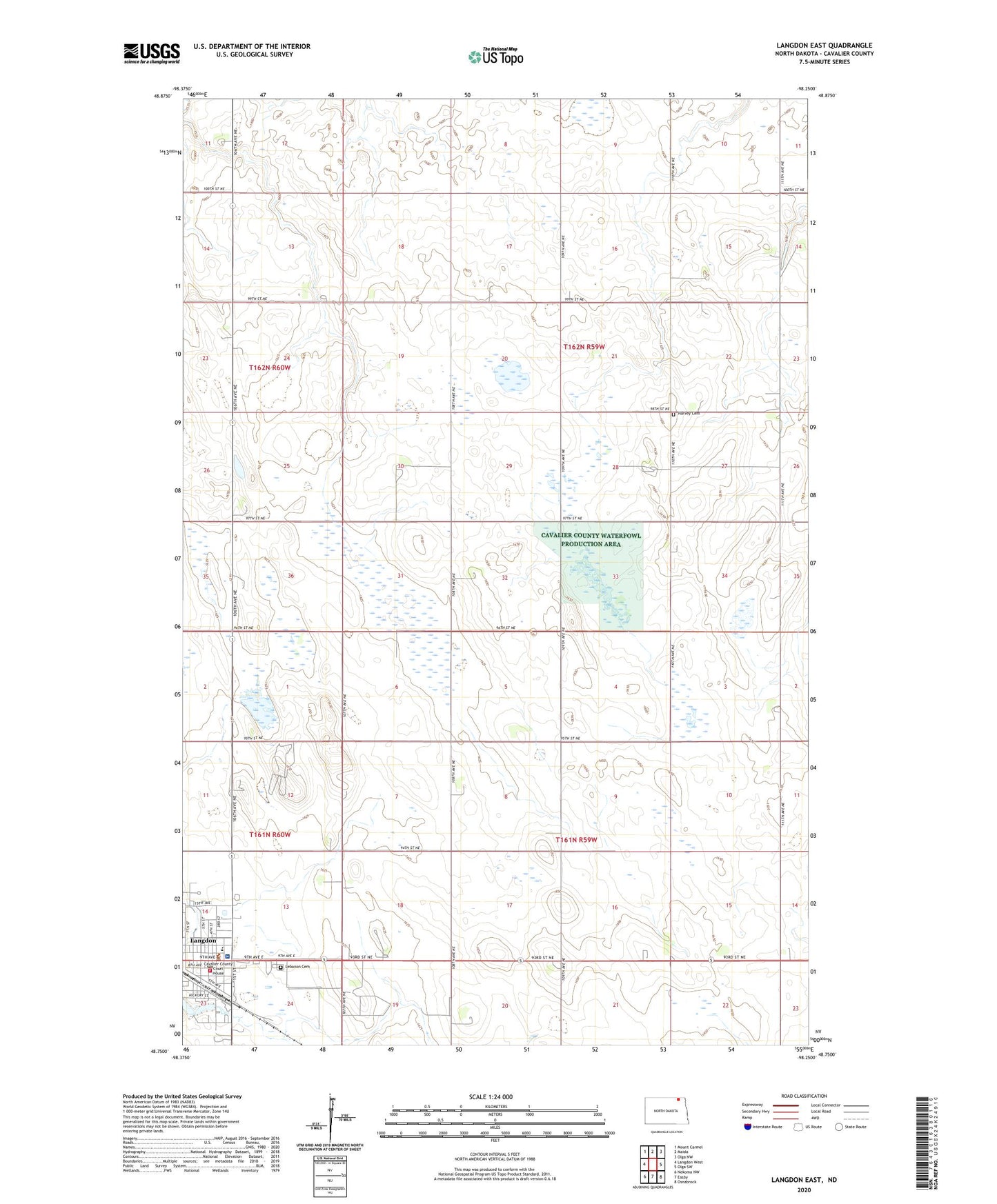
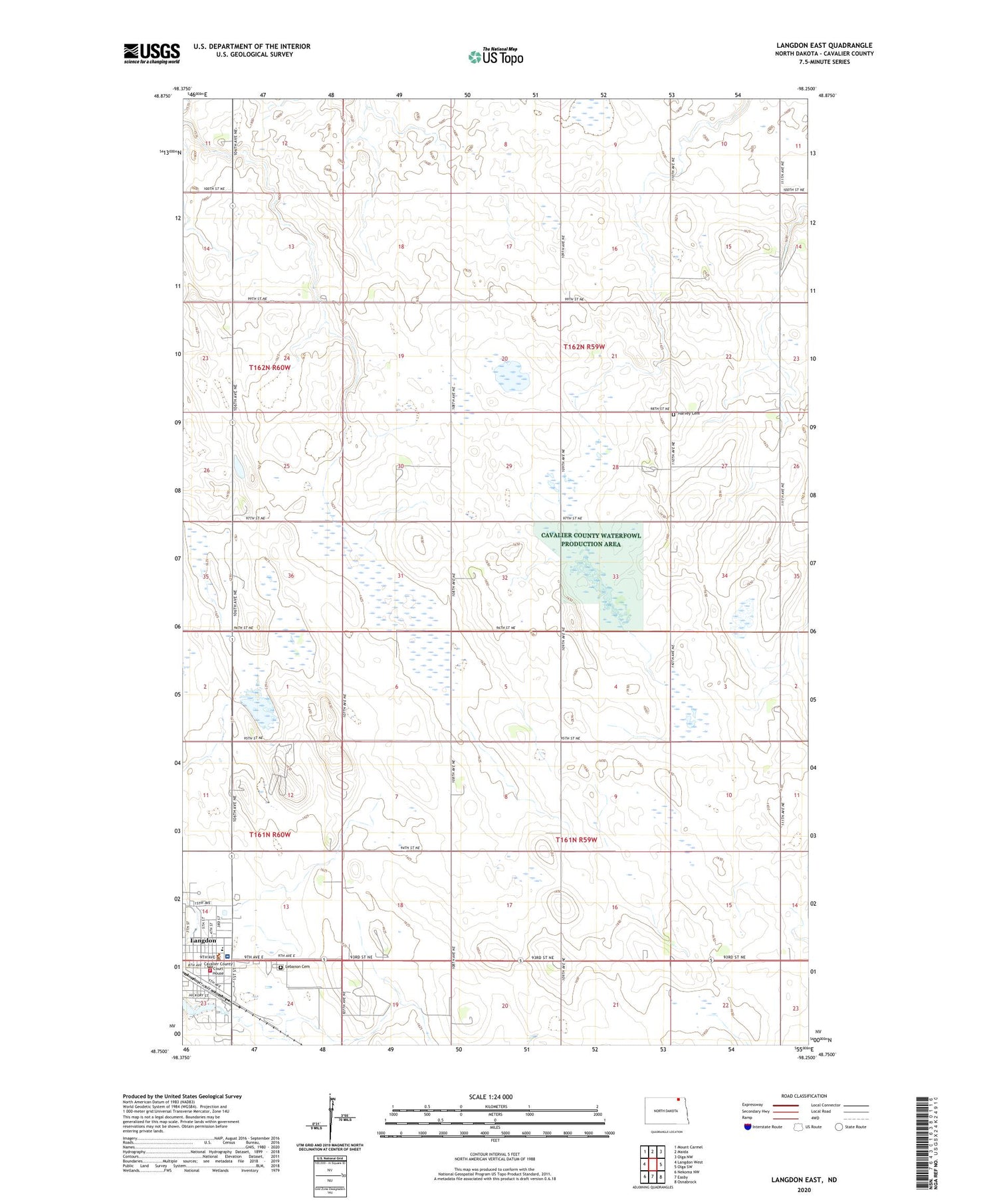
2020 topographic map quadrangle Langdon East in the state of North Dakota. Scale: 1:24000. Based on the newly updated USGS 7.5' US Topo map series, this map is in the following counties: Cavalier. The map contains contour data, water features, and other items you are used to seeing on USGS maps, but also has updated roads and other features. This is the next generation of topographic maps. Printed on high-quality waterproof paper with UV fade-resistant inks.
Quads adjacent to this one:
West: Langdon West
Northwest: Mount Carmel
North: Maida
Northeast: Olga NW
East: Olga SW
Southeast: Osnabrock
South: Easby
Southwest: Nekoma NW
Contains the following named places: Cavalier County Courthouse, Cavalier County Jail, Cavalier County Library, Cavalier County Memorial Hospital, Cavalier County Sheriff's Office, City of Langdon, Harvey Cemetery, Harvey Center Church, KNDK-AM (Langdon), Langdon, Langdon City Hall, Langdon Fire Department, Langdon Post Office, Lebanon Cemetery, Saint Alphonsus Elementary School, Township of Harvey, Township of Manilla, ZIP Code: 58249