
MyTopo
Long X Divide North Dakota US Topo Map
Couldn't load pickup availability
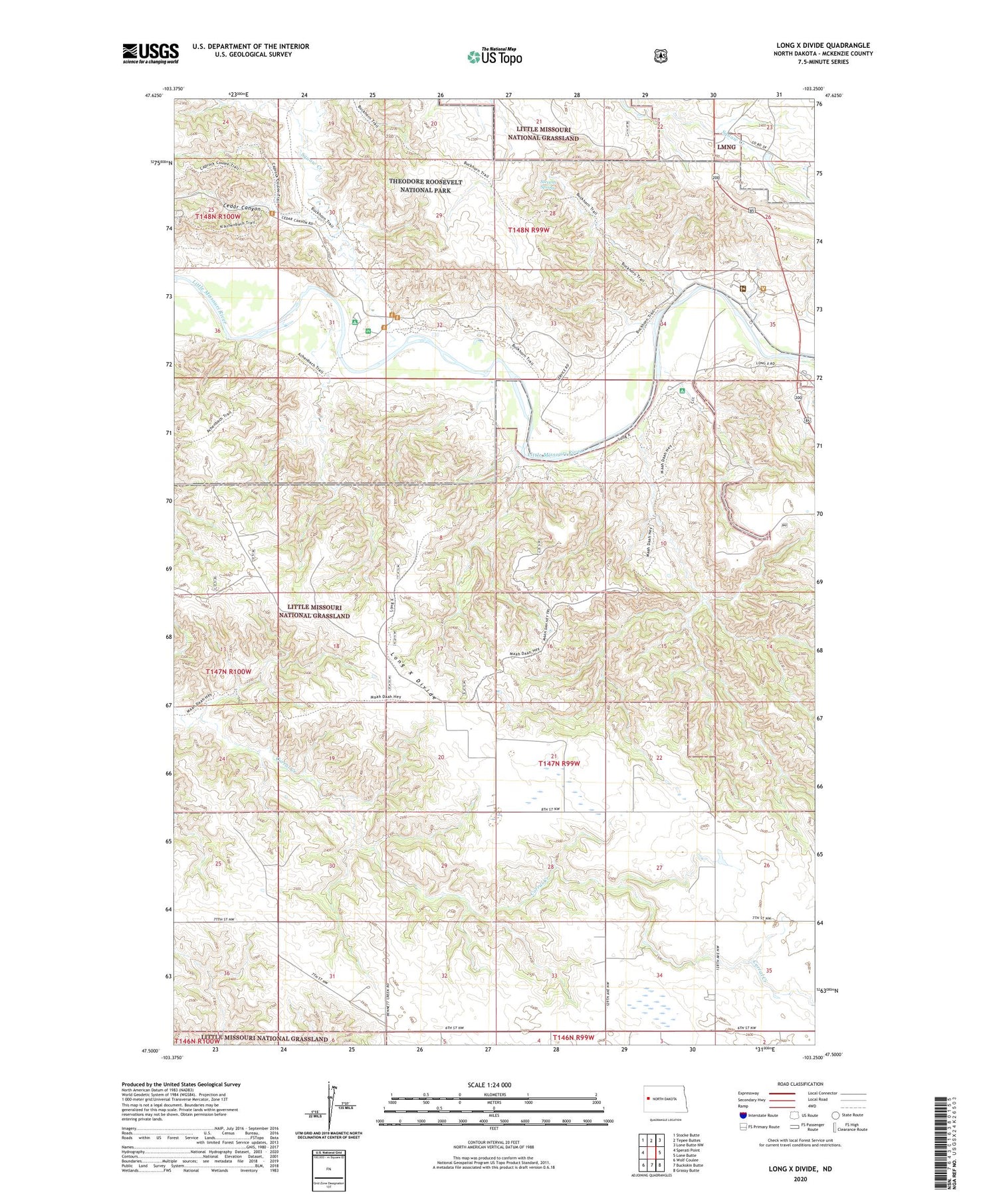
2020 topographic map quadrangle Long X Divide in the state of North Dakota. Scale: 1:24000. Based on the newly updated USGS 7.5' US Topo map series, this map is in the following counties: McKenzie. The map contains contour data, water features, and other items you are used to seeing on USGS maps, but also has updated roads and other features. This is the next generation of topographic maps. Printed on high-quality waterproof paper with UV fade-resistant inks.
Quads adjacent to this one:
West: Sperati Point
Northwest: Stocke Butte
North: Tepee Buttes
Northeast: Lone Butte NW
East: Lone Butte
Southeast: Grassy Butte
South: Buckskin Butte
Southwest: Wolf Coulee
Contains the following named places: Boehm School, C Lange Ranch, Cedar Canyon, Clifton School, Johnston Ranch, Long X Divide, R Baye Ranch, Squaw Creek, Squaw Creek Campground, Stevens Spring, T Eschenko Ranch, T Tarnavsky Ranch, Theodore Roosevelt National Memorial Park Ranger Station, W Carson Ranch


