MyTopo
Mountain North Dakota US Topo Map
Couldn't load pickup availability
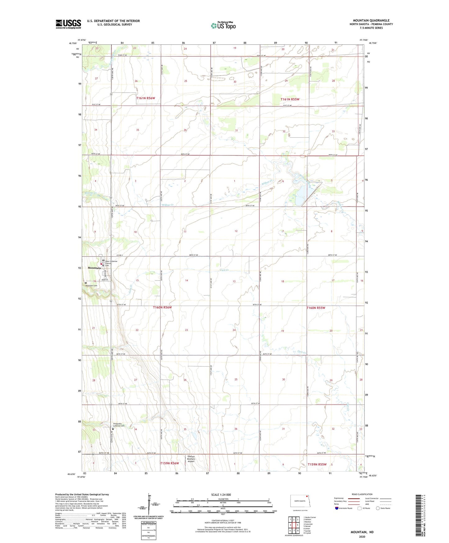
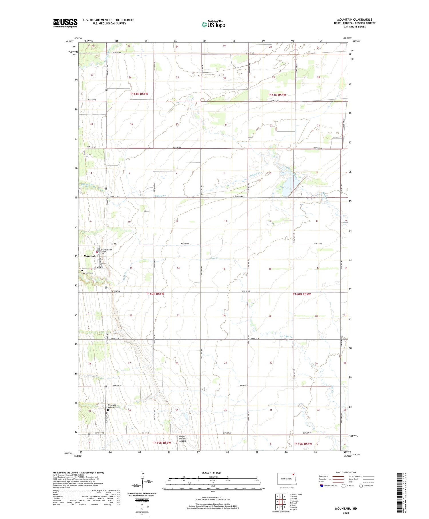
2020 topographic map quadrangle Mountain in the state of North Dakota. Scale: 1:24000. Based on the newly updated USGS 7.5' US Topo map series, this map is in the following counties: Pembina. The map contains contour data, water features, and other items you are used to seeing on USGS maps, but also has updated roads and other features. This is the next generation of topographic maps. Printed on high-quality waterproof paper with UV fade-resistant inks.
Quads adjacent to this one:
West: Concrete
Northwest: Hanks Corner
North: Hallson
Northeast: Backoo
East: Hensel
Southeast: Crystal
South: Gardar
Southwest: Union
Contains the following named places: Bernhoft Farms, City of Mountain, Eyford Church, Mountain, Mountain Cemetery, Mountain Post Office, Mountain Thingvalla Fire Station, Olafson Brothers Airport, Thingvalla Lutheran Cemetery, Thingvalla Town Hall, Township of Thingvalla, Vikur Lutheran Church Cemetery, Willow Creek-Park River Dam Number 1