MyTopo
Rogers North Dakota US Topo Map
Couldn't load pickup availability
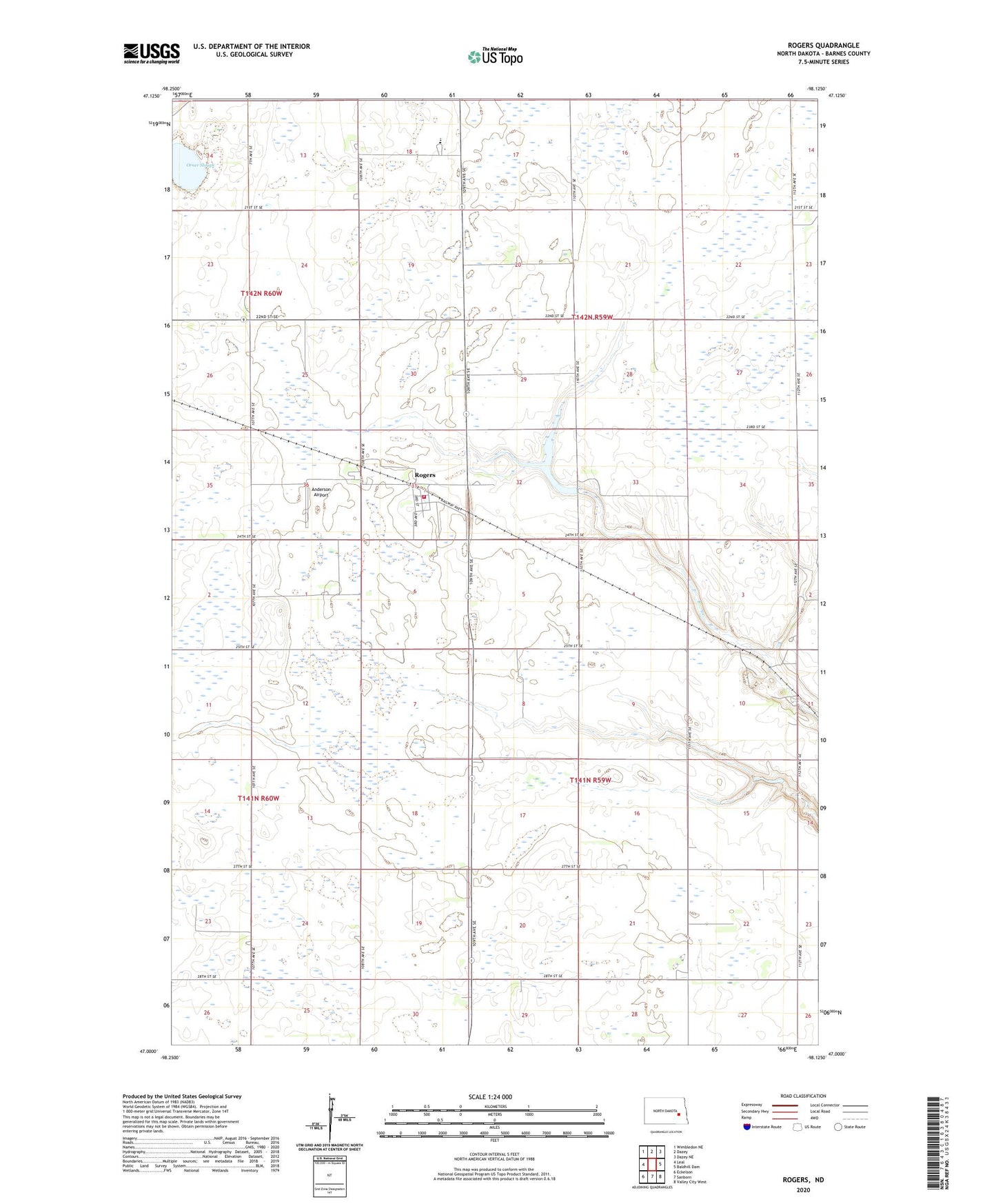
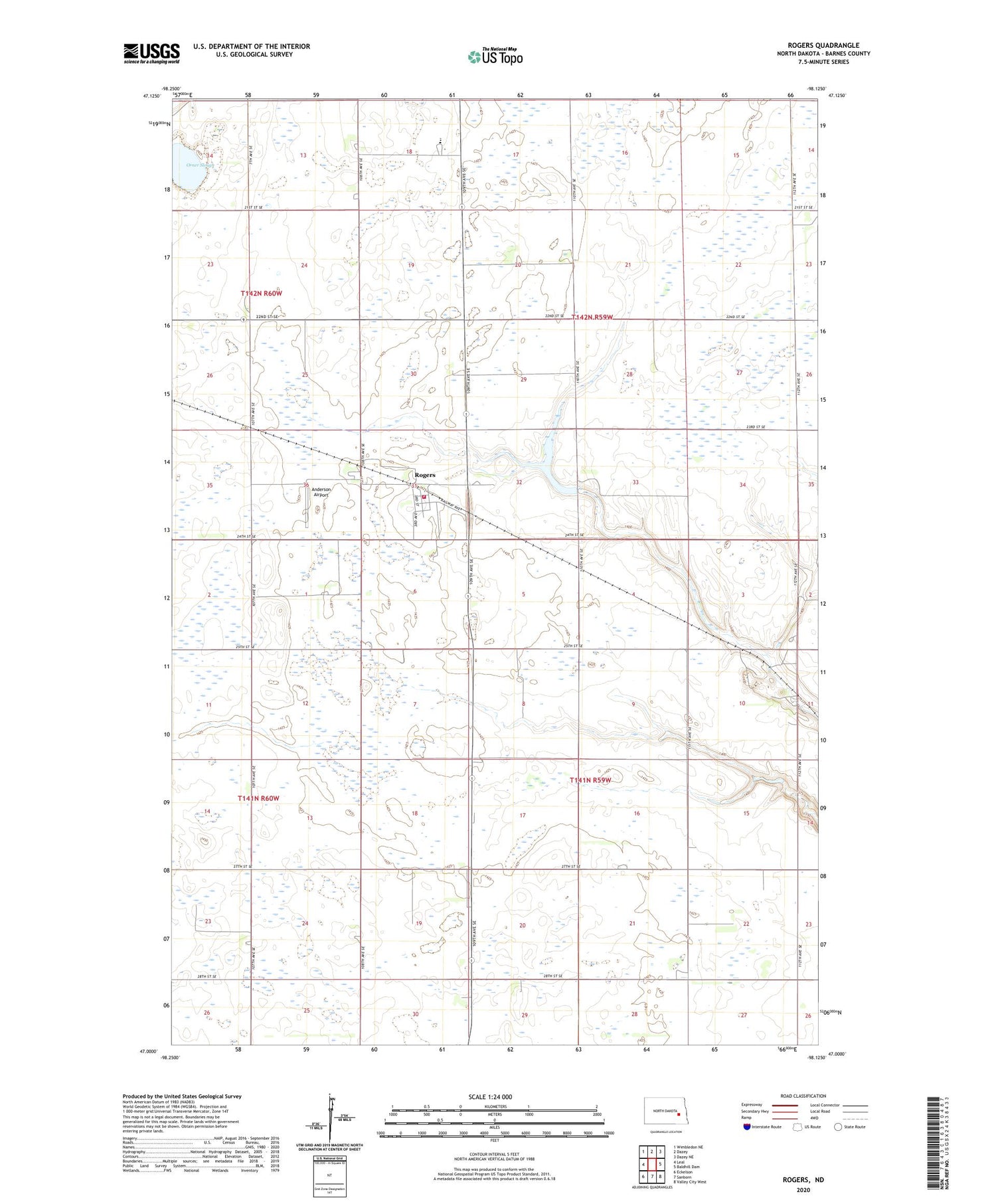
2020 topographic map quadrangle Rogers in the state of North Dakota. Scale: 1:24000. Based on the newly updated USGS 7.5' US Topo map series, this map is in the following counties: Barnes. The map contains contour data, water features, and other items you are used to seeing on USGS maps, but also has updated roads and other features. This is the next generation of topographic maps. Printed on high-quality waterproof paper with UV fade-resistant inks.
Quads adjacent to this one:
West: Leal
Northwest: Wimbledon NE
North: Dazey
Northeast: Dazey NE
East: Baldhill Dam
Southeast: Valley City West
South: Sanborn
Southwest: Eckelson
Contains the following named places: Anderson Airport, Anderson Town Hall, Barnes County North-North Central Public School, Booth, City of Rogers, Odell, Orner Slough, Rogers, Rogers Fire Department, Rogers Post Office, Tomahawk Dam, Tomahawk Lake, Tomahawk National Wildlife Refuge, Township of Rogers, Township of Stewart, ZIP Code: 58479