MyTopo
Snyder Lake North Dakota US Topo Map
Couldn't load pickup availability
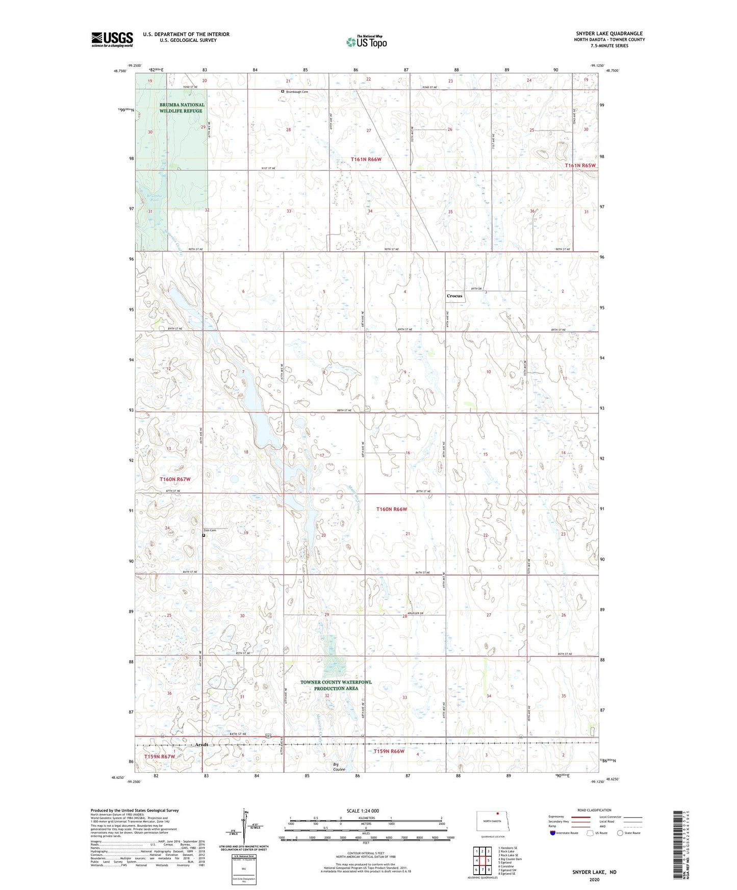
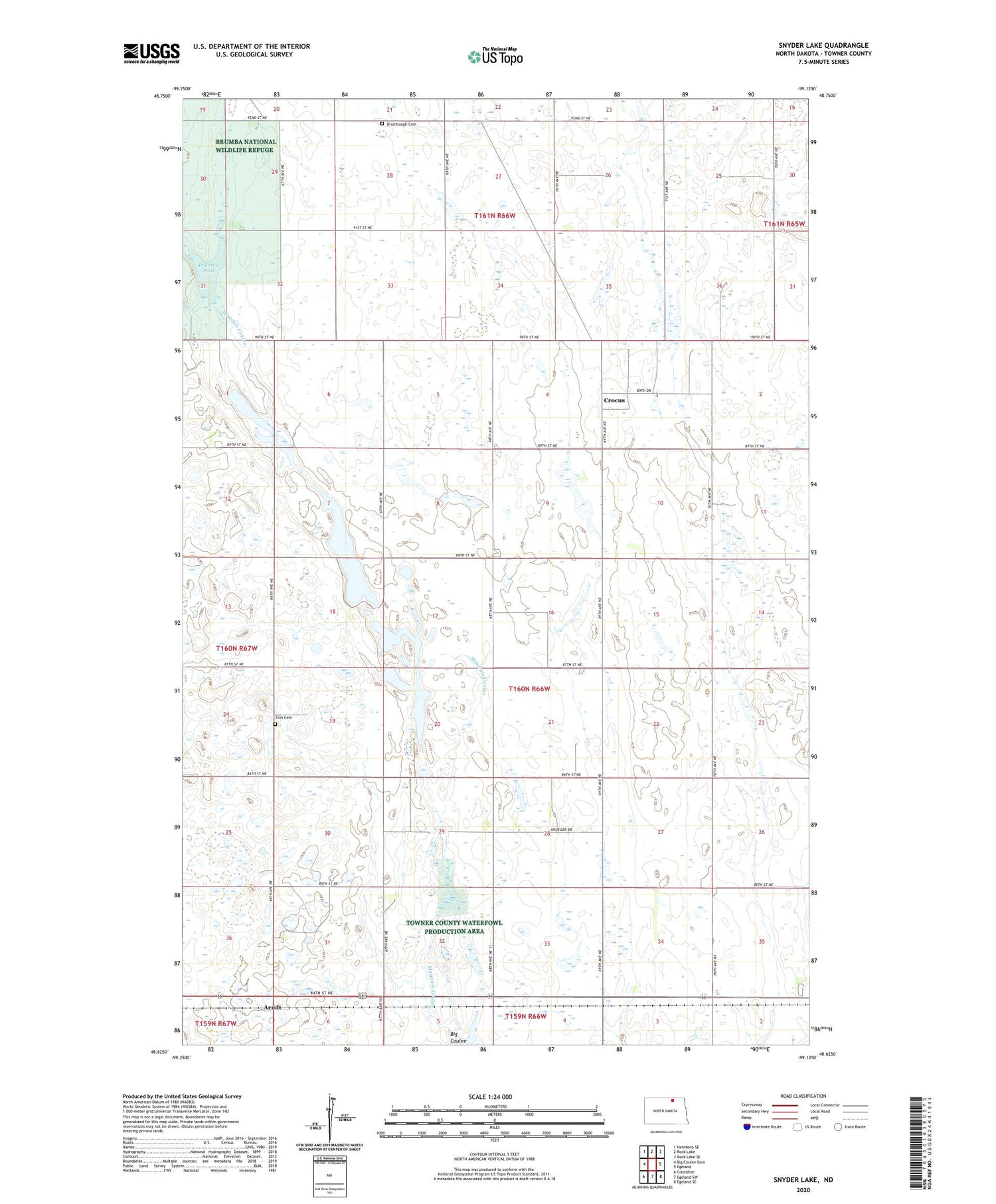
2020 topographic map quadrangle Snyder Lake in the state of North Dakota. Scale: 1:24000. Based on the newly updated USGS 7.5' US Topo map series, this map is in the following counties: Towner. The map contains contour data, water features, and other items you are used to seeing on USGS maps, but also has updated roads and other features. This is the next generation of topographic maps. Printed on high-quality waterproof paper with UV fade-resistant inks.
Quads adjacent to this one:
West: Big Coulee Dam
Northwest: Hansboro SE
North: Rock Lake
Northeast: Rock Lake SE
East: Egeland
Southeast: Egeland SE
South: Egeland SW
Southwest: Considine
Contains the following named places: Arndt, Brumba National Wildlife Refuge, Brumba Pool, Brumbaugh Cemetery, Crocus, Snyder Lake, Snyder Lake Dam, Snyder Lake National Wildlife Refuge, Towner County, Township of Crocus, Zion Cemetery