MyTopo
Stanley North Dakota US Topo Map
Couldn't load pickup availability
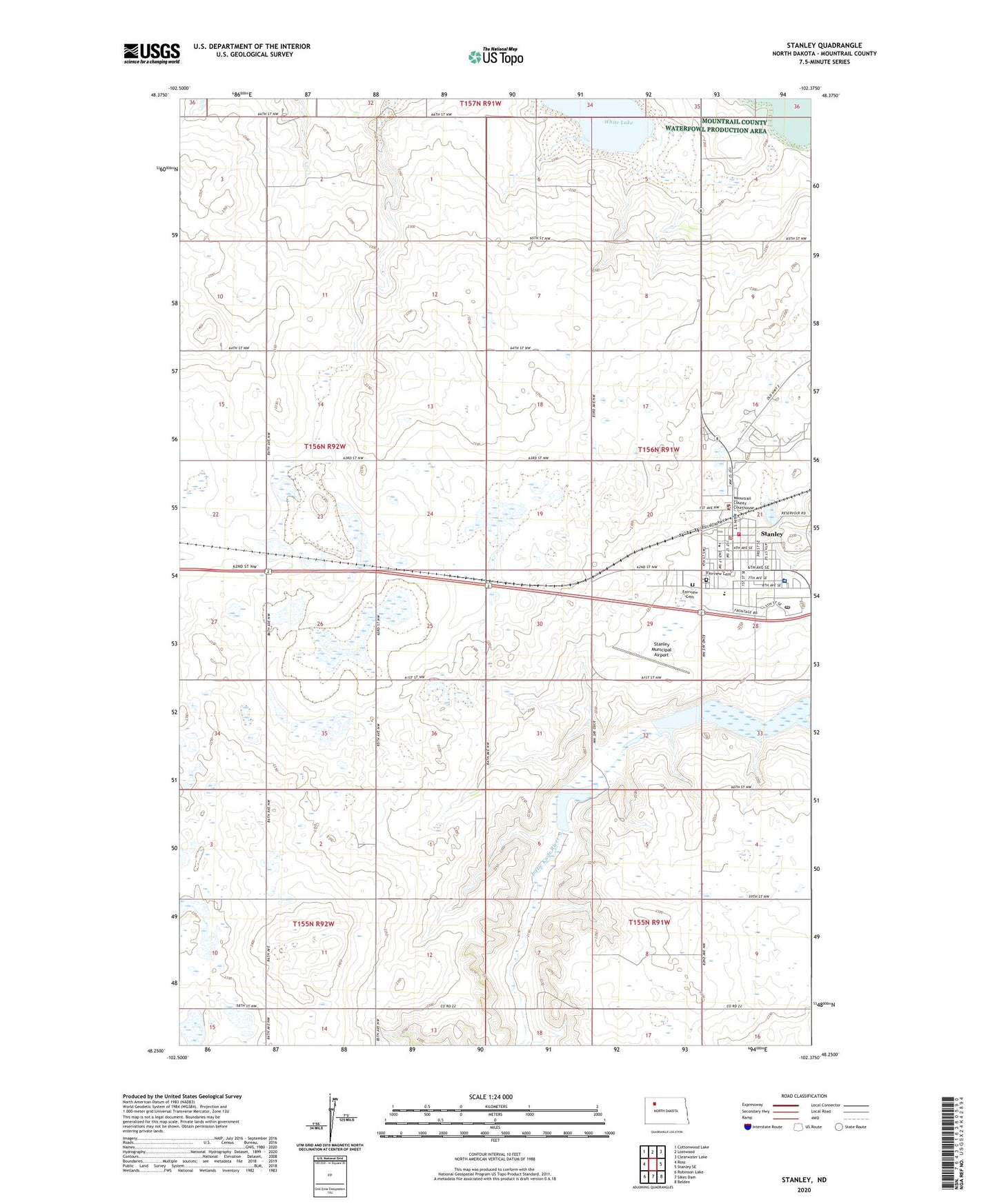
2020 topographic map quadrangle Stanley in the state of North Dakota. Scale: 1:24000. Based on the newly updated USGS 7.5' US Topo map series, this map is in the following counties: Mountrail. The map contains contour data, water features, and other items you are used to seeing on USGS maps, but also has updated roads and other features. This is the next generation of topographic maps. Printed on high-quality waterproof paper with UV fade-resistant inks.
Quads adjacent to this one:
West: Ross
Northwest: Cottonwood Lake
North: Lostwood
Northeast: Clearwater Lake
East: Stanley SE
Southeast: Belden
South: Sikes Dam
Southwest: Robinson Lake
Contains the following named places: City of Stanley, Fairview Cemetery, Flickertail Village Museum, Ina Mae Rude Aquatic Center, Mountrail Bethel Home, Mountrail County Courthouse, Mountrail County Medical Center, Mountrail County Sheriff's Office, Stanley, Stanley Ambulance Service, Stanley City Hall, Stanley Dam, Stanley Elementary School, Stanley Fire Station, Stanley High School, Stanley Municipal Airport, Stanley Police Department, Stanley Post Office, Stanley Public Library, ZIP Code: 58784