MyTopo
Sutton North Dakota US Topo Map
Couldn't load pickup availability
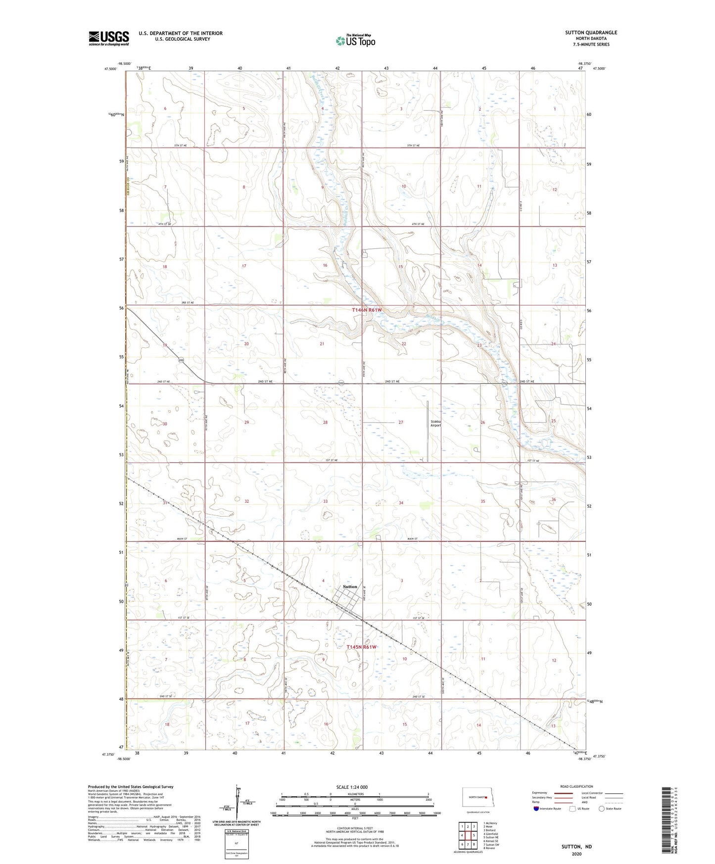
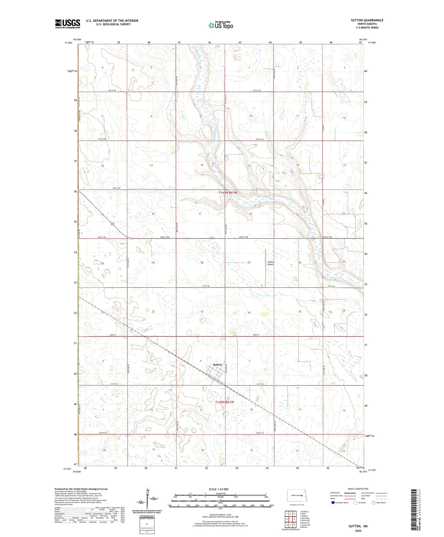
2020 topographic map quadrangle Sutton in the state of North Dakota. Scale: 1:24000. Based on the newly updated USGS 7.5' US Topo map series, this map is in the following counties: Griggs, Foster. The map contains contour data, water features, and other items you are used to seeing on USGS maps, but also has updated roads and other features. This is the next generation of topographic maps. Printed on high-quality waterproof paper with UV fade-resistant inks.
Quads adjacent to this one:
West: Glenfield
Northwest: McHenry
North: Mose
Northeast: Binford
East: Sutton NE
Southeast: Revere
South: Sutton SW
Southwest: Kensal SE
Contains the following named places: Kingsley Town Hall, Stokka Airport, Sutton, Sutton Census Designated Place, Township of Kingsley, ZIP Code: 58484