MyTopo
Tioga North Dakota US Topo Map
Couldn't load pickup availability
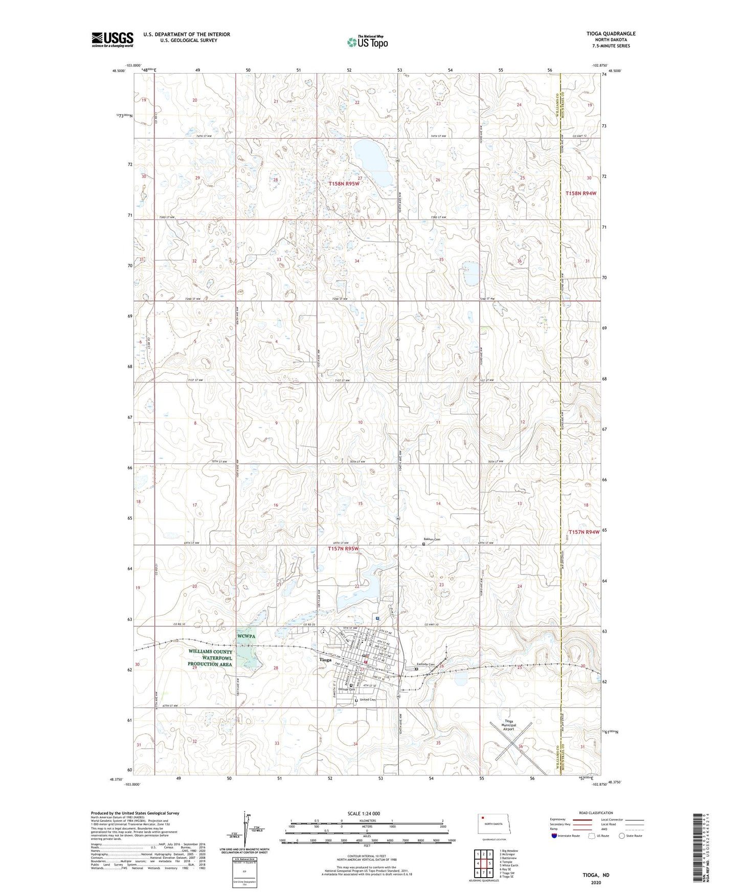
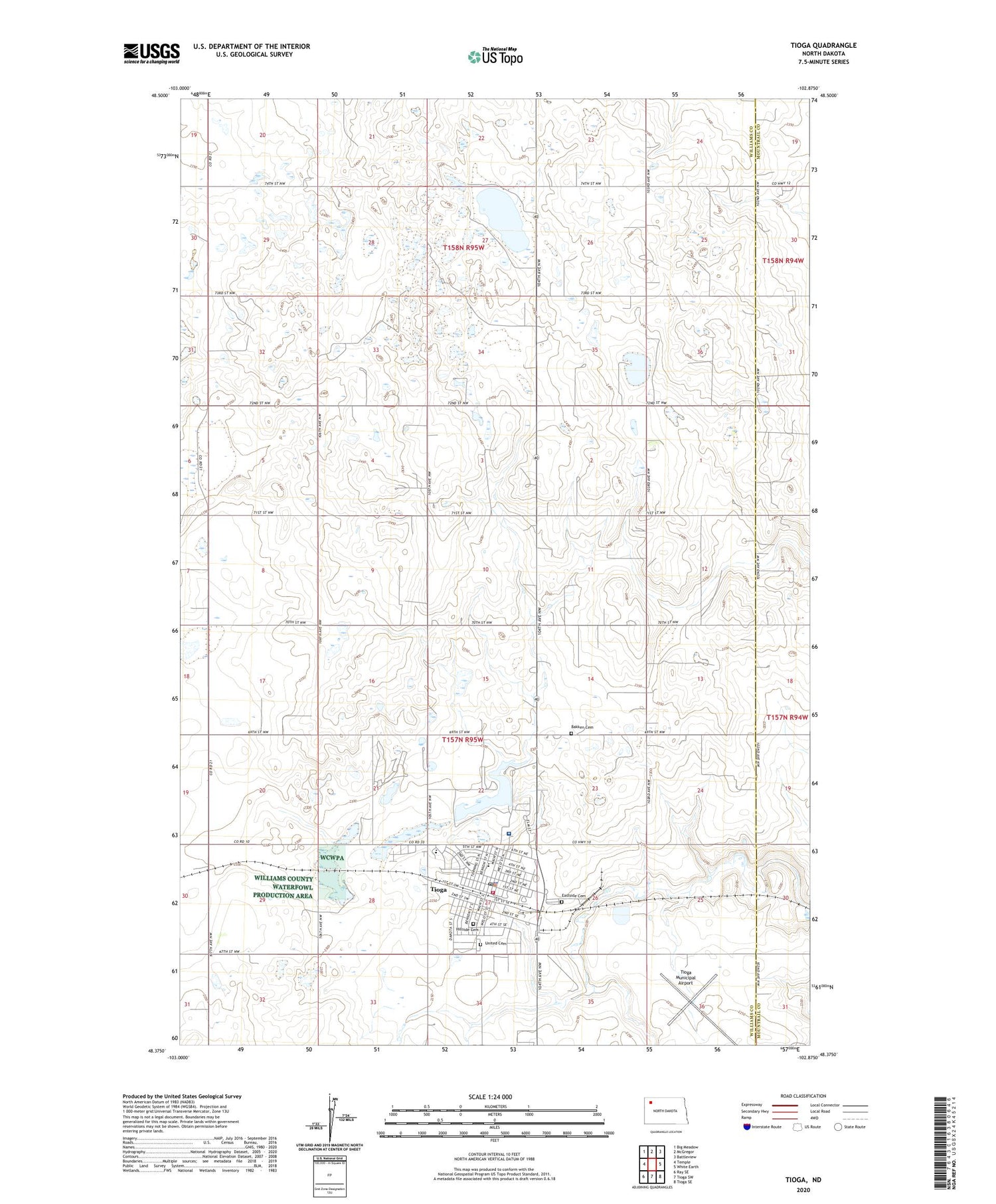
2020 topographic map quadrangle Tioga in the state of North Dakota. Scale: 1:24000. Based on the newly updated USGS 7.5' US Topo map series, this map is in the following counties: Williams, Mountrail. The map contains contour data, water features, and other items you are used to seeing on USGS maps, but also has updated roads and other features. This is the next generation of topographic maps. Printed on high-quality waterproof paper with UV fade-resistant inks.
Quads adjacent to this one:
West: Temple
Northwest: Big Meadow
North: McGregor
Northeast: Battleview
East: White Earth
Southeast: Tioga SE
South: Tioga SW
Southwest: Ray SE
Contains the following named places: Bakken Cemetery, Central Elementary School, City of Tioga, Eastside Cemetery, Hillside Cemetery, KTGO-AM (Tioga), Norseman Museum, Tioga, Tioga Ambulance Service, Tioga City Hall, Tioga Dam, Tioga Fire Department, Tioga Golf Course, Tioga High School, Tioga Mecical Center Long Term Care, Tioga Medical Center, Tioga Municipal Airport, Tioga Oil and Gas Field, Tioga Police Department, Tioga Post Office, Township of Tioga, United Cemetery