MyTopo
College Corner Ohio US Topo Map
Couldn't load pickup availability
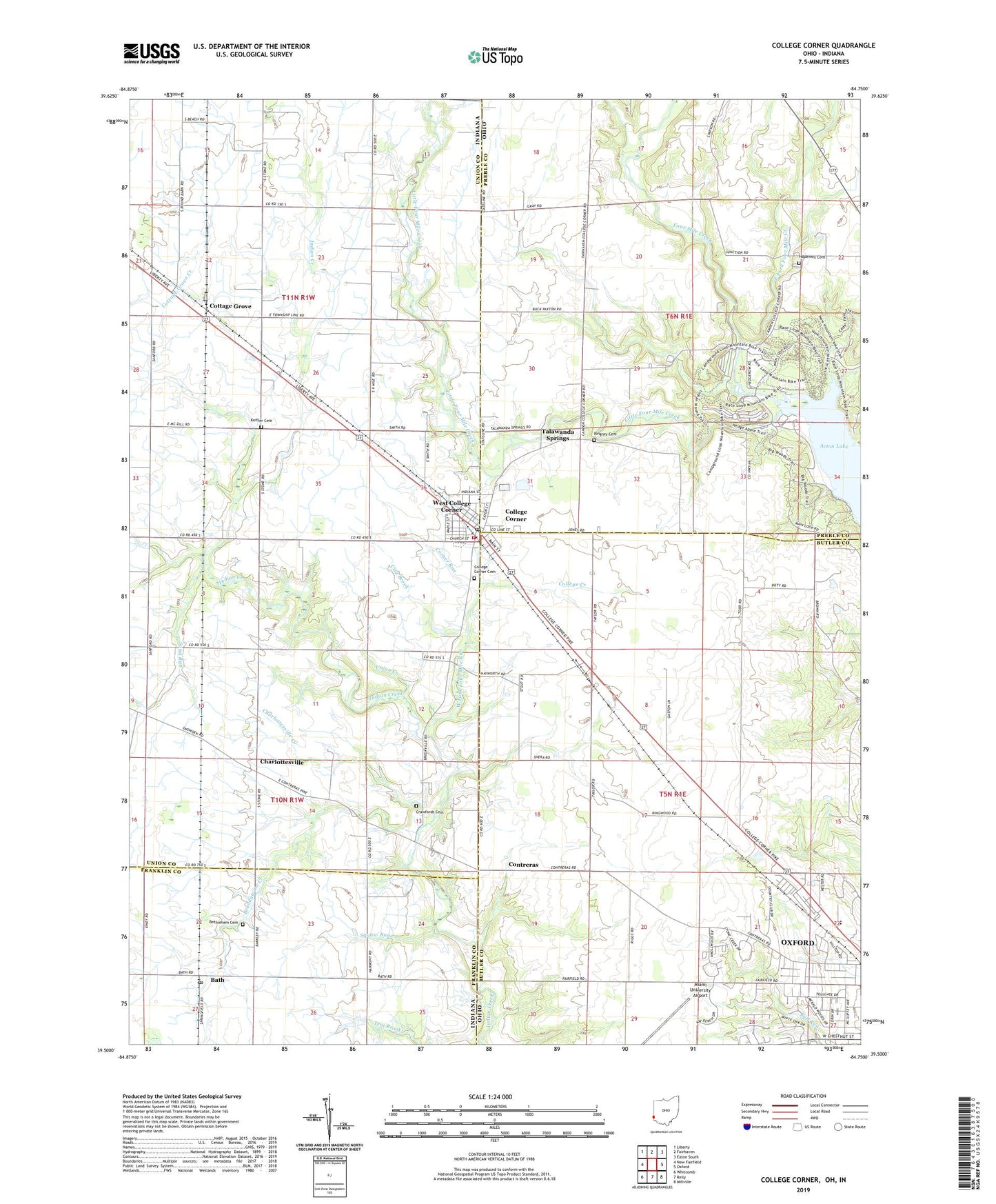
2019 topographic map quadrangle College Corner in the states of Ohio, Indiana. Scale: 1:24000. Based on the newly updated USGS 7.5' US Topo map series, this map is in the following counties: Butler, Preble, Union, Franklin. The map contains contour data, water features, and other items you are used to seeing on USGS maps, but also has updated roads and other features. This is the next generation of topographic maps. Printed on high-quality waterproof paper with UV fade-resistant inks.
Quads adjacent to this one:
West: New Fairfield
Northwest: Liberty
North: Fairhaven
Northeast: Eaton South
East: Oxford
Southeast: Millville
South: Reily
Southwest: Whitcomb
Contains the following named places: Bath, Bath Post Office, Bethlehem Cemetery, Big Woods Trail, Blue Heron Hiking Trail, Brandywine Creek, Cabin Trail, Cedar Falls Hiking Trail, Charlottesville, Charlottesville Creek, City Brook, College Corner, College Corner Cemetery, College Corner Fire Department, College Corner Post Office, College Corner Union Elementary School, College Creek, Contreras, Contreras Post Office, Corner Run, Cottage Grove, Cottage Grove Creek, Crawfords Cemetery, Deer Pen Picnic Area, East Fork Four Mile Creek, Equisetum Loop Trail, Fourmile Church, Gallion Run Trail, Hedge Apple Trail, Hedgerow Picnic Area, Hopewell Cemetery, Hopewell Church, Hueston Woods, Hueston Woods Lodge Heliport, Hueston Woods State Nature Preserve, Indian Mound Trail, Keiffer Cemetery, Kingrey Cemetery, Kramer Elementary School, Little Four Mile Creek, Maple Grove Picnic Area, McDonald, Miami University Airport, Nike Site CD-78C, Nike Site CD-78L, Oxford Country Club, Oxford Honor Camp, Oxford Park, Pine Grove Picnic Area, Pioneer Farm Museum, Quarry Picnic Area, Sand Run, School Number 2, School Number 3, School Number 4, School Number 5, Squaw Run, Sugar Bush Trail, Sycamore Grove Picnic Area, Sycamore Hiking Trail, Talawanda Springs, Tollgate Shopping Center, Town of West College Corner, Township of Bath, Township of Israel, Township of Oxford, Township of Union, Union Creek, Union Township School, Village of College Corner, West College Corner, West Fork Four Mile Run, Westgate Shopping Center, WMUB-FM (Oxford), ZIP Codes: 45003, 47003, 47010