MyTopo
Pleasant Hill Ohio US Topo Map
Couldn't load pickup availability
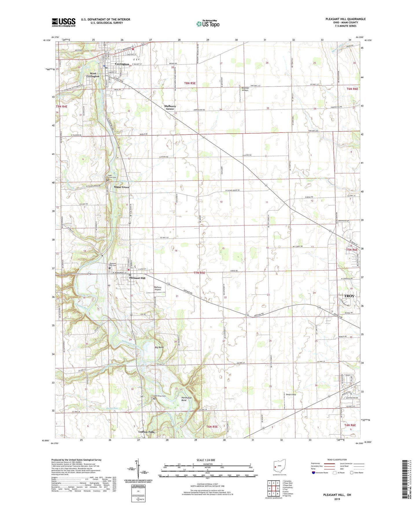
2019 topographic map quadrangle Pleasant Hill in the state of Ohio. Scale: 1:24000. Based on the newly updated USGS 7.5' US Topo map series, this map is in the following counties: Miami. The map contains contour data, water features, and other items you are used to seeing on USGS maps, but also has updated roads and other features. This is the next generation of topographic maps. Printed on high-quality waterproof paper with UV fade-resistant inks.
Quads adjacent to this one:
West: Gettysburg
Northwest: Versailles
North: Piqua West
Northeast: Piqua East
East: Troy
Southeast: Tipp City
South: West Milton
Southwest: Laura
Contains the following named places: Adams Landing Strip, Angle Farms, Ashland School, Bashore Airport, Big Bend, Bowman Airport, Brethren in Christ Church, Brukner Lake, Brukner Lake Dam, Burns Farms, Canyon Run, Carriage Crossing, Concord Elementary School, Covington, Covington Church of the Brethren, Covington City Police Department, Covington Elementary School, Covington Fire Department Station 1, Covington High School, Covington Post Office, Covington Presbyterian Church, Covington Rescue Squad, Covington United Church of Christ, Dayton Boys Club, Diltz Corners, Edgewater, Ellemans, F L Blankenship Riverside Sanctuary, Fairfield, Fairview School, Fenner School, First Brethren Church, First Lutheran Church, Fisher Farms, Fox Harbor, Greenville Creek, Greenville Falls, Hemm Ditch, Horseshoe Bend, Jackson Farms, Jimtown, Kensington, Kings Chapel, Lavy Dairy Farm, Lickskillet School, Long's Farm, Ludlow Creek, McFadden Farms, Morrow Farms, Mulberry Grove, Myers Farm, Newton Elementary School, Newton High School, Old Union Cemetery, Opossum Run, Painter Creek, Pamela Estates, Pierce School, Pleasant Hill, Pleasant Hill - Newton Township Joint Fire District, Pleasant Hill Cemetery, Pleasant Hill Church of God, Pleasant Hill Pit, Pleasant Hill Post Office, Pleasant Hill United Church of Christ, Priest Hill School, Rocky Run, Rolling Hills Girl Scout Camp, Rowdyville, Saint Johns Evangelical Lutheran Church, Saint Teresa of the Infant Jesus Roman Catholic Church, Shoman Family Farms, Smith Field, Stonebridge, Stonebridge Meadows, Sugar Grove, Sugar Grove Camp, Sugar Grove Cemetery, Sugar Grove Church of the Brethren, Sunnyside School, Tadpole School, Township of Newton, Township of Washington, Triple K Farm, Village of Covington, Village of Pleasant Hill, Wackler Farms, West Covington, Williams Lake, Williams Prairie, Willowcreek, Windy Acres Farm, Wolfe Farms, ZIP Codes: 45339, 45359