MyTopo
Sherwood Ohio US Topo Map
Couldn't load pickup availability
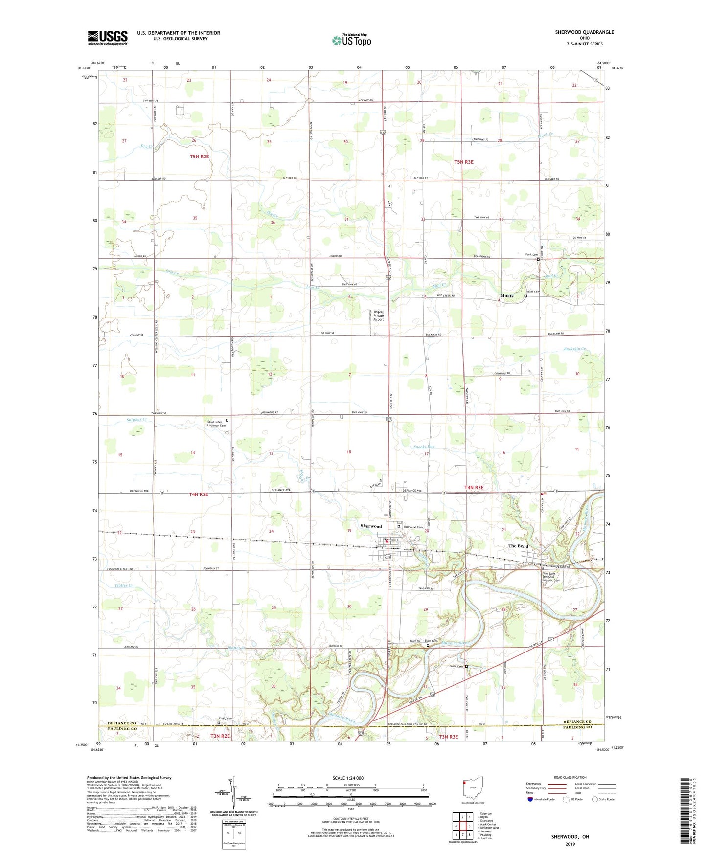
2019 topographic map quadrangle Sherwood in the state of Ohio. Scale: 1:24000. Based on the newly updated USGS 7.5' US Topo map series, this map is in the following counties: Defiance, Paulding. The map contains contour data, water features, and other items you are used to seeing on USGS maps, but also has updated roads and other features. This is the next generation of topographic maps. Printed on high-quality waterproof paper with UV fade-resistant inks.
Quads adjacent to this one:
West: Mark Center
Northwest: Edgerton
North: Bryan
Northeast: Evansport
East: Defiance West
Southeast: Junction
South: Paulding
Southwest: Antwerp
Contains the following named places: Blair Cemetery, Case School, Coffin School, Colby Cemetery, Colby School, Delaware Township Fire Department, Dickey School, Dry Creek, Dry Creek United Brethren Church, Fairview High School, Fairview Junior High School, Funk Cemetery, Glore Cemetery, Gordon Creek, Lost Creek, Mason School, Moats, Moats Cemetery, Moats Post Office, Mock School, New Saint Stephens Catholic Cemetery, North Delaware Church, Platter Creek, Platter Creek School, Pleasant Point School, Rogers Private Airport, Saint Johns Lutheran Cemetery, Saint John's Lutheran Church, Saint Johns School, School Number 1, School Number 5, School Number 8, Shady Corner School, Sherwood, Sherwood Cemetery, Sherwood Elementary School, Sherwood Post Office, Sherwood Village Volunteer Fire Department, Shoestring School, Snooks Run, Sulphur Creek, The Bend, The Bend Post Office, Township of Delaware, Village of Sherwood, WDFM-FM (Defiance), ZIP Codes: 43549, 43556