MyTopo
South Vienna Ohio US Topo Map
Couldn't load pickup availability
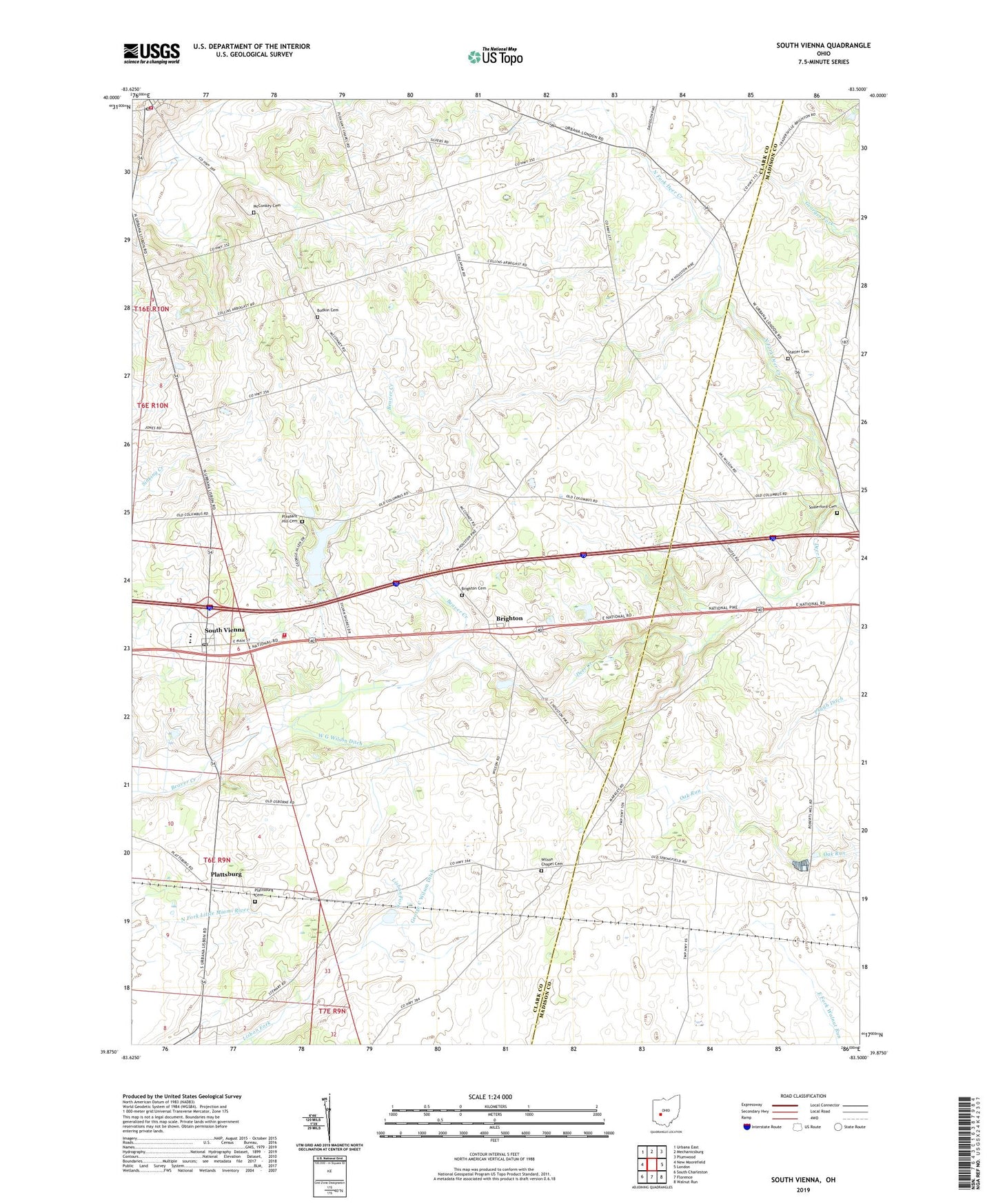
2019 topographic map quadrangle South Vienna in the state of Ohio. Scale: 1:24000. Based on the newly updated USGS 7.5' US Topo map series, this map is in the following counties: Clark, Madison. The map contains contour data, water features, and other items you are used to seeing on USGS maps, but also has updated roads and other features. This is the next generation of topographic maps. Printed on high-quality waterproof paper with UV fade-resistant inks.
Quads adjacent to this one:
West: New Moorefield
Northwest: Urbana East
North: Mechanicsburg
Northeast: Plumwood
East: London
Southeast: Walnut Run
South: Florence
Southwest: South Charleston
Contains the following named places: Baker Farms, Bar Farms, Bodkin Cemetery, Brighton, Brighton Cemetery, Catawba, Catawba Post Office, Catawba School, George C Wilson Ditch, Gill Livestock and Land Farms, Harmony Township Fire Department, Lake Sylvan, Lake Sylvan Dam, London Fish Hatchery, Markley, McConkey Cemetery, Myers, North Fork Deer Creek, Oakgrove School, Pelz Field Airport, Plattsburg, Plattsburg Cemetery, Plattsburg Post Office, Pleasant Hill Cemetery, Pleasant Township Fire Department, Reaver Farms Orchard, Sanford Farm, Somerford Cemetery, South Vienna, South Vienna Elementary School, South Vienna Post Office, Statler Cemetery, Sylvan Shores, Township of Pleasant, Village of Catawba, Village of South Vienna, W G Wilson Ditch, Wilson Chapel, Wilson Chapel Cemetery, ZIP Codes: 43010, 45369