
MyTopo
Haworth Oklahoma US Topo Map
Couldn't load pickup availability
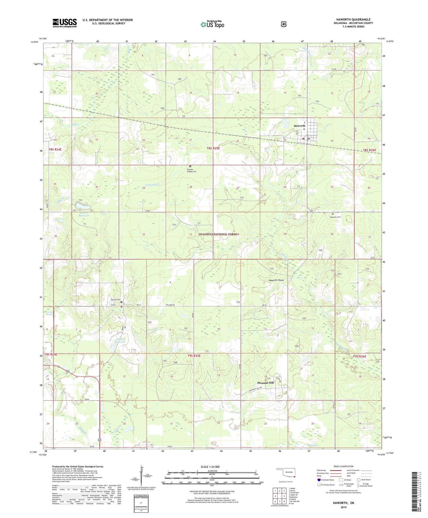
2019 topographic map quadrangle Haworth in the state of Oklahoma. Scale: 1:24000. Based on the newly updated USGS 7.5' US Topo map series, this map is in the following counties: McCurtain. The map contains contour data, water features, and other items you are used to seeing on USGS maps, but also has updated roads and other features. This is the next generation of topographic maps. Printed on high-quality waterproof paper with UV fade-resistant inks.
Quads adjacent to this one:
West: Idabel SE
Northwest: Idabel
North: Shults
Northeast: Goodwater
East: Bokhoma
Southeast: Tom
South: De Kalb NW
Southwest: English
Contains the following named places: Harris, Haworth, Haworth Cemetery, Haworth Elementary School, Haworth High School, Haworth Junior High School, Haworth Police Department, Haworth Post Office, Haworth Tower, Haworth Volunteer Fire Department Station 1, Haworth Volunteer Fire Department Station 3, Hickory Grove School, Kulli Campground, Kulli Tuklo School, Kullituklo, Oak Grove School, Oknoname 089007 Dam, Oknoname 089007 Reservoir, Oknoname 089017 Dam, Oknoname 089017 Reservoir, Pleasant Hill, Pollard Cemetery, Pollard School, Thomas Chapel, Thomas Chapel Cemetery, Thomas Chapel School, Tiak Lookout Tower, Tiak Work Center, Tom Elementary School, Town of Haworth, Water Fall-Gilford Site Number 11 Dam


