MyTopo
Hopeton Oklahoma US Topo Map
Couldn't load pickup availability
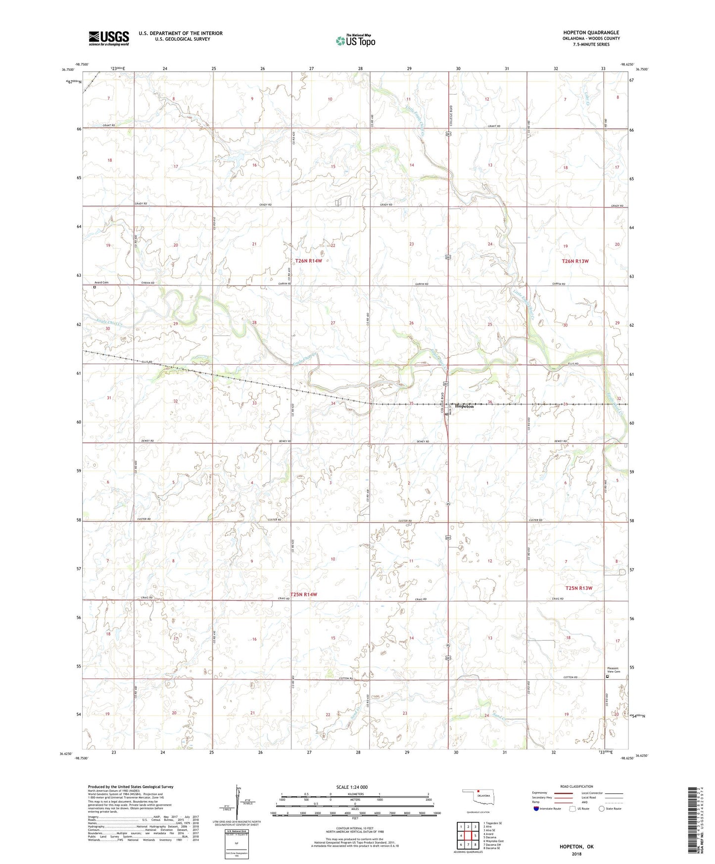
2018 topographic map quadrangle Hopeton in the state of Oklahoma. Scale: 1:24000. Based on the newly updated USGS 7.5' US Topo map series, this map is in the following counties: Woods. The map contains contour data, water features, and other items you are used to seeing on USGS maps, but also has updated roads and other features. This is the next generation of topographic maps. Printed on high-quality waterproof paper with UV fade-resistant inks.
Quads adjacent to this one:
West: Avard
Northwest: Tegarden SE
North: Alva
Northeast: Alva SE
East: Dacoma
Southeast: Dacoma SE
South: Dacoma SW
Southwest: Waynoka East
Contains the following named places: Avard Cemetery, Hopeton, Hopeton Census Designated Place, Hopeton Post Office, Little Eagle Chief Creek, Overton Lake, Overton Lake Dam, Pleasant View Cemetery, Pleasant View Church, Township of Hopeton, Township of Liberty, ZIP Code: 73746