MyTopo
Stilwell East Oklahoma US Topo Map
Couldn't load pickup availability
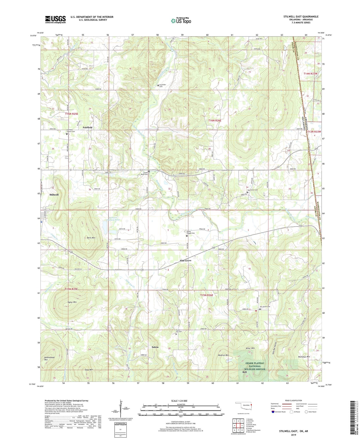
2019 topographic map quadrangle Stilwell East in the state of Oklahoma. Scale: 1:24000. Based on the newly updated USGS 7.5' US Topo map series, this map is in the following counties: Adair, Washington. The map contains contour data, water features, and other items you are used to seeing on USGS maps, but also has updated roads and other features. This is the next generation of topographic maps. Printed on high-quality waterproof paper with UV fade-resistant inks.
Quads adjacent to this one:
West: Stilwell West
Northwest: Christie
North: Westville
Northeast: Lincoln
East: Evansville
Southeast: Natural Dam
South: Big Round Mountain
Southwest: Greasy
Contains the following named places: Adair County Jail, Adair County Sheriff's Office, Bethel Church, Calvary Church, Chalk Bluff Cemetery, Davis Mountain, Doublehead Mountain, Elm Grove, Elm Grove Cemetery, Elm Grove Census Designated Place, Elm Grove Church, Ewing Chapel, Ewing Chapel Cemetery, Fairfield, Fairfield Census Designated Place, Fairfield Church, Fairfield Church Cemetery, Faith Tabernacle, Four Corners Church, Fourkiller Cemetery, Honey Hill, Honey Hill Cemetery, Honey Hill Census Designated Place, Honey Hill Church, Killer Mountain, Muskrat Mountain, Oak Grove Cemetery, Oak Grove Church, Orchard Dam, Orchard Lake, Piney, Pleasant View Church, Rock Springs Church, Salem, Salem Census Designated Place, Soap Mountain, Stillwell Orchard Pond, Stillwell Orchard Pond Dam, Stilwell East Division, Stilwell Memorial Hospital Heliport, Taylor Mountain, Thea-Aut-La Springs Camp, Township of Stilwell, Tri - Community Volunteer Fire Department, United Church