
MyTopo
Arlington Oregon US Topo Map
Couldn't load pickup availability
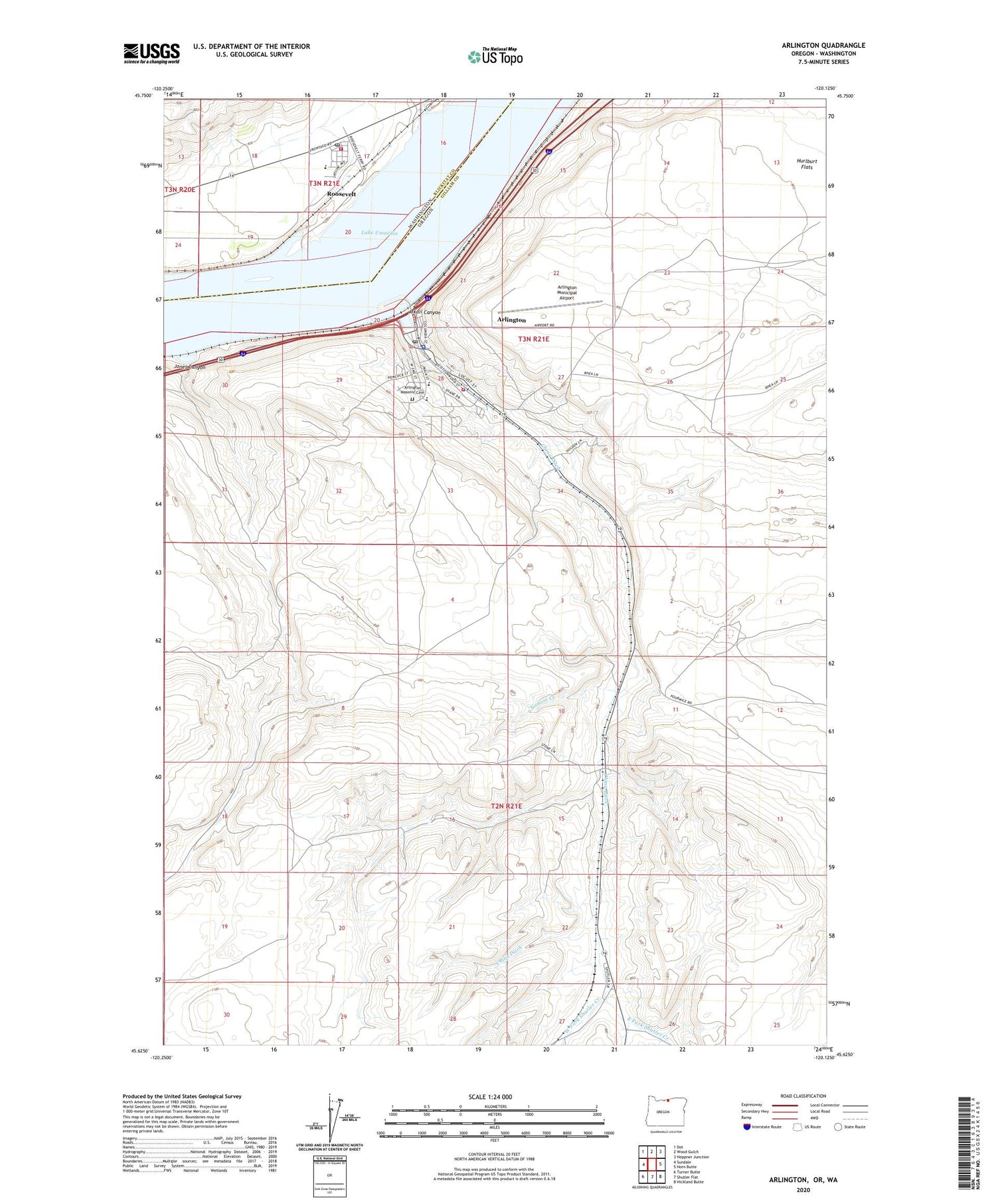
2020 topographic map quadrangle Arlington in the states of Oregon, Washington. Scale: 1:24000. Based on the newly updated USGS 7.5' US Topo map series, this map is in the following counties: Gilliam, Klickitat. The map contains contour data, water features, and other items you are used to seeing on USGS maps, but also has updated roads and other features. This is the next generation of topographic maps. Printed on high-quality waterproof paper with UV fade-resistant inks.
Quads adjacent to this one:
West: Sundale
Northwest: Dot
North: Wood Gulch
Northeast: Heppner Junction
East: Horn Butte
Southeast: Hickland Butte
South: Shutler Flat
Southwest: Turner Butte
Contains the following named places: Alkali Canyon, Alkali Park, Arlington, Arlington City Hall, Arlington Elementary School, Arlington High School, Arlington Masonic Cemetery, Arlington Municipal Airport, Arlington Post Office, Arlington Public Library, Arlington Public Works Department, Arlington Rodeo Grounds, Arlington Sewer Treatment Plant, Arlington State Park, China Ditch, City of Arlington, Earl Snell Memorial Park, East Fork Shutler Creek, Eddy, Gilliam County Justice Court Arlington Branch, Hurlburt Flats, Jones Canyon, Klickitat County Fire District 9, Nonose Creek, North Gilliam County Rural Fire Protection District, Oregon State Police Department Arlington, Owyhee Rapids, Pebble Springs Camp, Port of Arlington Marina, Port of Arlington Marina Boat Launch, Roosevelt, Roosevelt Census Designated Place, Roosevelt Elementary School, Roosevelt Post Office, Roosevelt Treaty Fishing Access Site, Shutler, Shutler Post Office, West Fork Shutler Creek, West Hurlburt Camp


