MyTopo
Murphy Waterholes NE Oregon US Topo Map
Couldn't load pickup availability
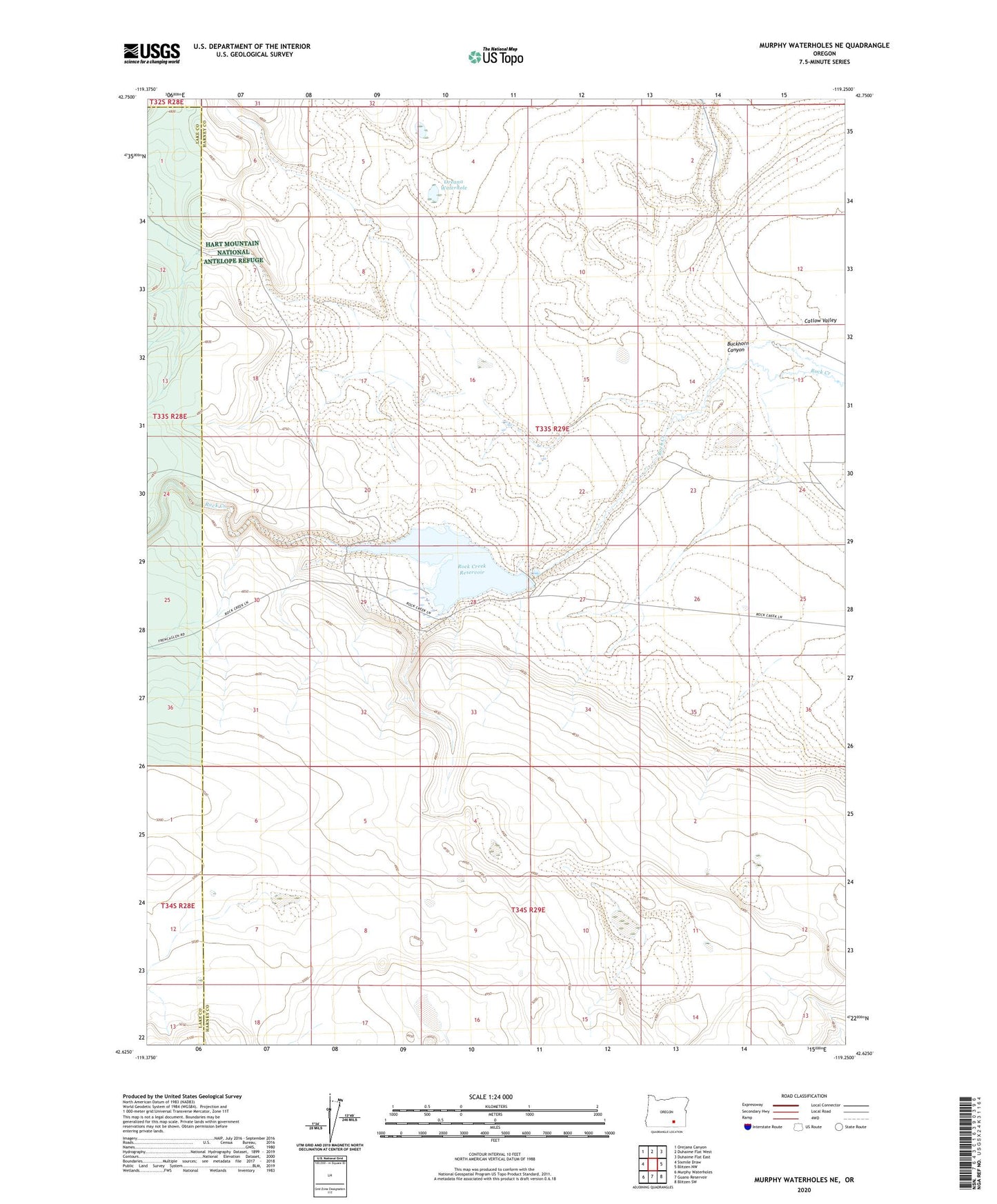
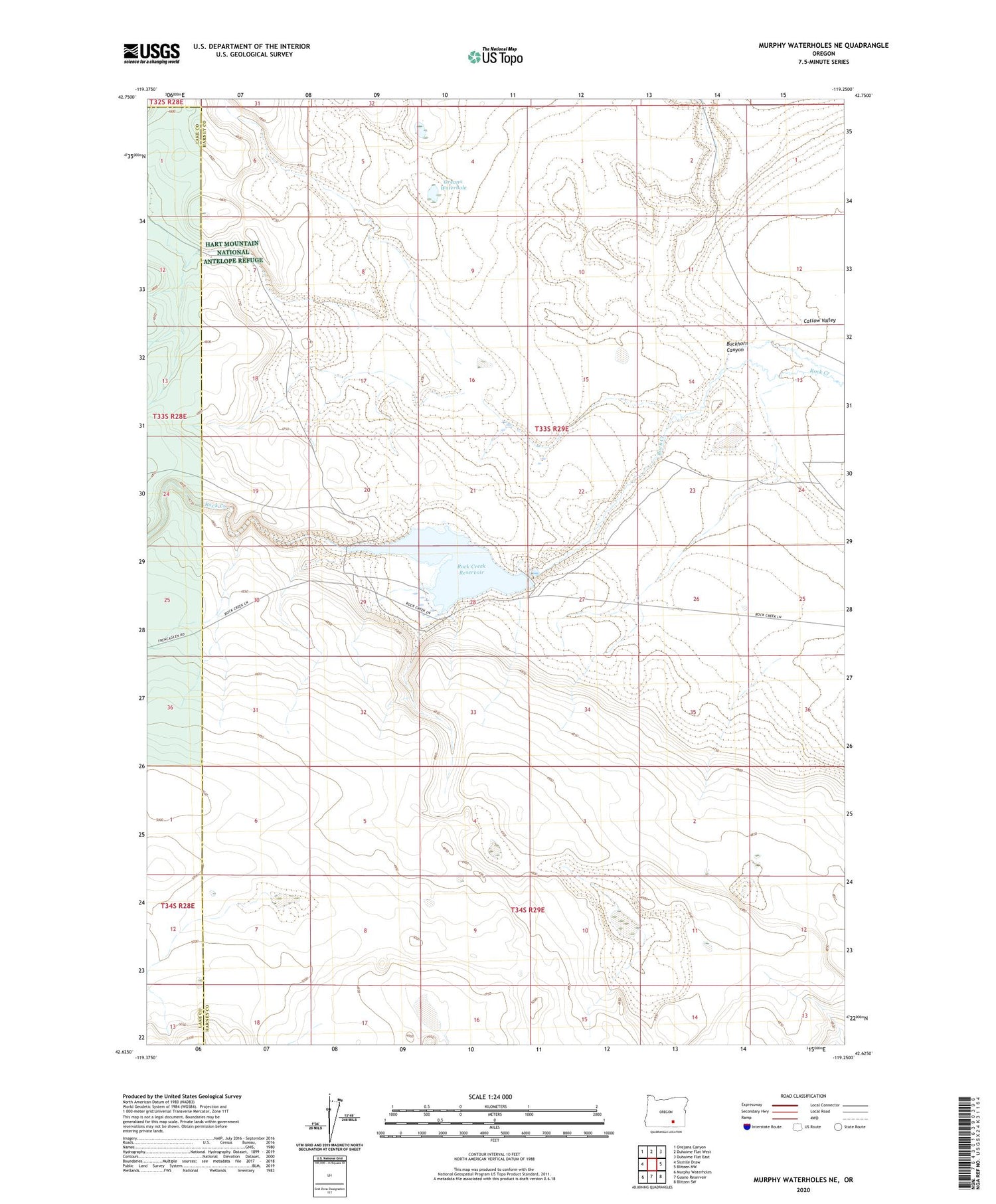
2020 topographic map quadrangle Murphy Waterholes NE in the state of Oregon. Scale: 1:24000. Based on the newly updated USGS 7.5' US Topo map series, this map is in the following counties: Harney, Lake. The map contains contour data, water features, and other items you are used to seeing on USGS maps, but also has updated roads and other features. This is the next generation of topographic maps. Printed on high-quality waterproof paper with UV fade-resistant inks.
Quads adjacent to this one:
West: Sixmile Draw
Northwest: Orejana Canyon
North: Duhaime Flat West
Northeast: Duhaime Flat East
East: Blitzen NW
Southeast: Blitzen SW
South: Guano Reservoir
Southwest: Murphy Waterholes
Contains the following named places: Buckhorn Canyon, Oreana Waterhole, Rock Creek Reservoir