MyTopo
Glen Hazel Pennsylvania US Topo Map
Couldn't load pickup availability
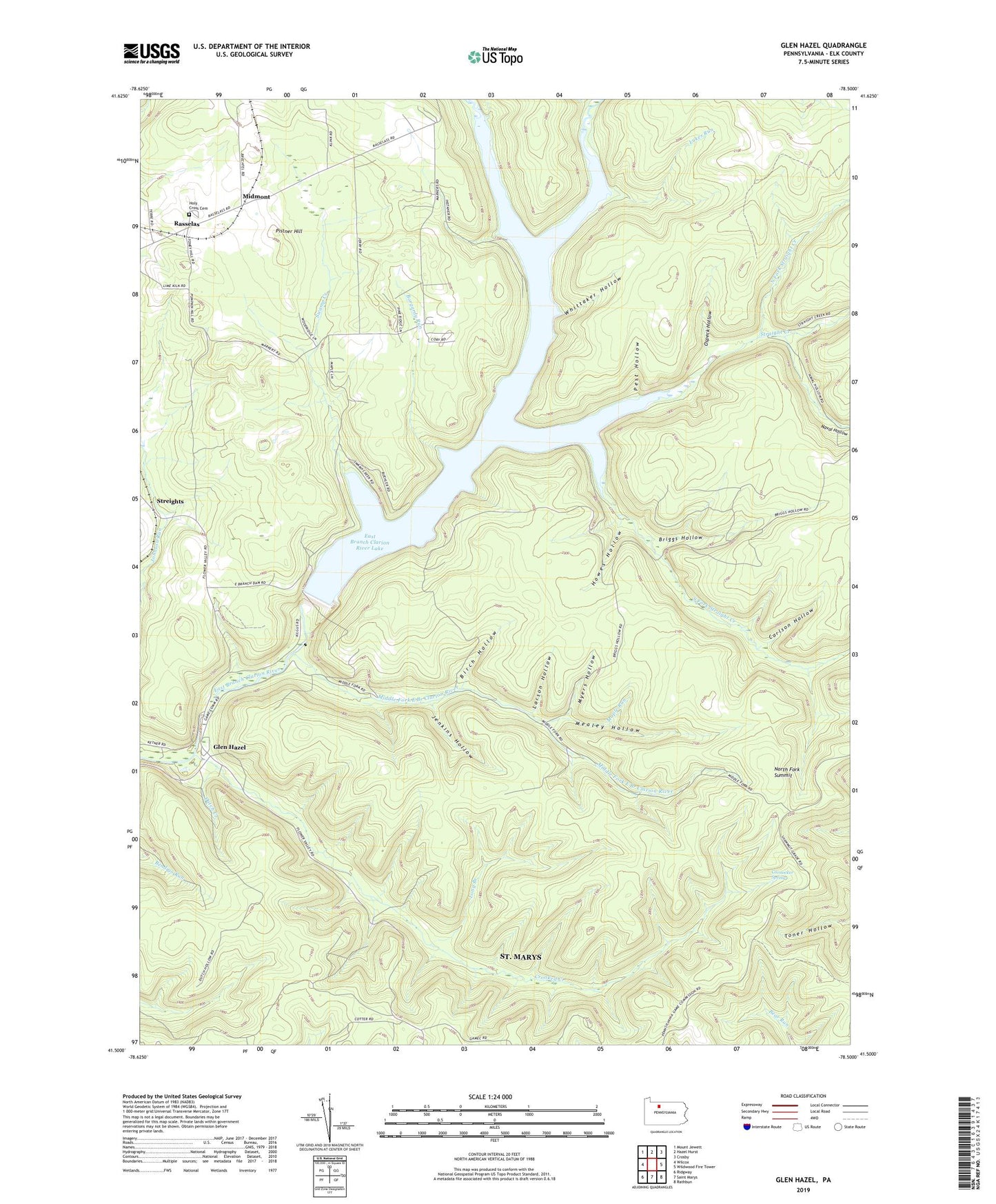
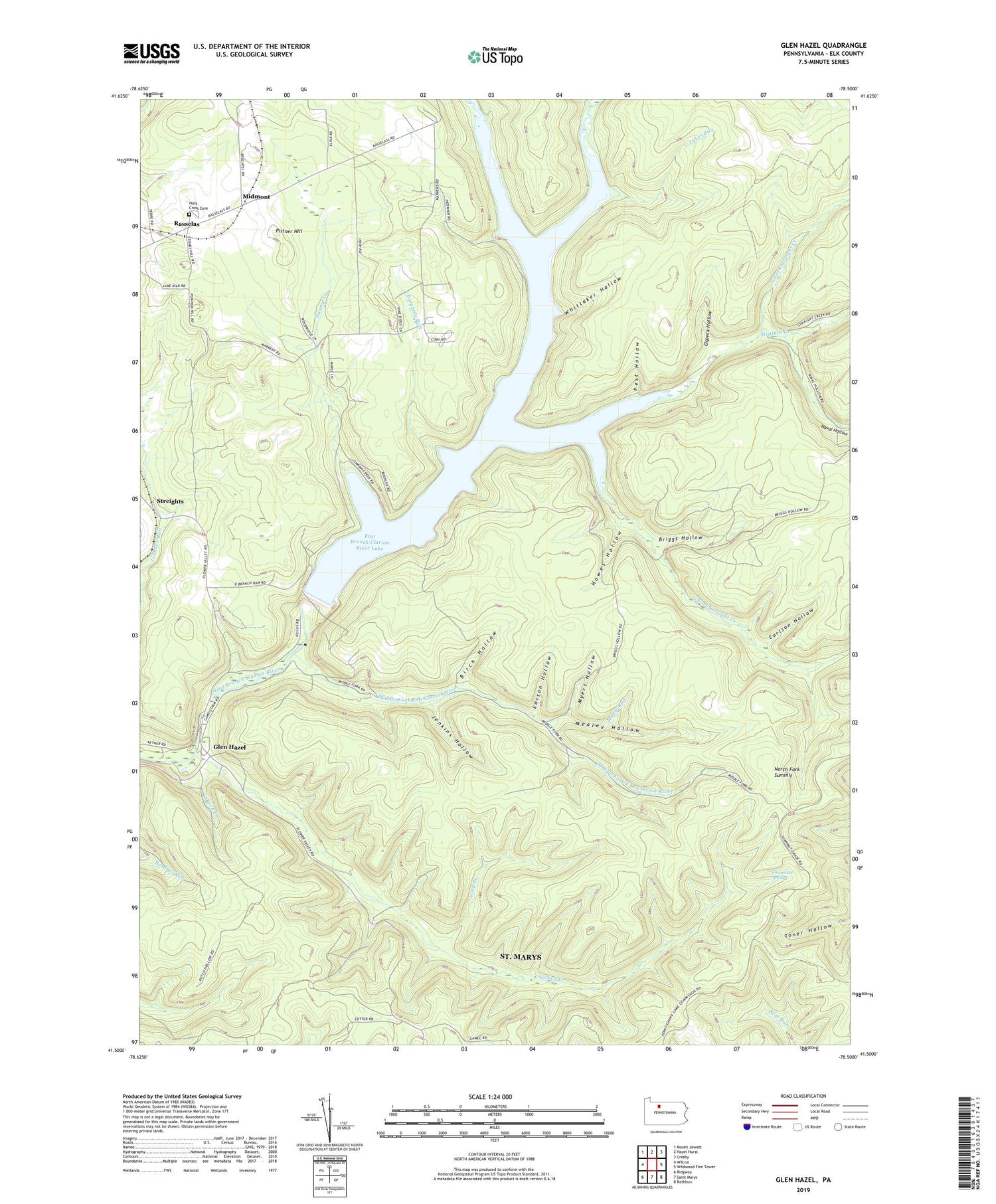
2019 topographic map quadrangle Glen Hazel in the state of Pennsylvania. Scale: 1:24000. Based on the newly updated USGS 7.5' US Topo map series, this map is in the following counties: Elk. The map contains contour data, water features, and other items you are used to seeing on USGS maps, but also has updated roads and other features. This is the next generation of topographic maps. Printed on high-quality waterproof paper with UV fade-resistant inks.
Quads adjacent to this one:
West: Wilcox
Northwest: Mount Jewett
North: Hazel Hurst
Northeast: Crosby
East: Wildwood Fire Tower
Southeast: Rathbun
South: Saint Marys
Southwest: Ridgway
Contains the following named places: Birch Hollow, Borgardy Run, Briggs Hollow, Carlson Hollow, Carnocker Spring, CCC Camp, Crooked Creek, Dutch Creek, East Branch Clarion River Lake, East Branch Clarion River Lake Dam, Elk State Park, Fivemile Run, Glen Hazel, Holy Cross Cemetery, Howes Hollow, Instanter, Jenkins Hollow, Larson Hollow, Long Branch, Lukes Run, Maple Run, Mealey Hollow, Middle Fork East Branch Clarion River, Midmont, Myers Hollow, Naval Hollow, North Fork Straight Creek, North Fork Summit, Ospeck Hollow, Pest Hollow, Pistner Hill, Rasselas, Shawmut Trail, South Fork Straight Creek, State Game Lands Number 25, Straight Creek, Streights, Swamp Creek, Township of Jones, Whittaker Hollow, ZIP Code: 15870