
MyTopo
Johnsonville South Carolina US Topo Map
Couldn't load pickup availability
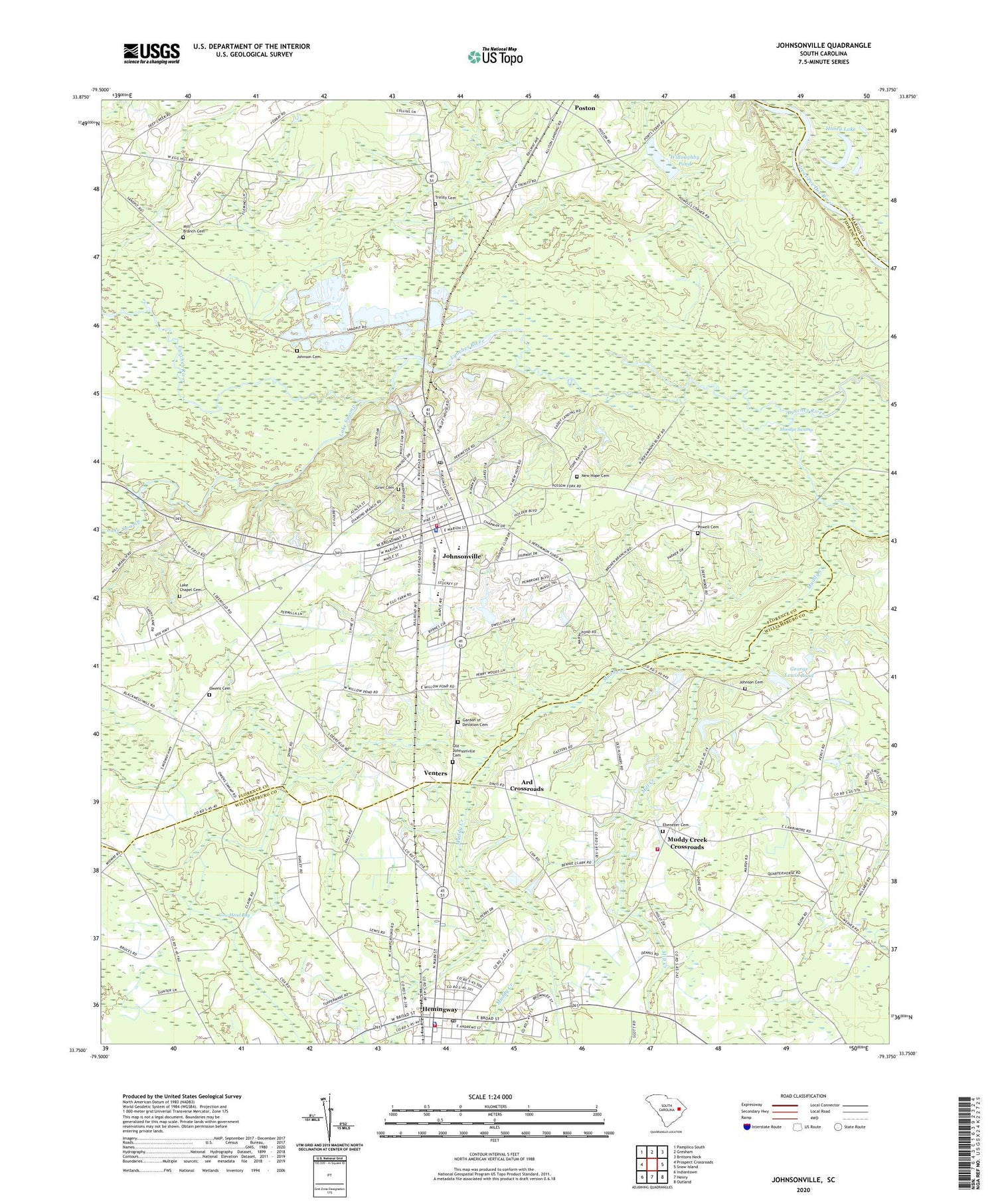
2020 topographic map quadrangle Johnsonville in the state of South Carolina. Scale: 1:24000. Based on the newly updated USGS 7.5' US Topo map series, this map is in the following counties: Florence, Williamsburg, Marion. The map contains contour data, water features, and other items you are used to seeing on USGS maps, but also has updated roads and other features. This is the next generation of topographic maps. Printed on high-quality waterproof paper with UV fade-resistant inks.
Quads adjacent to this one:
West: Prospect Crossroads
Northwest: Pamplico South
North: Gresham
Northeast: Brittons Neck
East: Snow Island
Southeast: Outland
South: Henry
Southwest: Indiantown
Contains the following named places: Ard Crossroads, Bethlehem Church, Christ Tabernacle Holiness Church, City of Johnsonville, Community Free Will Baptist Church, Cow Head Bay, Duboses Ferry, Ebenezer Cemetery, Ebenezer Methodist Church, Garden of Devotion Cemetery, George Lewis Pond, George Lewis Pond Dam D-3102, Graham Chapel, Grier Cemetery, Hemingway, Hemingway Career and Technology Center, Hemingway Commerce Center, Hemingway Fire Department, Hemingway Police Department, Hemingway Post Office, Honey Lake, Huggins Church, Johnson Cemetery, Johnsonville, Johnsonville Division, Johnsonville Elementary School, Johnsonville Fire Department Station 1, Johnsonville First Baptist Church, Johnsonville High School, Johnsonville Middle School, Johnsonville Pentecostal Holiness Church, Johnsonville Police Department, Johnsonville Post Office, Johnsonville Public Library, Johnsonville Rescue Squad, Johnsonville United Methodist Church, Johnsville Country Club Lake, Lake Chapel, Lake Chapel Cemetery, Lake Swamp, Longwood School, Mathews Hill Church, Mill Branch Cemetery, Mill Creek, Moodys Swamp, Muddy Creek Crossroads, Muddy Creek School, Nazareth African Methodist Episcopal Church, New Hope Cemetery, New Hope Church, Old Johnsonville Cemetery, Old Johnsonville Methodist Church, Old Johnsonville School, Owens Cemetery, Poston, Powell Cemetery, Rehoba Church, Saint Johns Church, Saint Johns Crossroads, Saint Marks Church, Saint Matthews School, South Carolina Noname 21011 D-3565 Dam, Stone Ranch, The Wellman Club, Tie Lake, Town of Hemingway, Trinity Cemetery, Trinity Church, Trinity School, Venters, Westside Church, Williamsburg County Fire Department Station 5, Willoughby Pond, ZIP Code: 29555


