MyTopo
Prospect Crossroads South Carolina US Topo Map
Couldn't load pickup availability
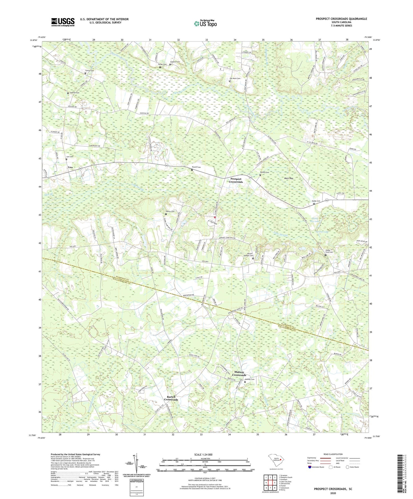
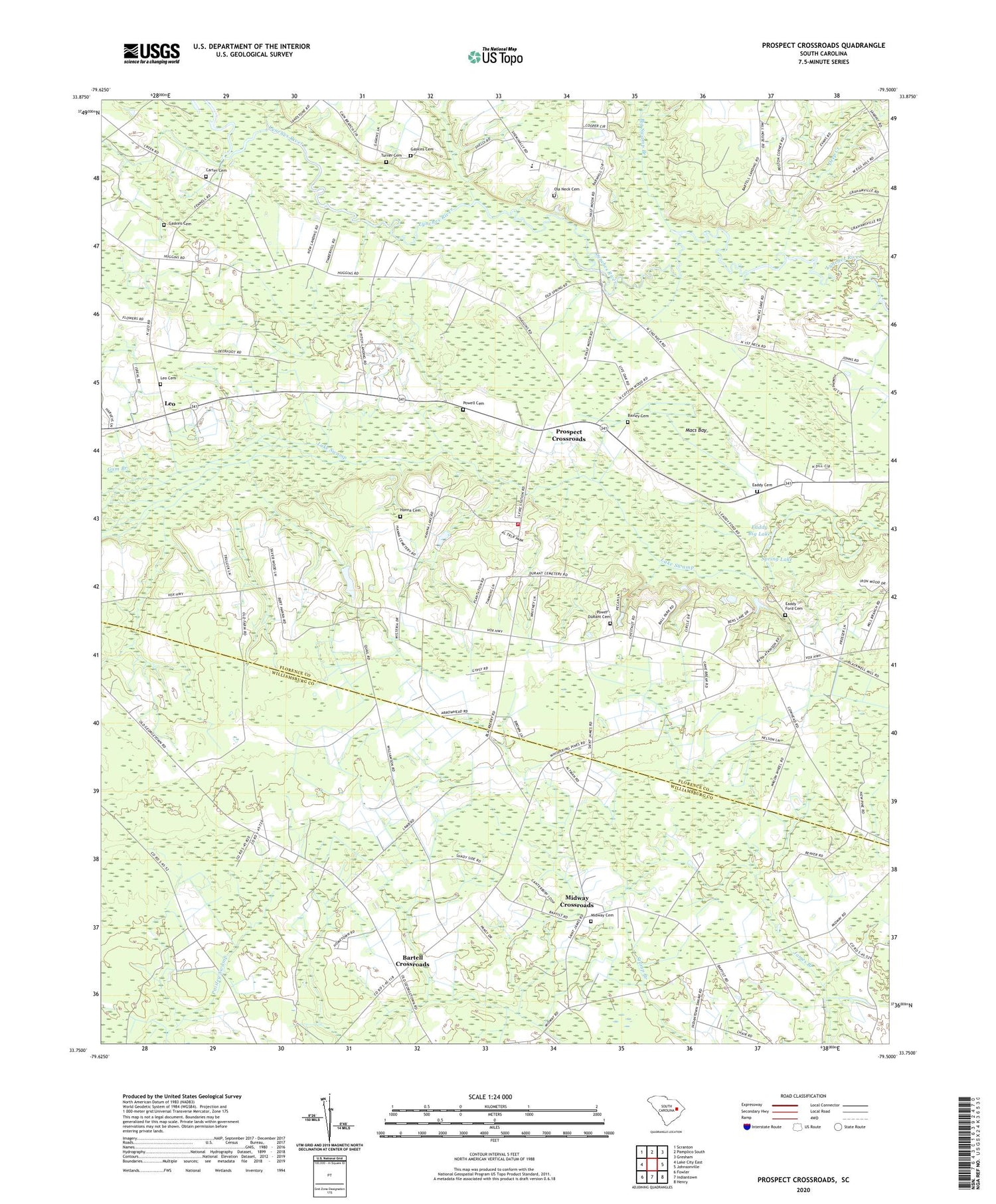
2020 topographic map quadrangle Prospect Crossroads in the state of South Carolina. Scale: 1:24000. Based on the newly updated USGS 7.5' US Topo map series, this map is in the following counties: Florence, Williamsburg. The map contains contour data, water features, and other items you are used to seeing on USGS maps, but also has updated roads and other features. This is the next generation of topographic maps. Printed on high-quality waterproof paper with UV fade-resistant inks.
Quads adjacent to this one:
West: Lake City East
Northwest: Scranton
North: Pamplico South
Northeast: Gresham
East: Johnsonville
Southeast: Henry
South: Indiantown
Southwest: Fowler
Contains the following named places: Bartell Crossroads, Baxley Cemetery, Bens Lake, Beulah Church, Big Swamp Branch, Carter Cemetery, Cooper School, Deep Creek, Eaddy - Ford Cemetery, Eaddy Big Lake, Eaddy Cemetery, Gaskins Cemetery, Gum Branch, Half Moon, Hanna Cemetery, Hannah Chapel, Holiness Church, House of Prayer, Indiantown Division, Jeremiah Church, Johnsonville Fire Department Station 2, Leo, Leo Cemetery, Leo Hanna Pond, Leo Hanna Pond Dam D-3567, Leo School, Little Bethel Church, Little Star Church, Macs Bay, Midway Baptist Church, Midway Cemetery, Midway Crossroads, Midway School, New Prospect Christian School, New Prospect Church, Ninevah School, Nineveh Church, Ola Neck Cemetery, Powell Cemetery, Power - DuRant Cemetery, Prospect Church, Prospect Crossroads, Prospect School, Raccoon Lake, Saint James Church, Saint Marks Church, Saint Marks School, Saint Marys Church, Saint Paul School, Spring Lake, Turner Cemetery, Vox Church, Vox School