MyTopo
Taxahaw South Carolina US Topo Map
Couldn't load pickup availability
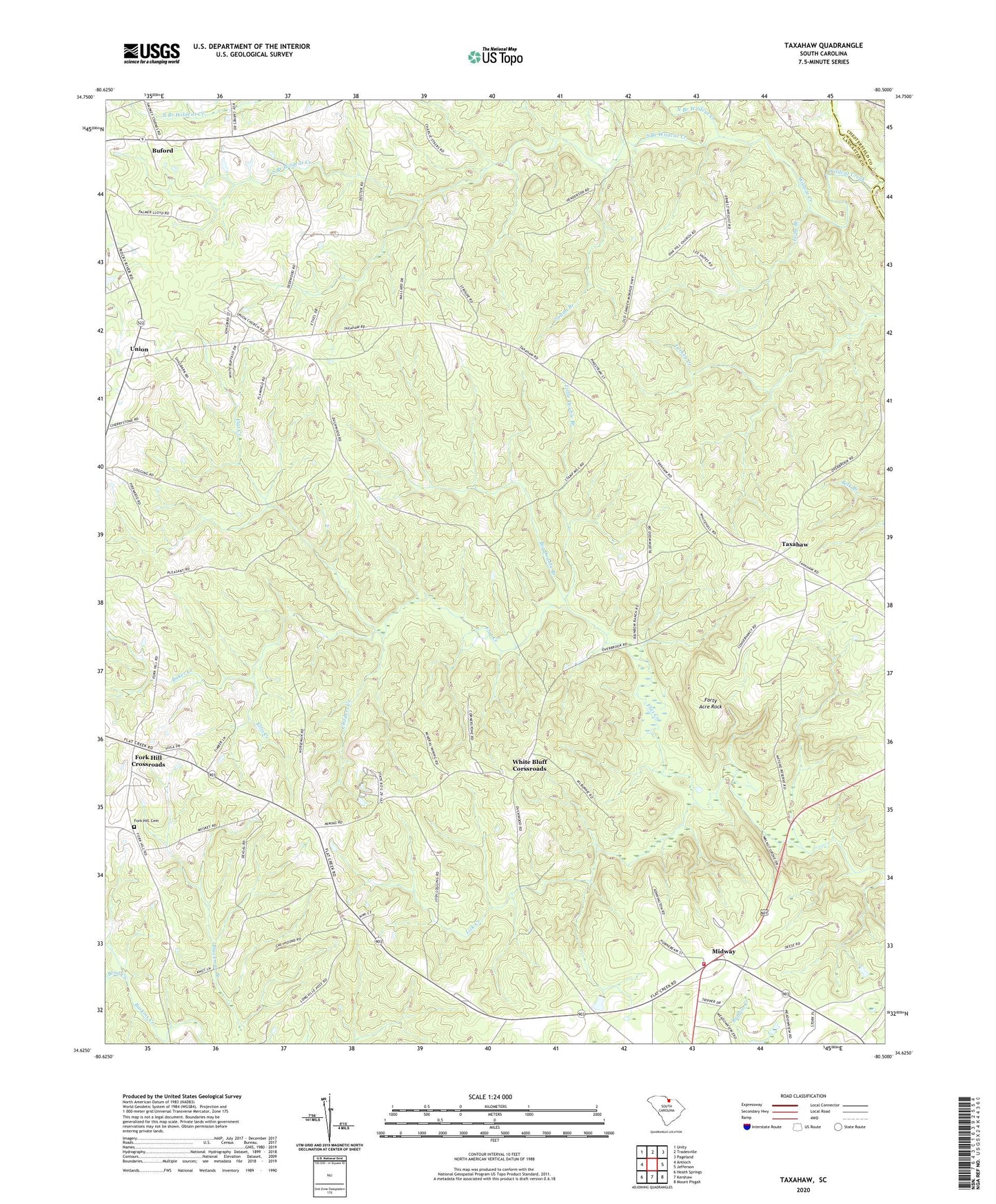
2020 topographic map quadrangle Taxahaw in the state of South Carolina. Scale: 1:24000. Based on the newly updated USGS 7.5' US Topo map series, this map is in the following counties: Lancaster, Chesterfield. The map contains contour data, water features, and other items you are used to seeing on USGS maps, but also has updated roads and other features. This is the next generation of topographic maps. Printed on high-quality waterproof paper with UV fade-resistant inks.
Quads adjacent to this one:
West: Antioch
Northwest: Unity
North: Tradesville
Northeast: Pageland
East: Jefferson
Southeast: Mount Pisgah
South: Kershaw
Southwest: Heath Springs
Contains the following named places: Baker Creek, Bend Creek, Big Double Branch, Buford, Childers Creek, Ellis Creek, Flat Creek Fire Department Station 7, Flat Creek Schools, Fork Hill Cemetery, Fork Hill Church, Fork Hill Crossroads, Fork Hill School, Forty Acre Rock, Kennington Pond Dam D-1776, Lick Creek, Little Double Branch, Long Branch, Midway, New Zion Church, North Branch Wildcat Creek, Oak Hill Church, Oak Hill School, Saint Paul School, Saint Pauls Church, South Branch Wildcat Creek, Sutton Branch, Taxahaw, Taxahaw Baptist Church, Taxahaw School, Three Fork School, Tradesville Division, Union, Union Church, Union School, White Bluff Baptist Church, White Bluff Corssroads, White Bluff School, Wildcat Creek