MyTopo
Tradesville South Carolina US Topo Map
Couldn't load pickup availability
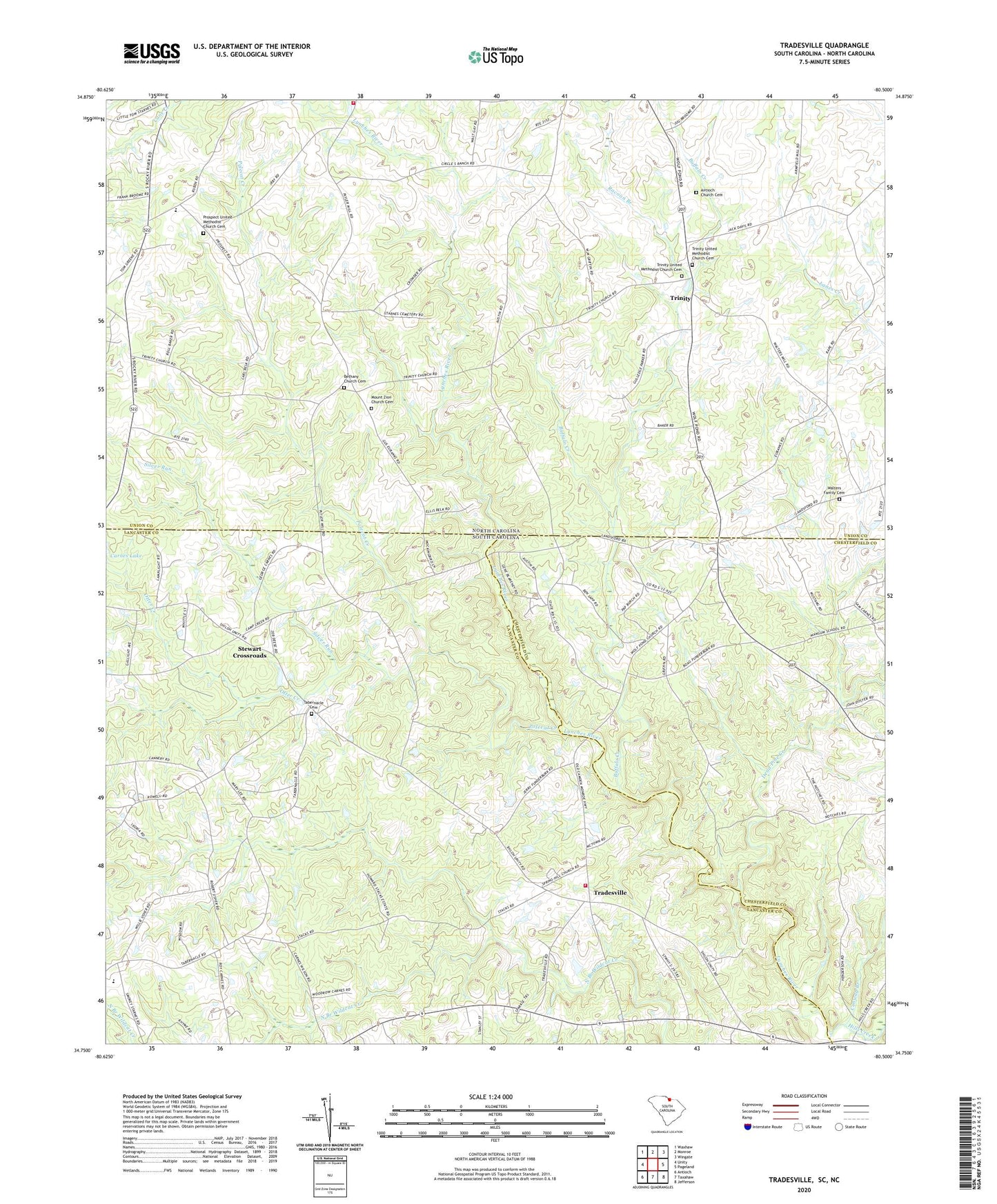
2020 topographic map quadrangle Tradesville in the states of South Carolina, North Carolina. Scale: 1:24000. Based on the newly updated USGS 7.5' US Topo map series, this map is in the following counties: Lancaster, Union, Chesterfield. The map contains contour data, water features, and other items you are used to seeing on USGS maps, but also has updated roads and other features. This is the next generation of topographic maps. Printed on high-quality waterproof paper with UV fade-resistant inks.
Quads adjacent to this one:
West: Unity
Northwest: Waxhaw
North: Monroe
Northeast: Wingate
East: Pageland
Southeast: Jefferson
South: Taxahaw
Southwest: Antioch
Contains the following named places: Antioch Church, Antioch Church Cemetery, Bethany Church, Bethany Church Cemetery, Buffalo Creek, Buffalo School, Conway Branch, Dead Pine Creek, Hills Creek, Houghs ford, Mount Zion Church, Mount Zion Church Cemetery, Otter Creek, Perry Lake, Perry Lake Dam, Polecat Creek, Prospect Church, Prospect Elementary School, Prospect United Methodist Church Cemetery, Racoon Branch, Rose Hill Church, Sandy Ridge Fire and Rescue Department Station 12, Silver Run, Spring Hill Church, Stewart Crossroads, Tabernacle Cemetery, Tabernacle Church, Tabernacle School, Tradesville, Tradesville Census Designated Place, Tradesville Fire Department Station 18, Tradesville School, Trinity, Trinity United Methodist Church, Trinity United Methodist Church Cemetery, Union Emergency Medical Services, Walters Family Cemetery, Wolf Pond Baptist Church, Wolf Pond Baptist Church Cemetery, Wolf Pond Cross Roads