MyTopo
Black Banks Creek East South Dakota US Topo Map
Couldn't load pickup availability
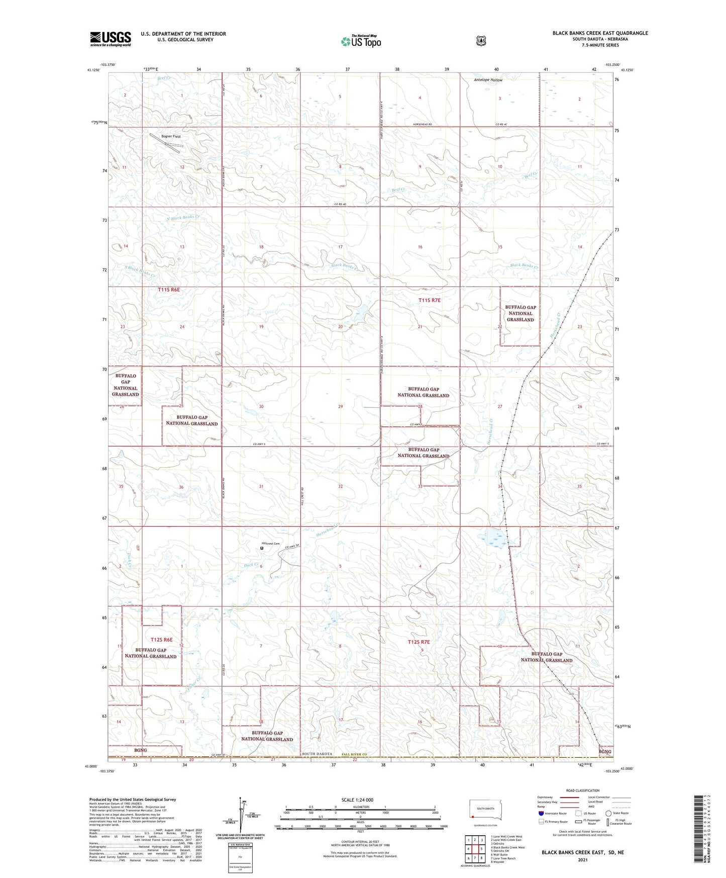
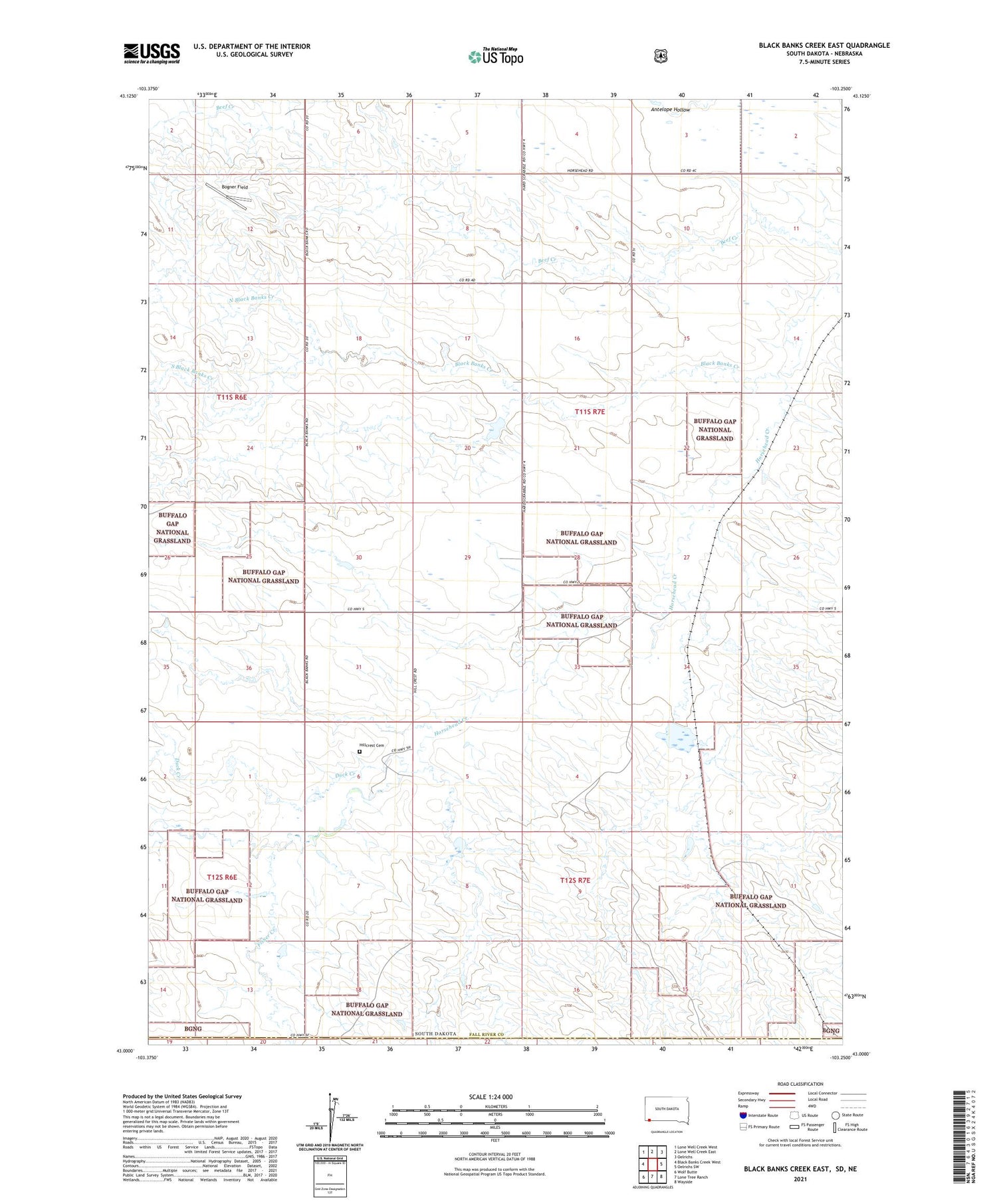
2021 topographic map quadrangle Black Banks Creek East in the state of South Dakota. Scale: 1:24000. Based on the newly updated USGS 7.5' US Topo map series, this map is in the following counties: Fall River, Dawes. The map contains contour data, water features, and other items you are used to seeing on USGS maps, but also has updated roads and other features. This is the next generation of topographic maps. Printed on high-quality waterproof paper with UV fade-resistant inks.
Quads adjacent to this one:
West: Black Banks Creek West
Northwest: Lone Well Creek West
North: Lone Well Creek East
Northeast: Oelrichs
East: Oelrichs SW
Southeast: Wayside
South: Lone Tree Ranch
Southwest: Wolf Butte
Contains the following named places: Black Banks Creek, Bogner Field, Duck Creek, E E Pettegrew Dam, E E Pettegrew Dam Number 2, Hillcrest, Hillcrest Cemetery, North Black Banks Creek, Pettigrew Dam, Pettigrew Pond Number 2 Dam, Reaser Stock Dam, Romey Irrigation Dam, South Black Banks Creek, Township of Harmony, ZIP Code: 57763