MyTopo
Caputa South Dakota US Topo Map
Couldn't load pickup availability
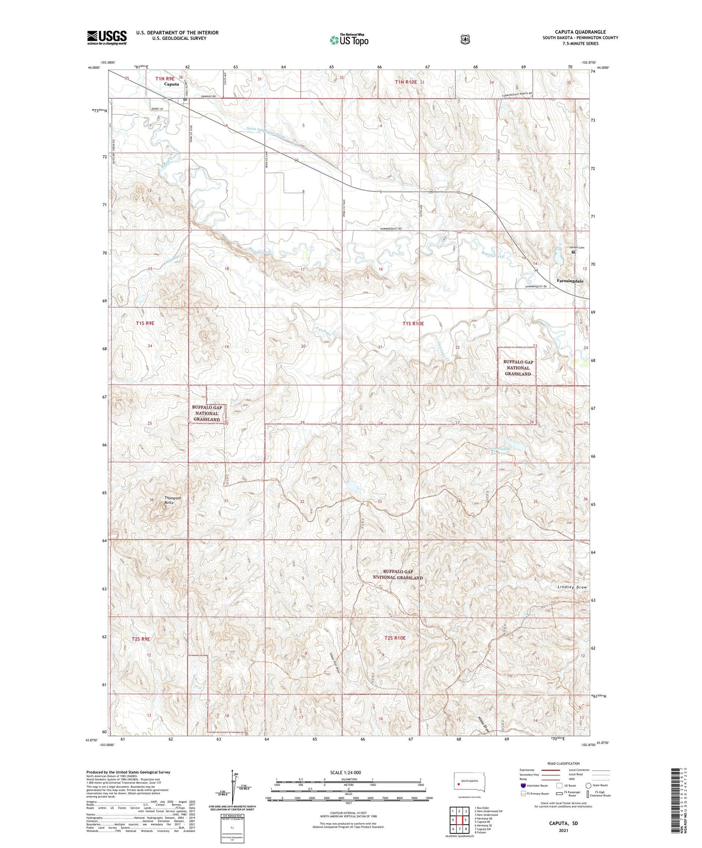
2021 topographic map quadrangle Caputa in the state of South Dakota. Scale: 1:24000. Based on the newly updated USGS 7.5' US Topo map series, this map is in the following counties: Pennington. The map contains contour data, water features, and other items you are used to seeing on USGS maps, but also has updated roads and other features. This is the next generation of topographic maps. Printed on high-quality waterproof paper with UV fade-resistant inks.
Quads adjacent to this one:
West: Hermosa NE
Northwest: Box Elder
North: New Underwood SW
Northeast: New Underwood
East: Caputa NE
Southeast: Folsom
South: Caputa SW
Southwest: Hermosa SE
Contains the following named places: Antelope Creek, Caputa, Caputa Census Designated Place, Caputa Post Office, Farming Dale 1 Dam, Farming Dale Dam, Farmingdale, Farmingdale Reservoir, Larsen Cemetery, Saint Germaine Ditch, Thompson Butte