MyTopo
Clear Lake NE South Dakota US Topo Map
Couldn't load pickup availability
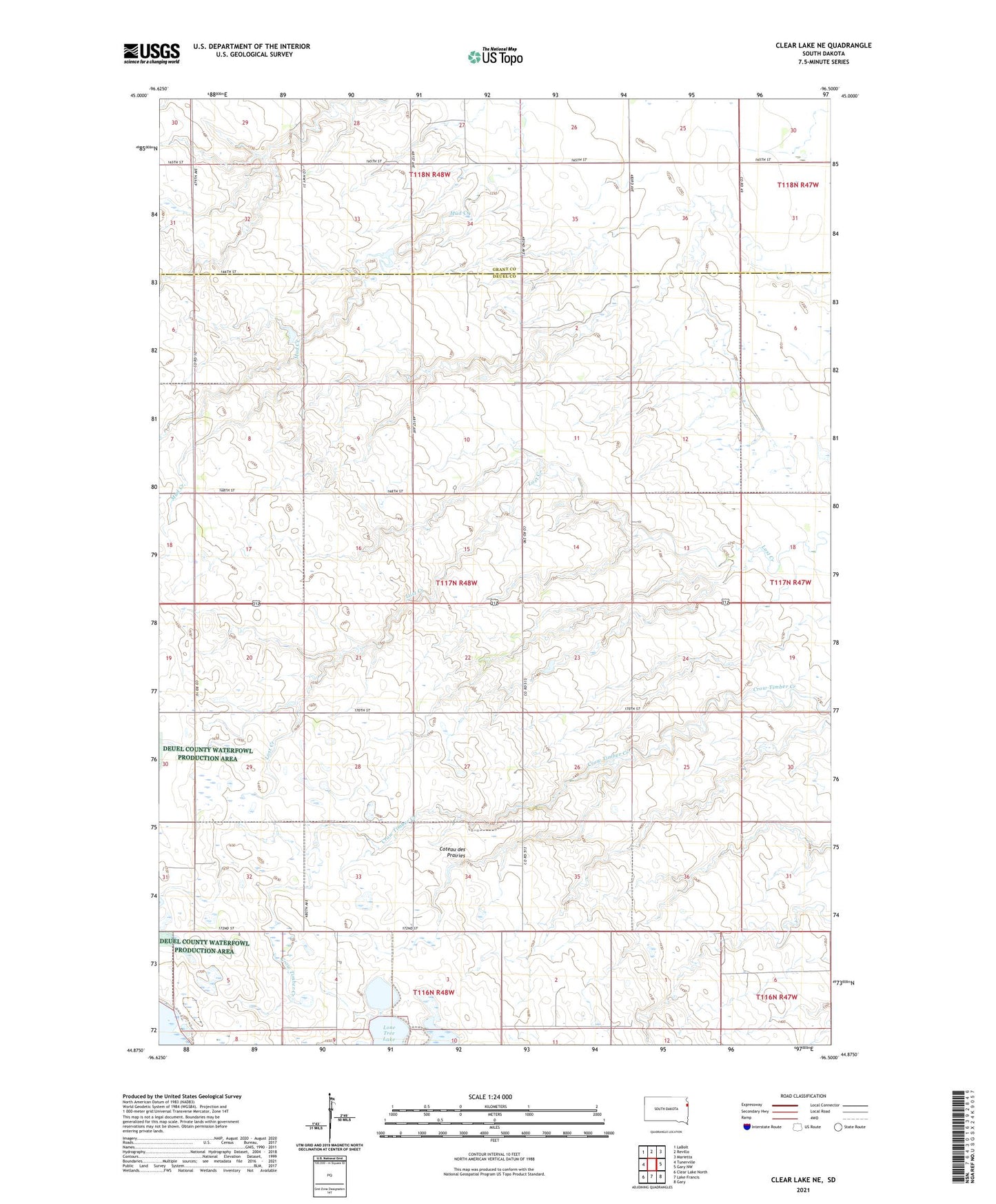
2021 topographic map quadrangle Clear Lake NE in the state of South Dakota. Scale: 1:24000. Based on the newly updated USGS 7.5' US Topo map series, this map is in the following counties: Deuel, Grant. The map contains contour data, water features, and other items you are used to seeing on USGS maps, but also has updated roads and other features. This is the next generation of topographic maps. Printed on high-quality waterproof paper with UV fade-resistant inks.
Quads adjacent to this one:
West: Tunerville
Northwest: LaBolt
North: Revillo
Northeast: Marietta
East: Gary NW
Southeast: Gary
South: Lake Francis
Southwest: Clear Lake North
Contains the following named places: Fairview School, Lone Tree Lake State Public Shooting Area, Lonetree Lake Post Office, Mitchell State Public Shooting Area, Prairie Rose School, Township of Lowe, Underwood School, Young America School