MyTopo
Deep Creek SE South Dakota US Topo Map
Couldn't load pickup availability
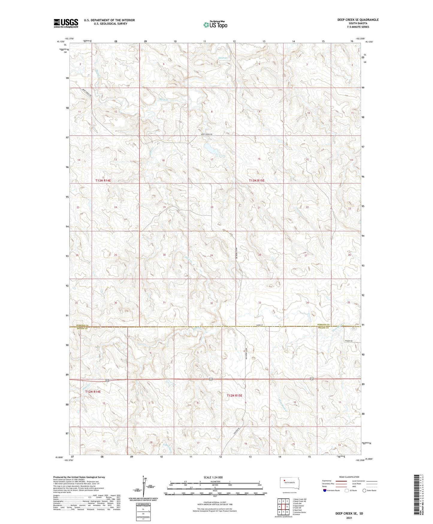
2021 topographic map quadrangle Deep Creek SE in the state of South Dakota. Scale: 1:24000. Based on the newly updated USGS 7.5' US Topo map series, this map is in the following counties: Perkins, Meade. The map contains contour data, water features, and other items you are used to seeing on USGS maps, but also has updated roads and other features. This is the next generation of topographic maps. Printed on high-quality waterproof paper with UV fade-resistant inks.
Quads adjacent to this one:
West: Signal Butte
Northwest: Deep Creek NW
North: Deep Creek NE
Northeast: Faith NW
East: Faith SW
Southeast: Avance
South: Lemmon Butte
Southwest: Opal East
Contains the following named places: Deep Creek School, E Hoffman Number 1 Dam, E Hoffman Number 2 Dam, E Hoffman Number 3 Dam, E Hoffman Number 4 Dam, E Hoffman Number 5 Dam, E Hoffman Number 6 Dam, E Hoffman Number 7 Dam, E Hoffman Number 9 Dam, Flint Creek, Flint Rock Hill, Howard Capp Dam, Roy McGinnis Dam, Tom Mason Dam, Township of Deep Creek