MyTopo
Elm Springs South Dakota US Topo Map
Couldn't load pickup availability
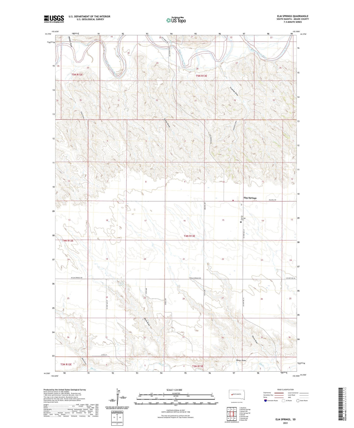
2021 topographic map quadrangle Elm Springs in the state of South Dakota. Scale: 1:24000. Based on the newly updated USGS 7.5' US Topo map series, this map is in the following counties: Meade. The map contains contour data, water features, and other items you are used to seeing on USGS maps, but also has updated roads and other features. This is the next generation of topographic maps. Printed on high-quality waterproof paper with UV fade-resistant inks.
Quads adjacent to this one:
West: Elm Springs SW
Northwest: Haydraw
North: Boneita Springs
Northeast: Dalzell NW
East: Dalzell
Southeast: Wasta NW
South: Owanka NE
Southwest: Owanka NW
Contains the following named places: Adams Draw, Bull Creek, Davis Draw, Dover Draw, Elm Springs, Elm Springs Cemetery, Elm Springs Church, Elm Springs Elementary School, Elm Springs Fire Department, Gilam Draw, Hay Creek, Huddleston Draw, Maddox Draw, North King School, Pierce Draw, Pierce School, South King School, Trussman Draw, Turner Draw