MyTopo
Florence South Dakota US Topo Map
Couldn't load pickup availability
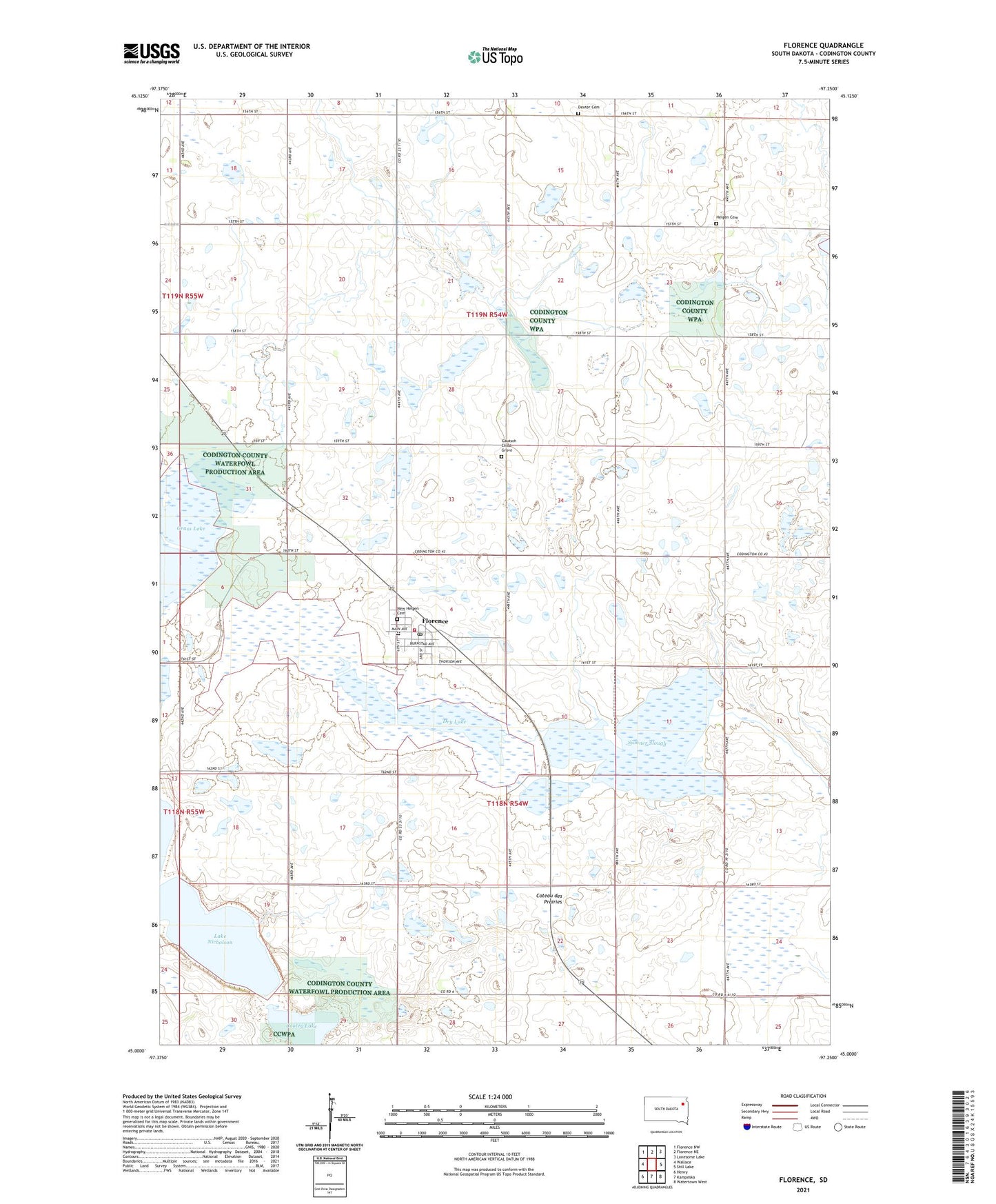
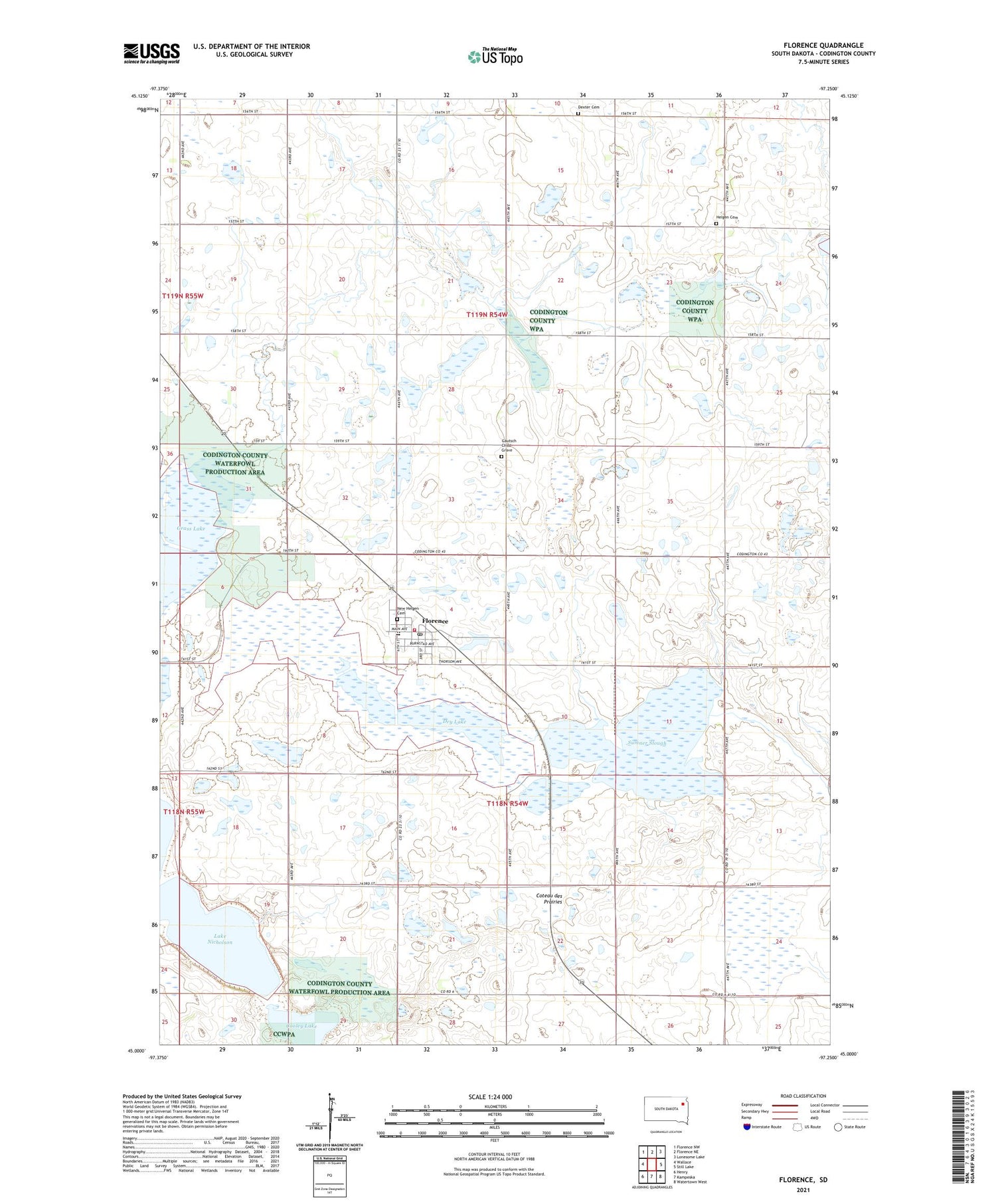
2021 topographic map quadrangle Florence in the state of South Dakota. Scale: 1:24000. Based on the newly updated USGS 7.5' US Topo map series, this map is in the following counties: Codington. The map contains contour data, water features, and other items you are used to seeing on USGS maps, but also has updated roads and other features. This is the next generation of topographic maps. Printed on high-quality waterproof paper with UV fade-resistant inks.
Quads adjacent to this one:
West: Wallace
Northwest: Florence NW
North: Florence NE
Northeast: Lonesome Lake
East: Still Lake
Southeast: Watertown West
South: Kampeska
Southwest: Henry
Contains the following named places: American Game Association State Public Shooting Area, Codington County Waterfowl Production Area, Cooley Lake, Dexter Cemetery, Dexter Church, Donnelly State Public Shooting Area, Dry Lake, Dry Lake State Public Shooting Area, Florence, Florence Elementary School, Florence Fire Department, Florence High School, Florence Junior High School, Florence Post Office, Gautsch Child Grave, Helgen, Helgen Cemetery, Lake Nicholson, New Helgen Cemetery, New Helgen Lutheran Church, Sumner Slough, Town of Florence, Township of Dexter, Township of Fuller, ZIP Code: 57235