MyTopo
Forbes NW South Dakota US Topo Map
Couldn't load pickup availability
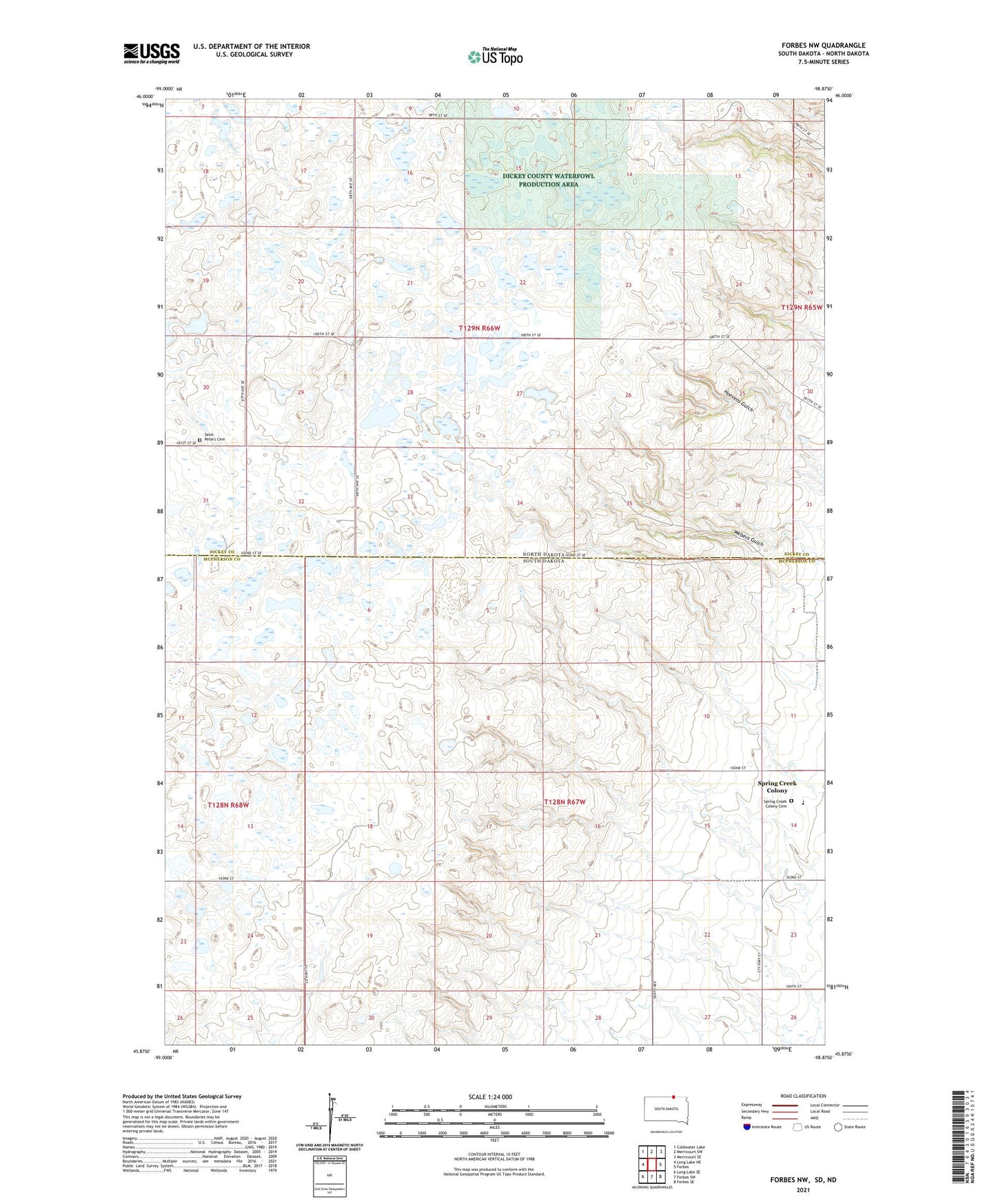
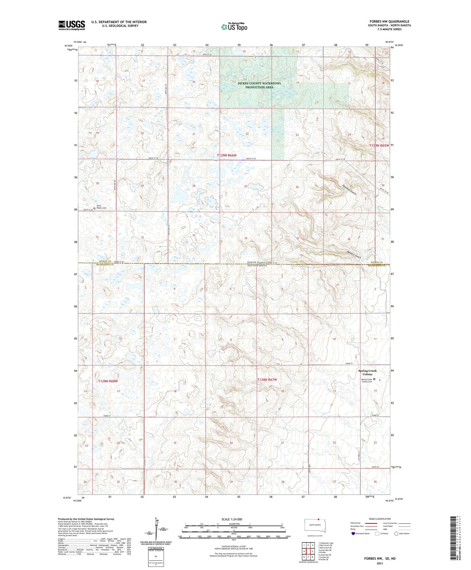
2021 topographic map quadrangle Forbes NW in the states of North Dakota, South Dakota. Scale: 1:24000. Based on the newly updated USGS 7.5' US Topo map series, this map is in the following counties: McPherson, Dickey. The map contains contour data, water features, and other items you are used to seeing on USGS maps, but also has updated roads and other features. This is the next generation of topographic maps. Printed on high-quality waterproof paper with UV fade-resistant inks.
Quads adjacent to this one:
West: Long Lake NE
Northwest: Coldwater Lake
North: Merricourt SW
Northeast: Merricourt SE
East: Forbes
Southeast: Forbes SE
South: Forbes SW
Southwest: Long Lake SE
Contains the following named places: Albertha Town Hall, Dickey County Waterfowl Production Area, Saint Peters Cemetery, Spring Creek Colony, Spring Creek Colony Census Designated Place, Spring Creek Colony Elementary School, Township of Albertha, Township of Weber, Webers Gulch