MyTopo
Henry South Dakota US Topo Map
Couldn't load pickup availability
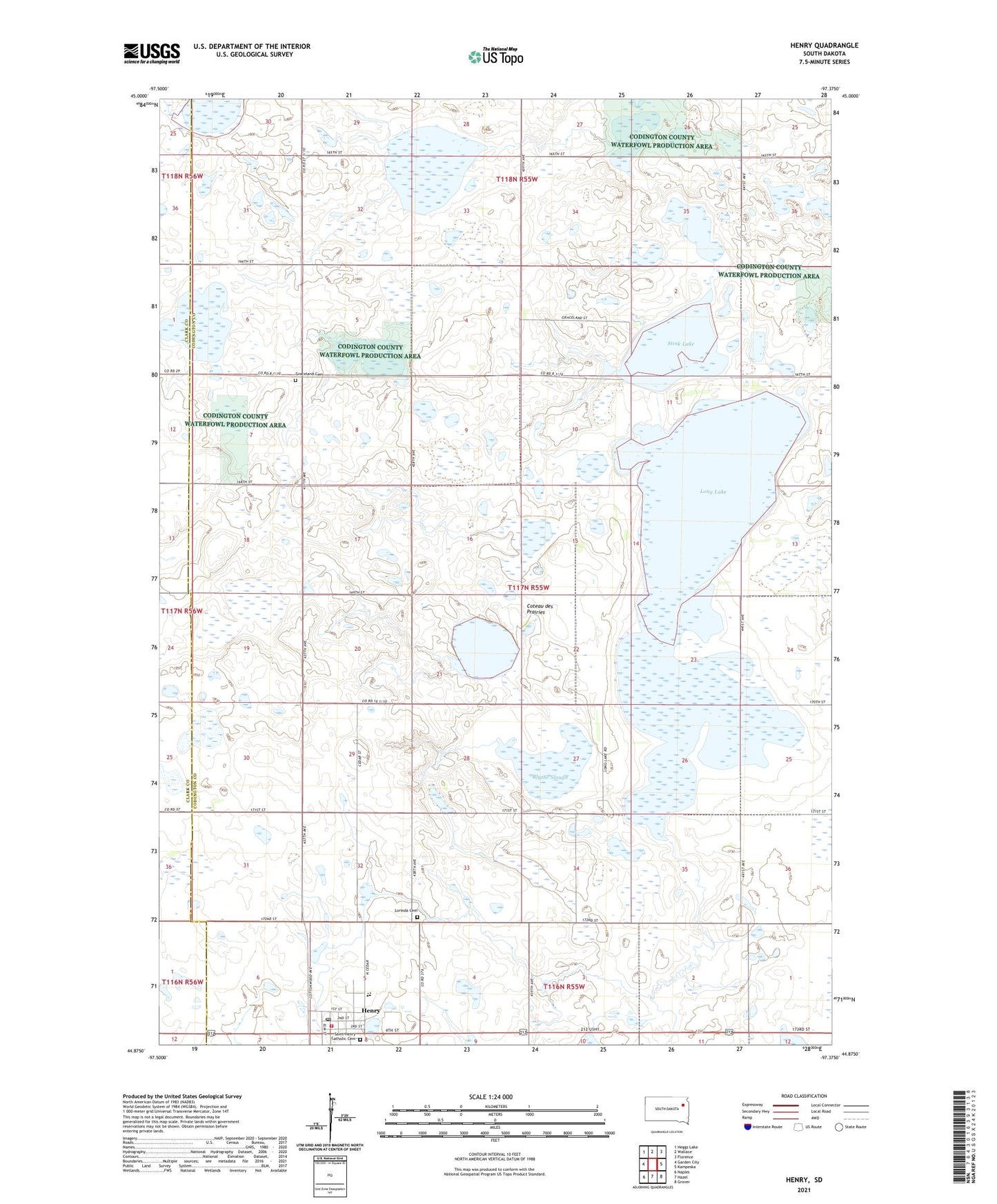
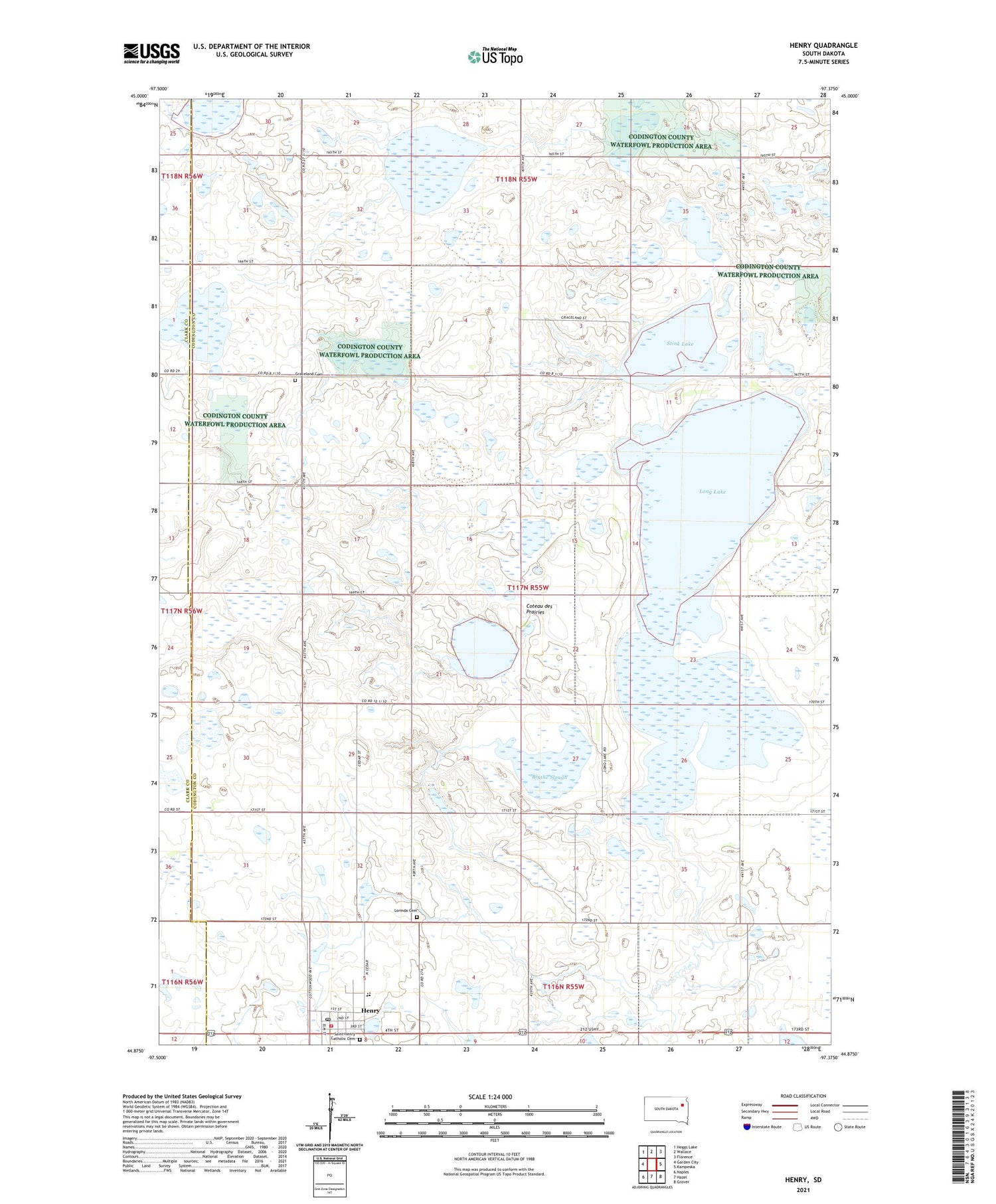
2021 topographic map quadrangle Henry in the state of South Dakota. Scale: 1:24000. Based on the newly updated USGS 7.5' US Topo map series, this map is in the following counties: Codington, Clark. The map contains contour data, water features, and other items you are used to seeing on USGS maps, but also has updated roads and other features. This is the next generation of topographic maps. Printed on high-quality waterproof paper with UV fade-resistant inks.
Quads adjacent to this one:
West: Garden City
Northwest: Heggs Lake
North: Wallace
Northeast: Florence
East: Kampeska
Southeast: Grover
South: Hazel
Southwest: Naples
Contains the following named places: Alexander State Public Shooting Area, Blythe Slough, Blythe State Public Shooting Area, Gilbert State Public Shooting Area, Graceland Cemetery, Graceland Church, Henry, Henry Elementary School, Henry Fire Department, Henry High School, Henry Middle School, Henry Post Office, Long Lake, Long Lake State Public Shooting Area, Lorinda Cemetery, Nichols State Public Shooting Area, North Stink Lake State Public Shooting Area, Saint Henry Catholic Cemetery, Saint Henry's Catholic Church, Scott State Public Shooting Area, Stink Lake, Town of Henry, Township of Graceland, ZIP Code: 57243