
MyTopo
Isabel South Dakota US Topo Map
Couldn't load pickup availability
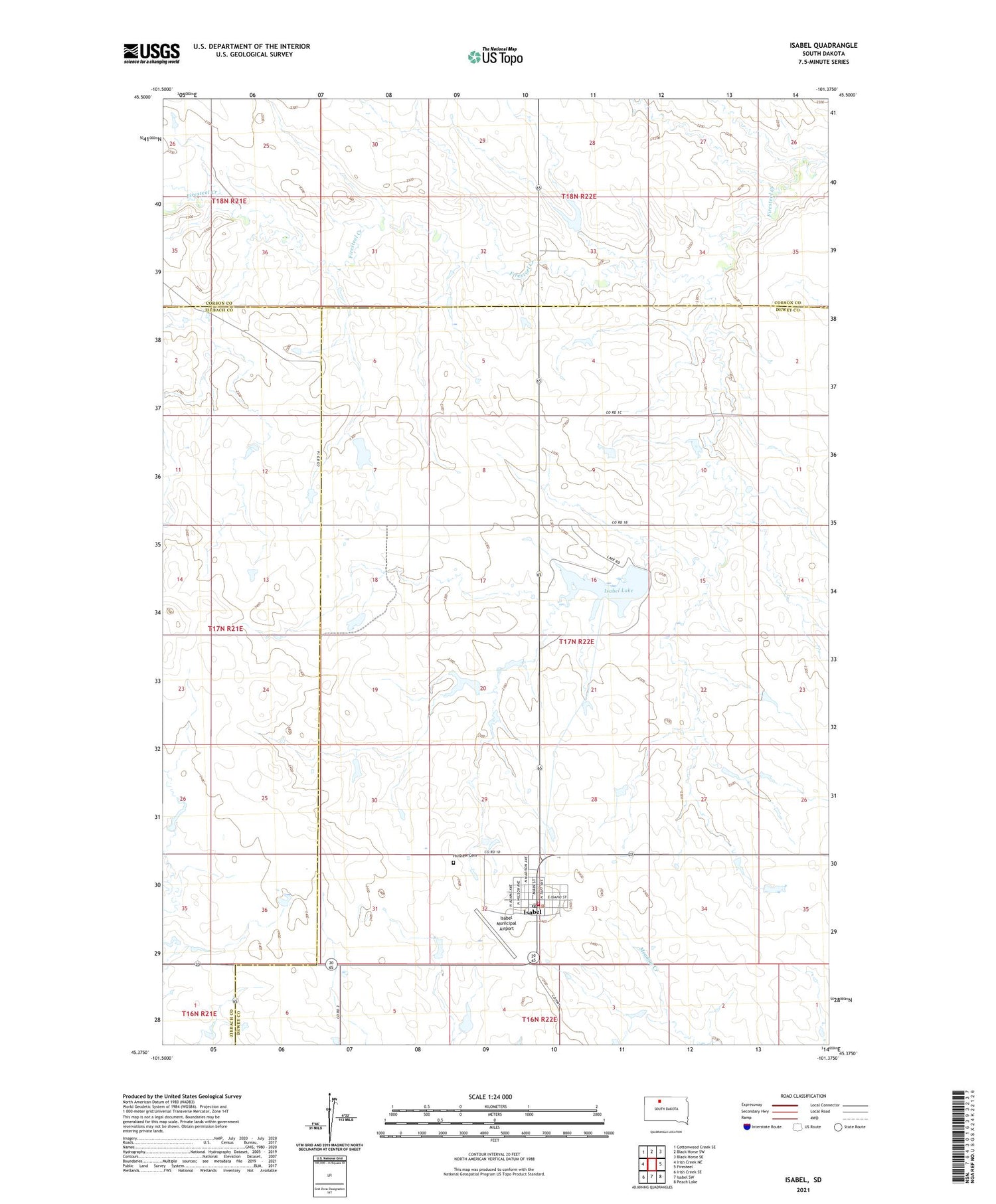
2021 topographic map quadrangle Isabel in the state of South Dakota. Scale: 1:24000. Based on the newly updated USGS 7.5' US Topo map series, this map is in the following counties: Dewey, Corson, Ziebach. The map contains contour data, water features, and other items you are used to seeing on USGS maps, but also has updated roads and other features. This is the next generation of topographic maps. Printed on high-quality waterproof paper with UV fade-resistant inks.
Quads adjacent to this one:
West: Irish Creek NE
Northwest: Cottonwood Creek SE
North: Black Horse SW
Northeast: Black Horse SE
East: Firesteel
Southeast: Peach Lake
South: Isabel SW
Southwest: Irish Creek SE
Contains the following named places: Bill Lindshov Dam, D Woddell Dam, Dewey County Ambulance Service Isabel, G and J Heck Number 1 Dam, G and J Heck Number 2 Dam, G Boldt Dam, Hillview Cemetery, Isabel, Isabel City Hall, Isabel Lake, Isabel Lake Dam, Isabel Lake State Public Shooting Area, Isabel Municipal Airport, Isabel Post Office, Isabel Volunteer Fire Department, John Meginess Dam, R Clark Number 1 Dam, R Clark Number 2 Dam, R Clark Number 3 Dam, S Tidball Dam, Town of Isabel, ZIP Code: 57633


