MyTopo
Java South Dakota US Topo Map
Couldn't load pickup availability
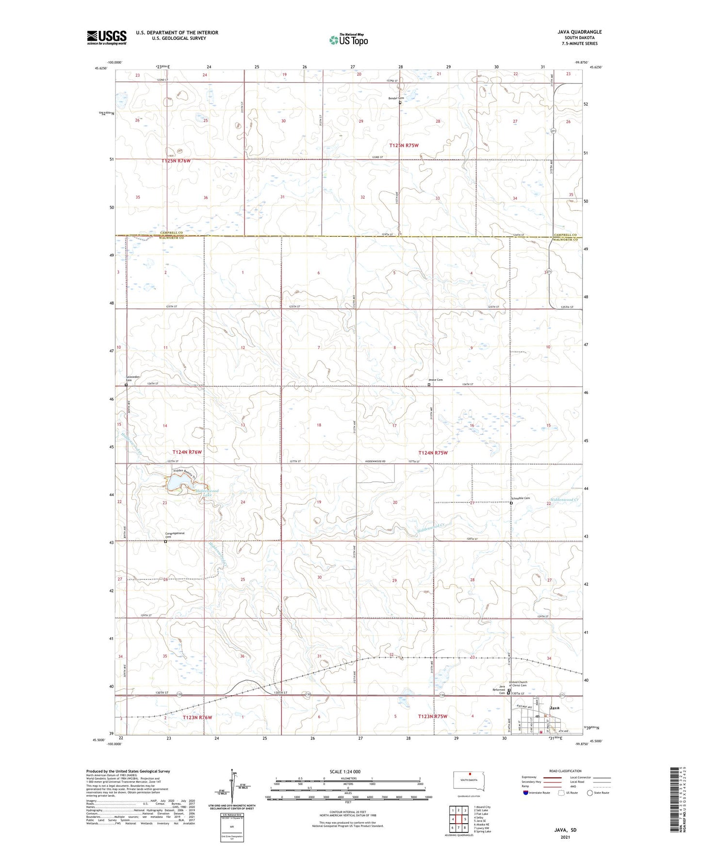
2021 topographic map quadrangle Java in the state of South Dakota. Scale: 1:24000. Based on the newly updated USGS 7.5' US Topo map series, this map is in the following counties: Walworth, Campbell. The map contains contour data, water features, and other items you are used to seeing on USGS maps, but also has updated roads and other features. This is the next generation of topographic maps. Printed on high-quality waterproof paper with UV fade-resistant inks.
Quads adjacent to this one:
West: Selby
Northwest: Mound City
North: Salt Lake
Northeast: Flat Lake
East: Java SE
Southeast: Spring Lake
South: Lowry NW
Southwest: Akaska NE
Contains the following named places: Bender Cemetery, Congregational Cemetery, Hiddenwood Lake, Java, Java City Hall, Java Fire Department, Java Post Office, Java Public Library, Java Reformed Cemetery, Lake Hiddenwood Dam, Lake Hiddenwood State Park, Peace Cemetery, Salzsiedler Cemetery, Schnaible Cemetery, Town of Java, Township of Highland, United Church of Christ Cemetery