MyTopo
Lake Herman South Dakota US Topo Map
Couldn't load pickup availability
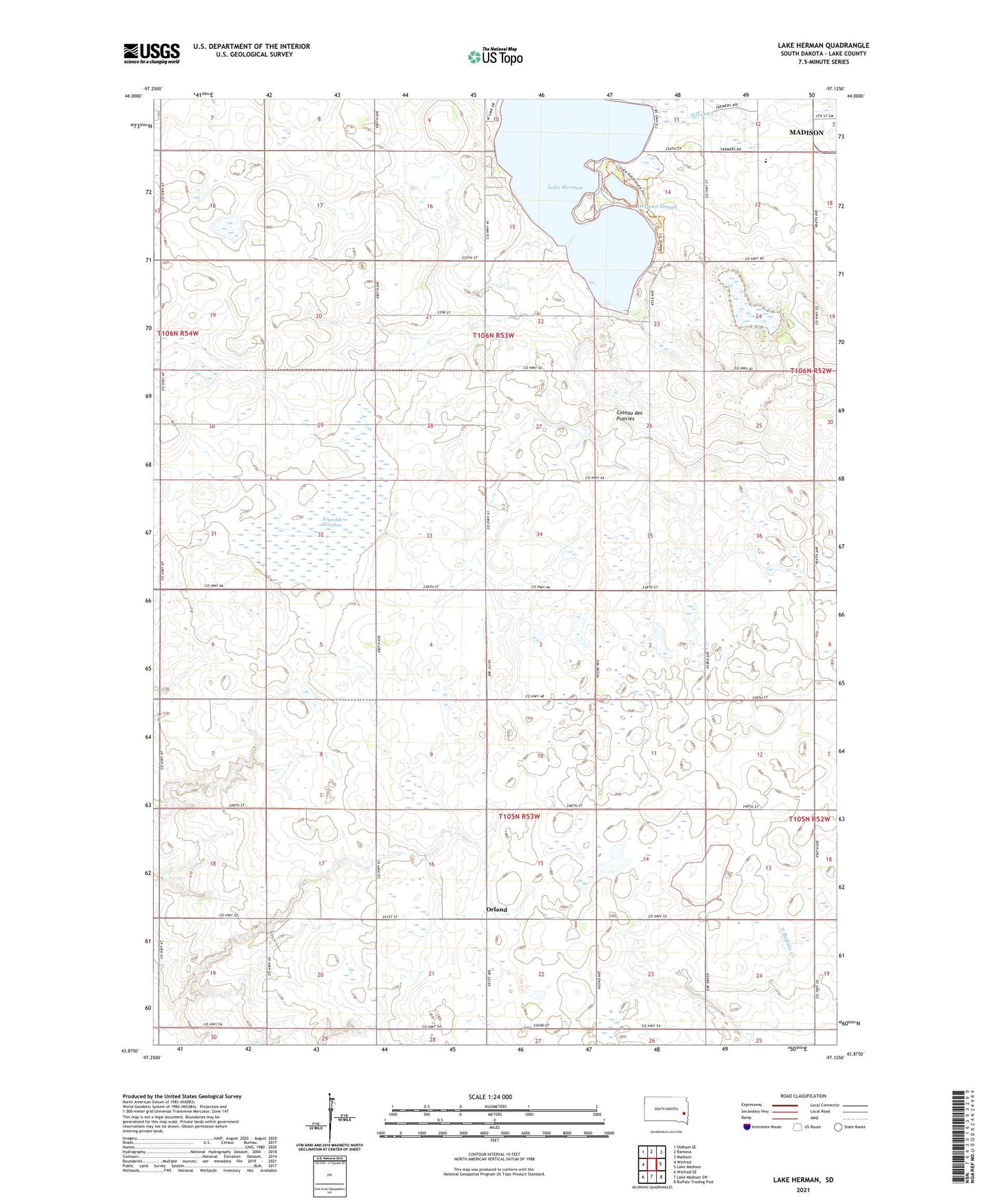
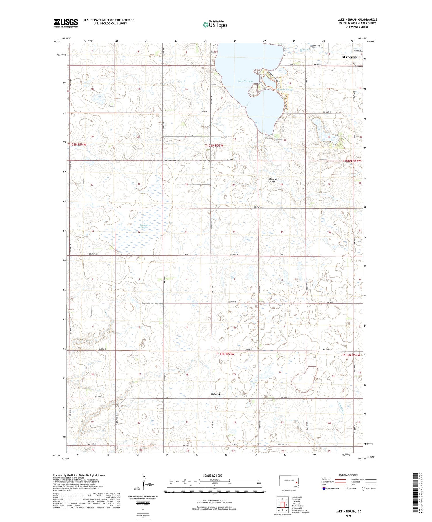
2021 topographic map quadrangle Lake Herman in the state of South Dakota. Scale: 1:24000. Based on the newly updated USGS 7.5' US Topo map series, this map is in the following counties: Lake. The map contains contour data, water features, and other items you are used to seeing on USGS maps, but also has updated roads and other features. This is the next generation of topographic maps. Printed on high-quality waterproof paper with UV fade-resistant inks.
Quads adjacent to this one:
West: Winfred
Northwest: Oldham SE
North: Ramona
Northeast: Madison
East: Lake Madison
Southeast: Buffalo Trading Post
South: Lake Madison SW
Southwest: Winfred SE
Contains the following named places: Camp Lakodia, Herman Slough, KJAM-FM (Madison), Lake Herman, Lake Herman State Park, Orland, Reynolds Slough, Saint Thomas Recreation Area, Township of Herman, Township of Orland, ZIP Code: 57042