MyTopo
No Heart Creek SW South Dakota US Topo Map
Couldn't load pickup availability
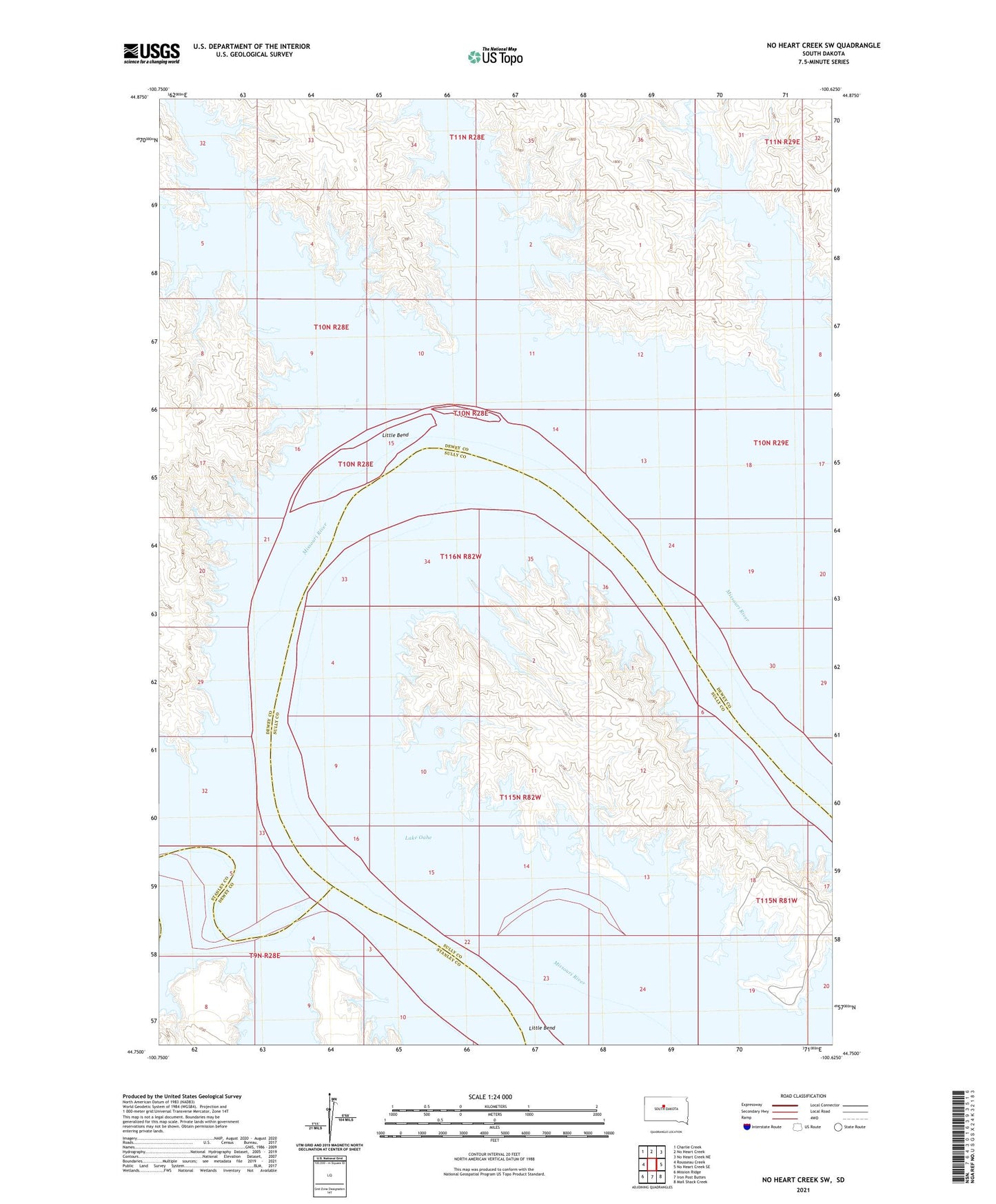
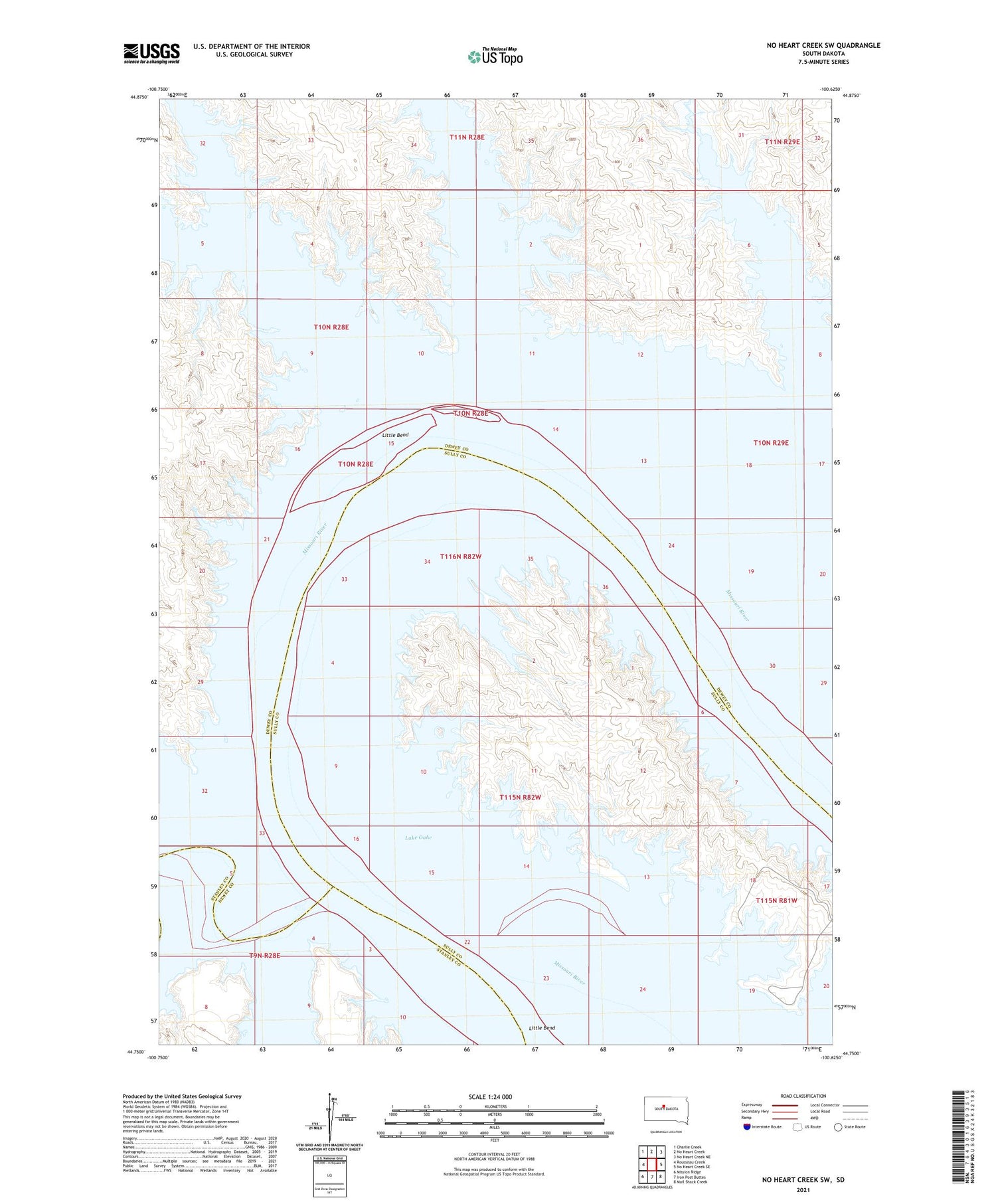
2021 topographic map quadrangle No Heart Creek SW in the state of South Dakota. Scale: 1:24000. Based on the newly updated USGS 7.5' US Topo map series, this map is in the following counties: Dewey, Sully, Stanley. The map contains contour data, water features, and other items you are used to seeing on USGS maps, but also has updated roads and other features. This is the next generation of topographic maps. Printed on high-quality waterproof paper with UV fade-resistant inks.
Quads adjacent to this one:
West: Rousseau Creek
Northwest: Charlie Creek
North: No Heart Creek
Northeast: No Heart Creek NE
East: No Heart Creek SE
Southeast: Mail Shack Creek
South: Iron Post Buttes
Southwest: Mission Ridge
Contains the following named places: Angel Bottom, Brush Creek, Charlie Creek, Fox Creek, Little Bend, Little Bend Post Office, Little Bend Recreational Area, No Heart Creek, Tall Prairie Chicken Creek, Township of Little Bend