MyTopo
Norris South Dakota US Topo Map
Couldn't load pickup availability
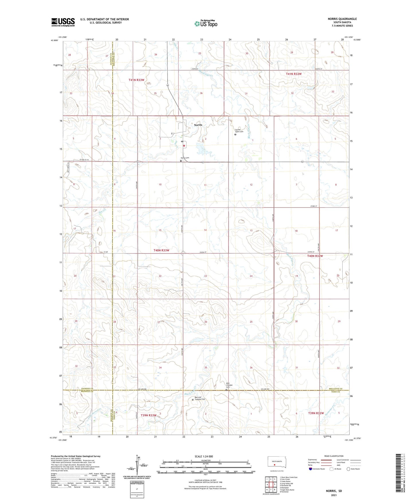
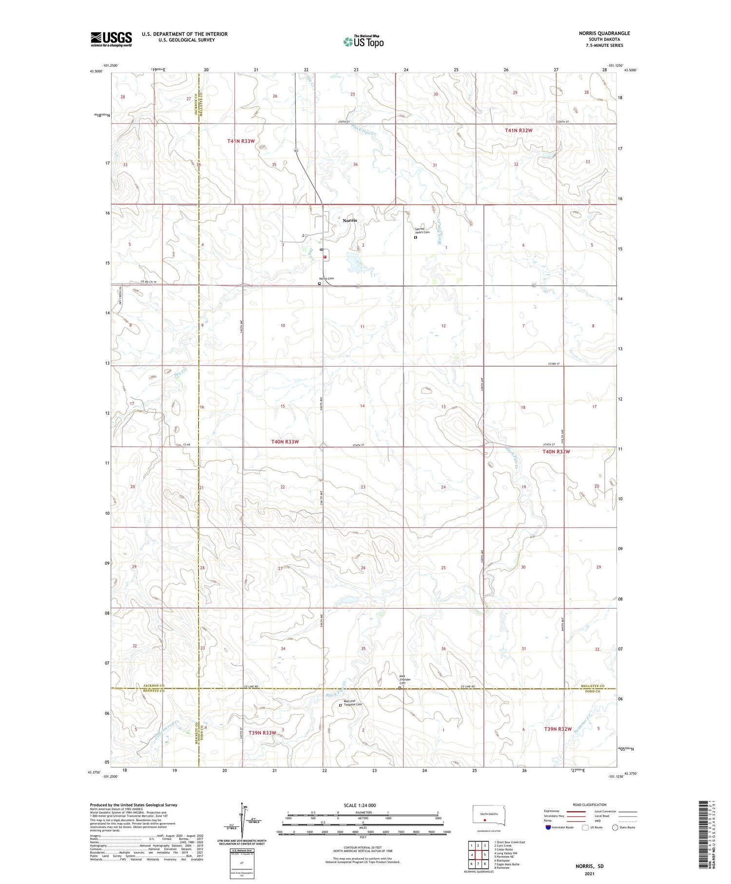
2021 topographic map quadrangle Norris in the state of South Dakota. Scale: 1:24000. Based on the newly updated USGS 7.5' US Topo map series, this map is in the following counties: Mellette, Jackson, Todd, Bennett. The map contains contour data, water features, and other items you are used to seeing on USGS maps, but also has updated roads and other features. This is the next generation of topographic maps. Printed on high-quality waterproof paper with UV fade-resistant inks.
Quads adjacent to this one:
West: Long Valley NW
Northwest: Short Bow Creek East
North: Corn Creek
Northeast: Cedar Butte
East: Parmelee NE
Southeast: Parmelee
South: Eagle Mans Butte
Southwest: Blackpipe
Contains the following named places: Black Pipe Issue Station, Black Pipe Segment, Cottonwood Creek, Norris, Norris Cemetery, Norris Census Designated Place, Norris Elementary School, Norris Post Office, Norris Volunteer Fire Department, Poor Thunder Cemetery, Red Leaf Campground, Red Leaf Creek, Red Leaf Tiospaye Cemetery, Sacred Heart Cemetery, Saint Stephens Church, Township of Norris, ZIP Code: 57560