MyTopo
Okreek SE South Dakota US Topo Map
Couldn't load pickup availability
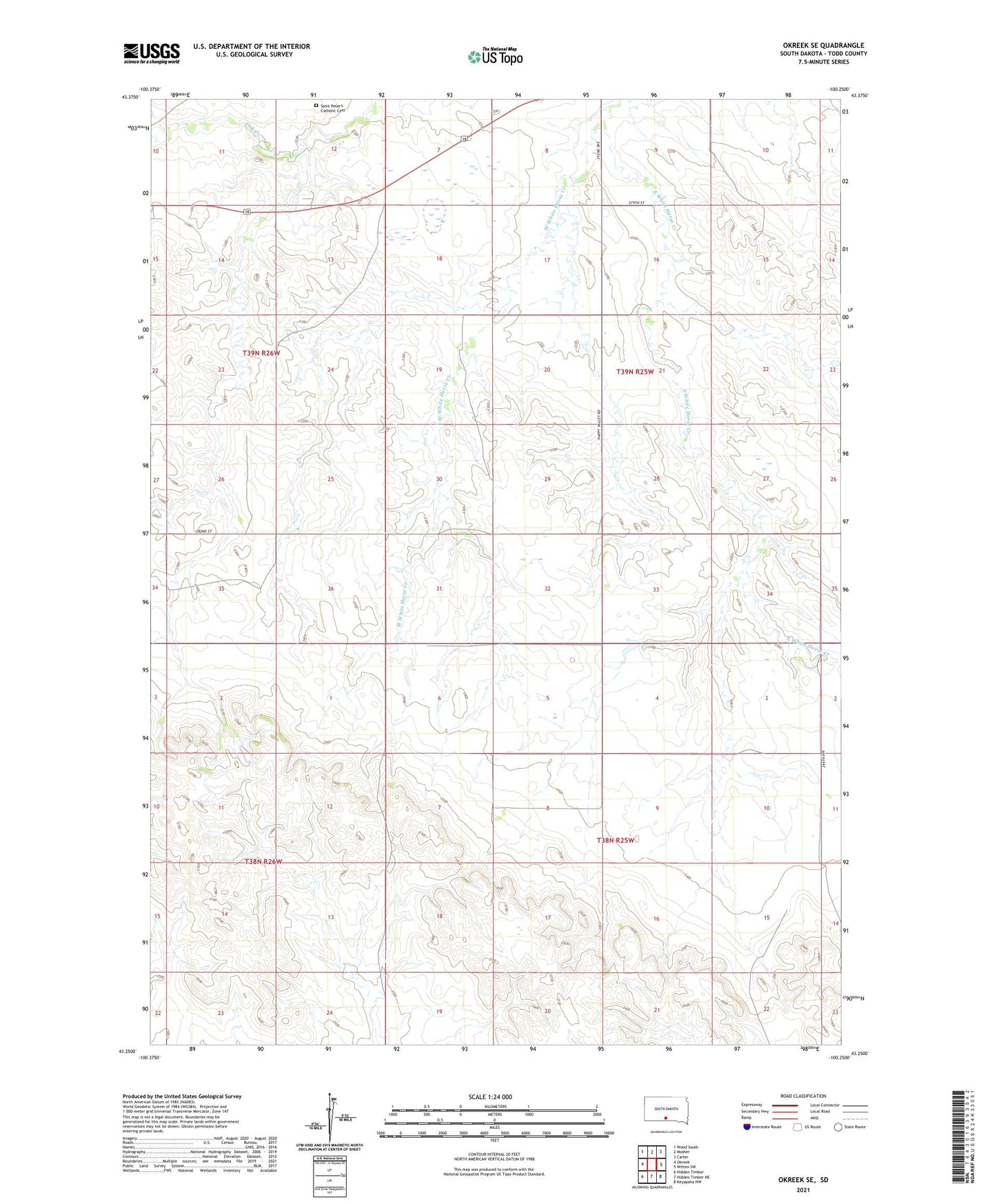
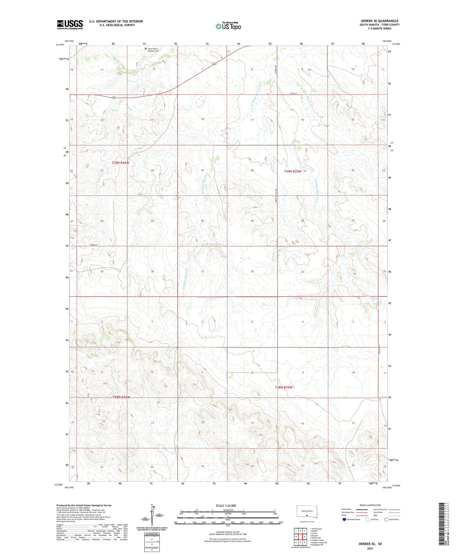
2021 topographic map quadrangle Okreek SE in the state of South Dakota. Scale: 1:24000. Based on the newly updated USGS 7.5' US Topo map series, this map is in the following counties: Todd. The map contains contour data, water features, and other items you are used to seeing on USGS maps, but also has updated roads and other features. This is the next generation of topographic maps. Printed on high-quality waterproof paper with UV fade-resistant inks.
Quads adjacent to this one:
West: Okreek
Northwest: Wood South
North: Mosher
Northeast: Carter
East: Witten SW
Southeast: Keyapaha NW
South: Hidden Timber NE
Southwest: Hidden Timber
Contains the following named places: East White Horse Creek, Saint Peter's Catholic Cemetery, West White Horse Creek, ZIP Code: 57563