MyTopo
Philip South Dakota US Topo Map
Couldn't load pickup availability
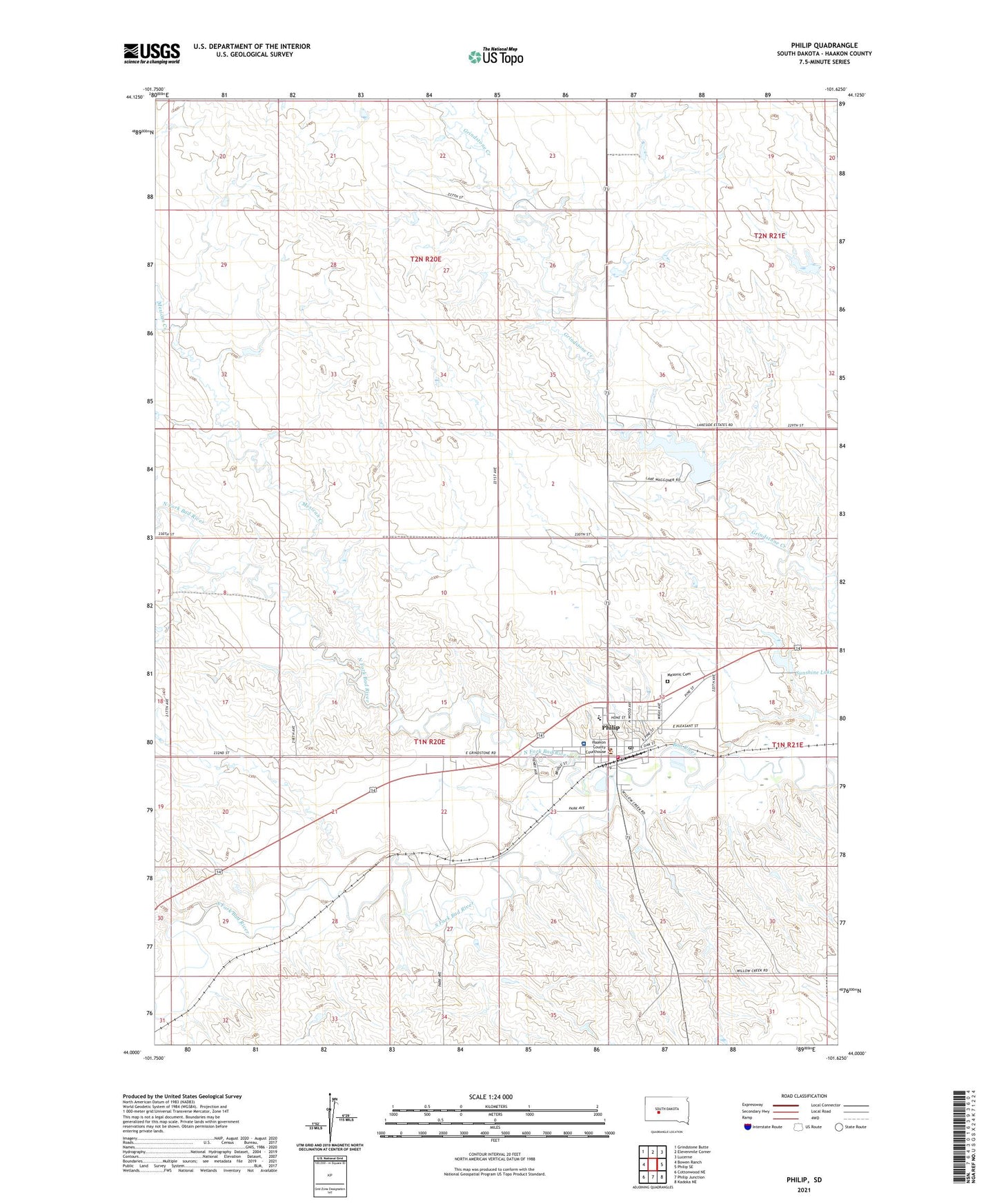
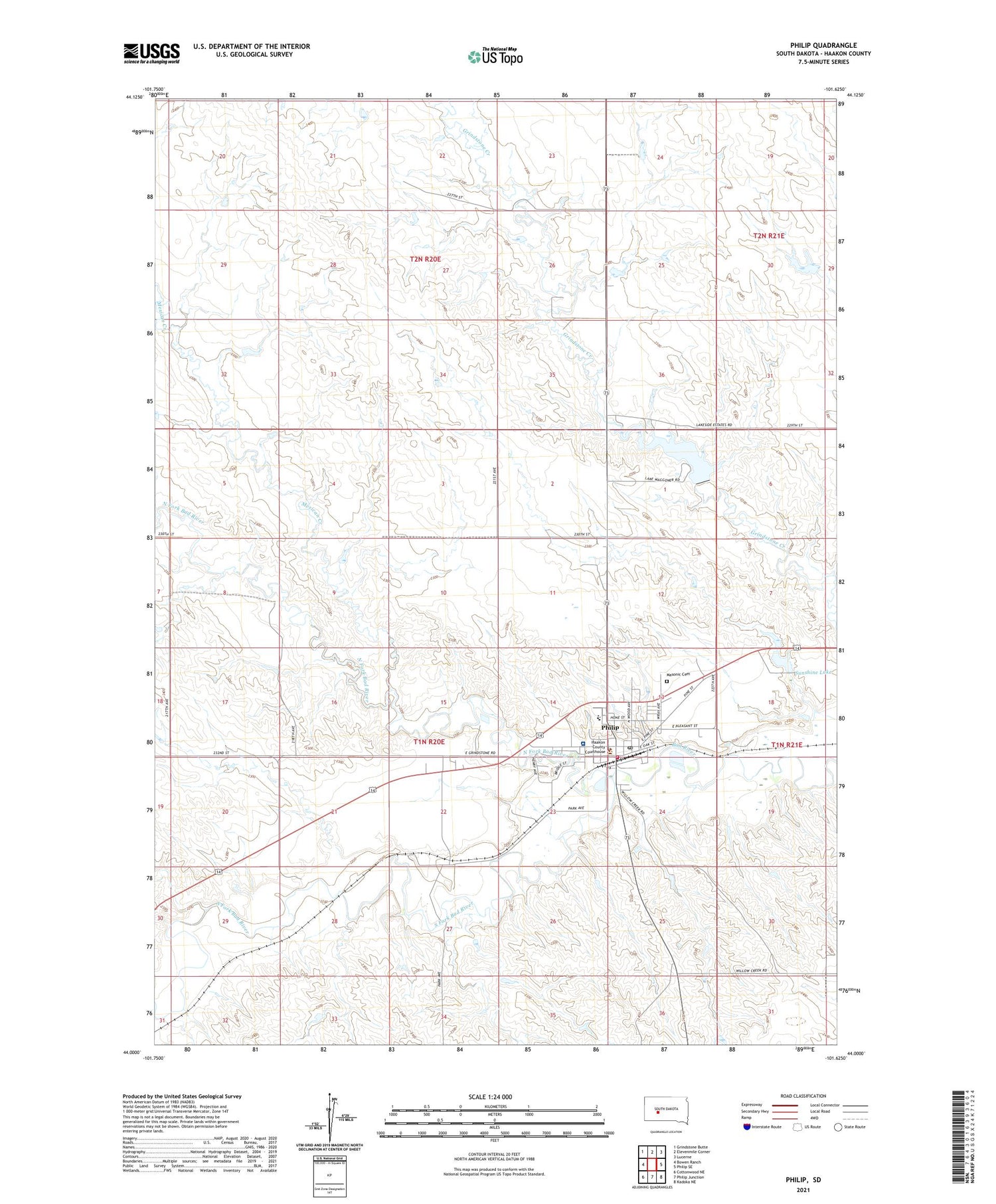
2021 topographic map quadrangle Philip in the state of South Dakota. Scale: 1:24000. Based on the newly updated USGS 7.5' US Topo map series, this map is in the following counties: Haakon. The map contains contour data, water features, and other items you are used to seeing on USGS maps, but also has updated roads and other features. This is the next generation of topographic maps. Printed on high-quality waterproof paper with UV fade-resistant inks.
Quads adjacent to this one:
West: Bowen Ranch
Northwest: Grindstone Butte
North: Elevenmile Corner
Northeast: Lucerne
East: Philip SE
Southeast: Kadoka NE
South: Philip Junction
Southwest: Cottonwood NE
Contains the following named places: City of Philip, Haakon County Courthouse, Haakon County Public Library, Haakon County Sheriff's Office, Hans P Peterson Memorial Hospital, Jones School, Masonic Cemetery, Mexican Creek, North Fork Bad River, Philip, Philip Ambulance Service, Philip Elementary School, Philip Fire Department, Philip High School, Philip Junior High School, Philip Police Department, Philip Post Office, South Fork Bad River, Sunshine Dam, Sunshine Lake, Sunshine School, Township of Brown, Waggoner Dam, Waggoner Lake, ZIP Code: 57567