MyTopo
Ridgeview SW South Dakota US Topo Map
Couldn't load pickup availability
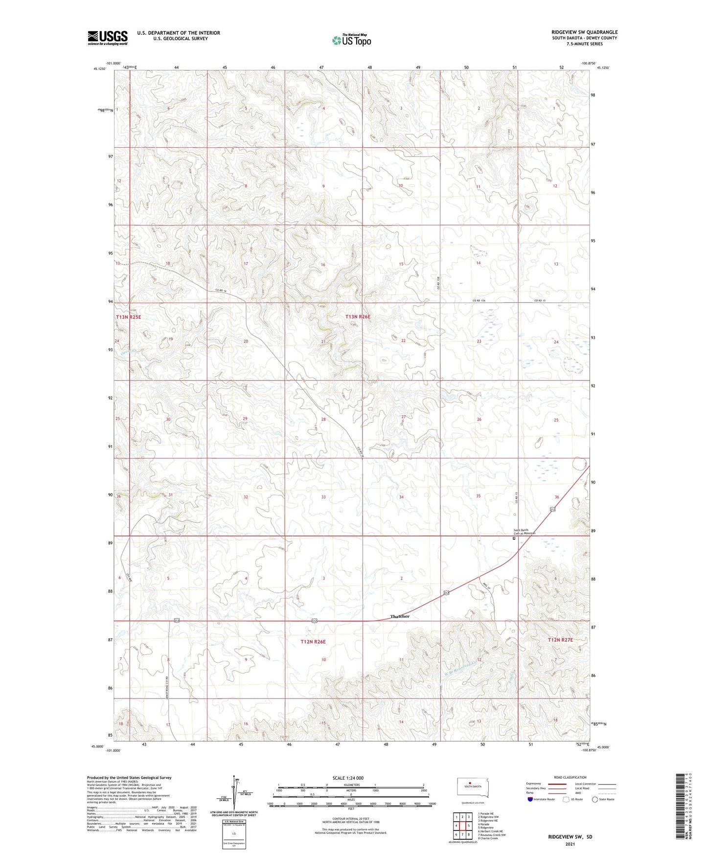
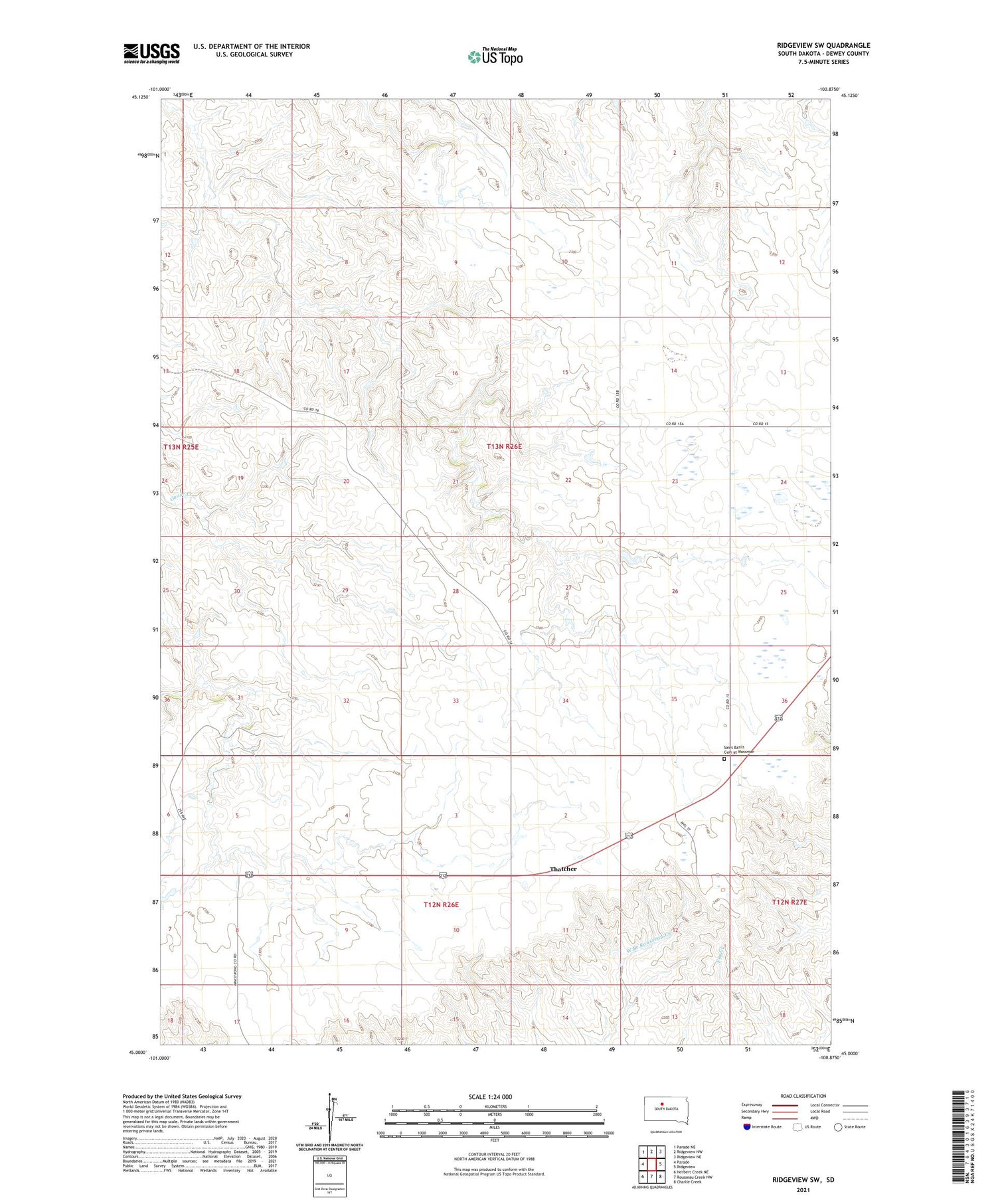
2021 topographic map quadrangle Ridgeview SW in the state of South Dakota. Scale: 1:24000. Based on the newly updated USGS 7.5' US Topo map series, this map is in the following counties: Dewey. The map contains contour data, water features, and other items you are used to seeing on USGS maps, but also has updated roads and other features. This is the next generation of topographic maps. Printed on high-quality waterproof paper with UV fade-resistant inks.
Quads adjacent to this one:
West: Parade
Northwest: Parade NE
North: Ridgeview NW
Northeast: Ridgeview NE
East: Ridgeview
Southeast: Charlie Creek
South: Rousseau Creek NW
Southwest: Herbert Creek NE
Contains the following named places: Dick Simon Number 1 Dam, Gesinger Ranch, Hagel Ranch, Hazel Miller Number 1 Dam, Mossman, Saint Basils Cemetery at Mossman, Saint Basils Church, Simon Ranch, Thatcher